

Settlement Reached in 20 Year Battle Over Water Rights at Nā Wai ʻEhā
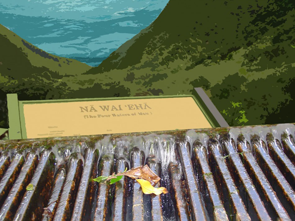
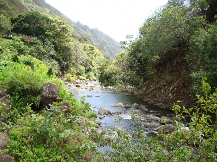
A settlement has been reached in the 20 year battle over water rights at Nā Wai ʻEhā on Maui. The state is calling it the “most comprehensive application of the Hawai‘i Water Code to water use and protection in history” amid more than two decades of conflict. The term Nā Wai ʻEhā refers to the “four great waters” of West Maui: Waihe’e, Waiehu, Wailuku, and Waikapū.
The Hawai‘i Commission on Water Resources Management reports that the 20-plus years of legal proceedings are now settled in a formal and lengthy Decision and Order, which for the first time recognizes appurtenant rights to west Maui waters. This includes setting aside “sufficient supply” for traditional taro farming and other traditional and customary practices.
State officials say the D&O is a result of a lengthy and complicated Contested Case Hearing that synthesizes voluminous evidence in what was a multi-faceted proceeding.

“This order works to establish a new paradigm for water resource management and collaboration in Nā Wai ʻEhā. We affirmed that kalo cultivation is a traditional and customary right in this region, recognized appurtenant rights to wai (water), and ensured connectivity of streams to enhance biota and ecosystem services. We also provided water for sustainable agriculture in Maui and required updated real-time metering of large-scale water diversions to enhance management and collaboration,” said water commissioner Dr. Kamanamaikalani Beamer.
The decision is a key shift from plantation water management to balanced water management, according to the department. CWRM Deputy Kaleo Manuel said, “The wai of Nā Wai ʻEhā have been a source of conflict since plantation diversions emptied streams decades ago. It has taken two decades to fully settle these complex matters which often strained relationships between instream users like kuleana tenants and mahi ‘ai kalo and offstream users and stream diverters. CWRM staff and the commission are extremely appreciative of all the stakeholders and their dedication, passion and patience.”
Manuel describes the commission’s deliberations as lengthy and comprehensive. The D&O documents the legal record, analysis, and more than 1,000 determinations that resulted in 116 recognized appurtenant rights and 176 permits. “The D&O establishes Interim Instream Flow Standards and Surface Water Use Permit Applications allocations that balance the commission’s public trust responsibilities,” he said.
Aggregate water allocations for Nā Wai ʻEhā include:
- More than one-half of available stream flows allocated to protect instream habitat and related benefits.
- Approximately 14% of the water for kalo production.
- About 1/3 of the water for beneficial offstream uses, such as municipal water supply and diversified agriculture.

In addition to retaining over half of stream flows for habitat, the commission is permitting over 23-million-gallons a day for other uses.

Water Commission Chair Suzanne Case said, “Our goal was three-pronged: The commission strove to
- 1. Honor past mediated settlements and Supreme Court rulings;
- 2. Establish stream flows required to offer a higher degree of habitat protection; and
- 3. Provide sufficient divertible flow to meet public trust and other reasonable and beneficial uses.”
“We recognize that the intended outcomes, implementation, and enforcement will rely on a high level of continued collaboration among competing interests. For example, in times of drought, all water users will need to share equally and equitably what are likely to be lower stream flows, resulting in less available water.”

Sponsored Content


