

Volcano Watch: Using earthquakes to look under the hood at Pāhala
From US Geological Survey Hawaiian Volcano Observatory scientists and affiliates
Deep beneath Pāhala, a town located in the southern part of the Island of Hawai’i, is currently the most seismically active region of the Hawaiian Islands. Frequent, deep earthquakes (greater than 20 km or 12 miles below sea level) are felt regularly by local residents, and, occasionally, people across the entire island. However, the current level of activity was not always common to the region and USGS Hawaiian Volcano Observatory researchers are interested in trying to understand more about why it is happening.

Map comparing two months of earthquake activity in the region deep beneath Pāhala from (a) March 1, 2014, to May 1, 2014, and (b) March 1, 2022, to May 1, 2022. Earthquake locations are marked by circles that are colored by depth; blue circles indicate earthquakes that occurred 20–40 km (12–25 miles) below sea level.
Until 2015, an average of 7 earthquakes occurred deep beneath Pāhala each week. By 2015, the number of earthquakes had approximately quadrupled, with nearly 34 events happening per week. By the spring of 2019, the average number of weekly earthquakes identified in this region increased approximately 70-fold, relative to pre-2015 rates. This high rate of earthquake activity, with several hundred earthquakes occurring in an average week, has continued to the present.
Since August 2020, larger-magnitude earthquakes have also begun to occur deep beneath Pāhala. Eight magnitude-4.2-to-4.6 earthquakes, at depths of 31–34 km (19–21 miles) have been recorded. These larger events have been reported felt by people on the Island of Hawai’i as well as nearby Hawaiian Islands.
HVO, in collaboration with the University of Hawai’i at Mānoa (UHM), will begin an investigation this summer to learn more about the nature of these frequent, deep earthquakes beneath the southern part of the Island of Hawaiʻi.
Previous geophysical studies have theorized that deep earthquake activity beneath the Pāhala region may be related to hot spot magma transport and/or faulting in the brittle upper mantle beneath the island. Interestingly, the area of elevated seismicity is almost equidistant from the summits of the three most active volcanoes in Hawaiʻi: Kīlauea, Mauna Loa, and Kamaʻehuakanaloa (Lō‘ihi Seamount).
Whether this region has a possible connection to the shallower magma storage and transport systems of Kīlauea or Mauna Loa is unclear, but there are no obvious indicators of magma transport from this region to the surface. Previous studies relied on data collected from HVO’s widely-spaced permanent seismometers in the region, which were not configured to study this area in detail.
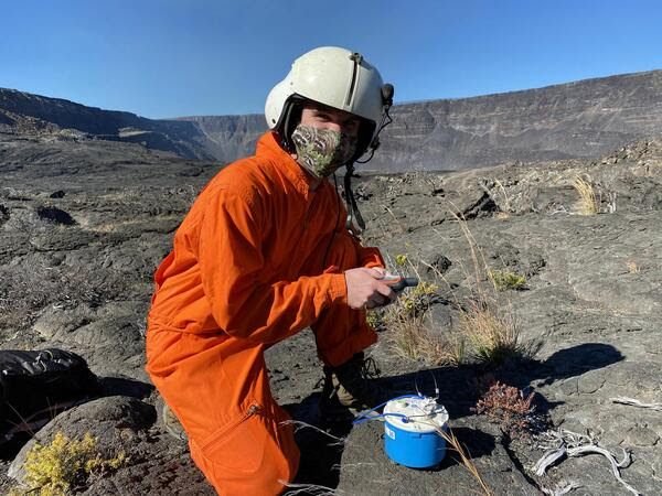
This summer, HVO and UHM scientists—funded by the Additional Supplemental Appropriations for Disaster Relief Act of 2019 (H.R. 2157)—will hike across the Pāhala region, deploying instruments called seismic nodes that will help to us to understand why these earthquakes are occurring. Seismic nodes are light, compact seismometers that measure ground shaking at the location where they are placed.
Unlike permanent seismic stations, which are placed farther apart and cover the entire Island of Hawai’i, the temporary seismic nodes will be tightly grouped in order to more densely record earthquake signals across the region surrounding Pāhala. For two months, these nodes will record ground shaking generated by shallow and deep earthquakes occurring across the Island of Hawai’i as well as distant earthquakes from around the world.
The densely-spaced nodal instruments recording earthquakes over a wide range of depths and locations during this experiment will collect seismic data from below the Pāhala region at unprecedented resolution. Seismologists at HVO and UHM will analyze data collected from these seismic nodes to create images of the structure of the Earth beneath Pāhala from as great as 40–50 km (25–31 miles) below sea level all the way to the surface.
The data and images will be used to precisely locate the earthquakes in this region and, hopefully, identify or constrain the locations and distributions of shallow and deep fault zones and potential magma pathways within the region. Together, the results will help us to understand what is causing the frequent earthquake activity deep in the region beneath Pāhala.
We plan to share the results of this project after the data are processed. In the meantime—if you are in the Pāhala area this summer, please watch out for seismic nodes that are recording valuable data to help HVO shed light on the mystery of frequent earthquake activity deep below.
Volcano Activity Updates
Kīlauea volcano is erupting. Its USGS Volcano Alert level is at WATCH.
Over the past week, lava has continued to erupt from the western vent within Halemaʻumaʻu crater. All lava is confined within Halemaʻumaʻu crater in Hawai‘i Volcanoes National Park. Sulfur dioxide emission rates remain elevated and were last measured at approximately 2,700 tonnes per day (t/d) on May 10. Seismicity is elevated but stable, with few earthquakes and ongoing volcanic tremor. Summit tiltmeters show several minor inflation and deflation trends over the past week.
Mauna Loa is not erupting and remains at Volcano Alert Level ADVISORY. This alert level does not mean that an eruption is imminent or that progression to an eruption from the current level of unrest is certain.
This past week, about 59 small-magnitude earthquakes were recorded below the summit and upper elevation flanks of Mauna Loa—the majority of these occurred at shallow depths less than 15 kilometers (9 miles) below sea level. Global Positioning System (GPS) measurements show low rates of ground deformation over the past week. Gas concentrations and fumarole temperatures at both the summit and at Sulphur Cone on the Southwest Rift Zone have remained stable over the past week.
One earthquake was reported felt in the Hawaiian Islands during the past week: a M3.4 earthquake 9 km (5 mi) E of Pāhala at 31 km (19 mi) depth on May 8 at 4:08 p.m. HST.
HVO continues to closely monitor Kīlauea’s ongoing eruption and Mauna Loa for any signs of increased activity.
Volcano Watch is a weekly article and activity update written by US Geological Survey Hawaiian Volcano Observatory scientists and affiliates.
Sponsored Content


