


Calvin Wednesday updates: Calvin becomes post-tropical as it pulls away from Hawaiʻi; Tropical Storm Warning lifted
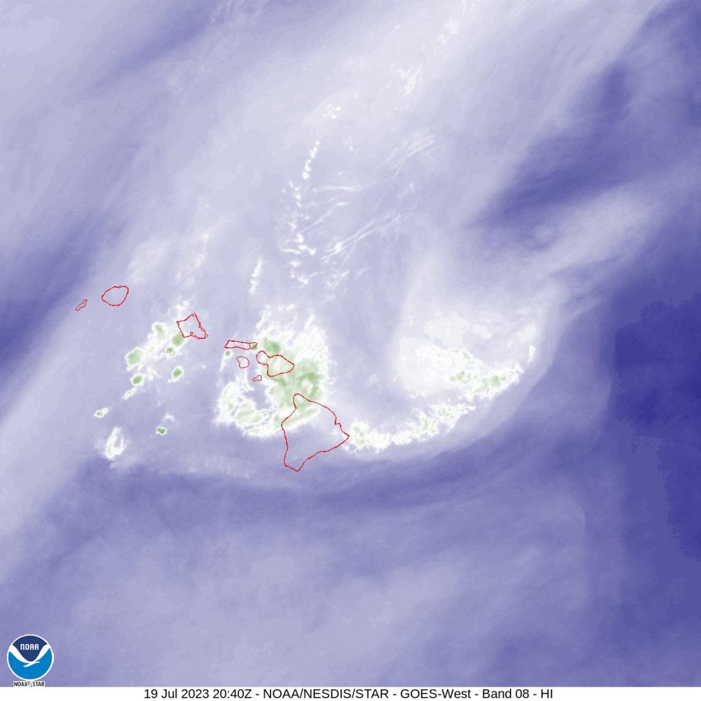
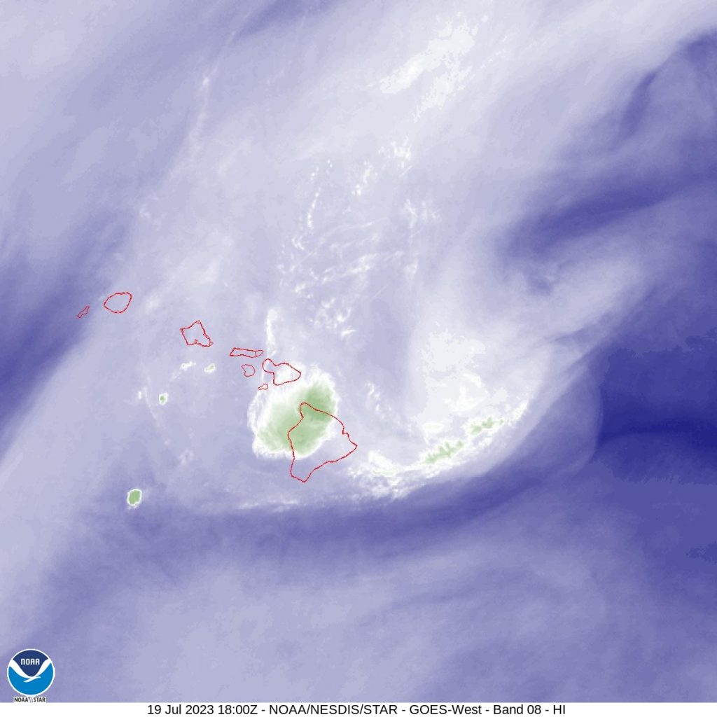
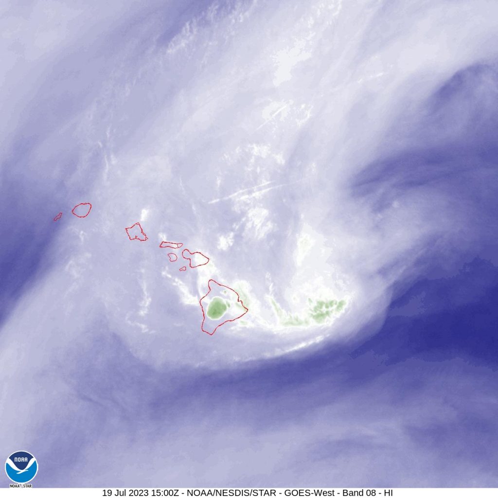
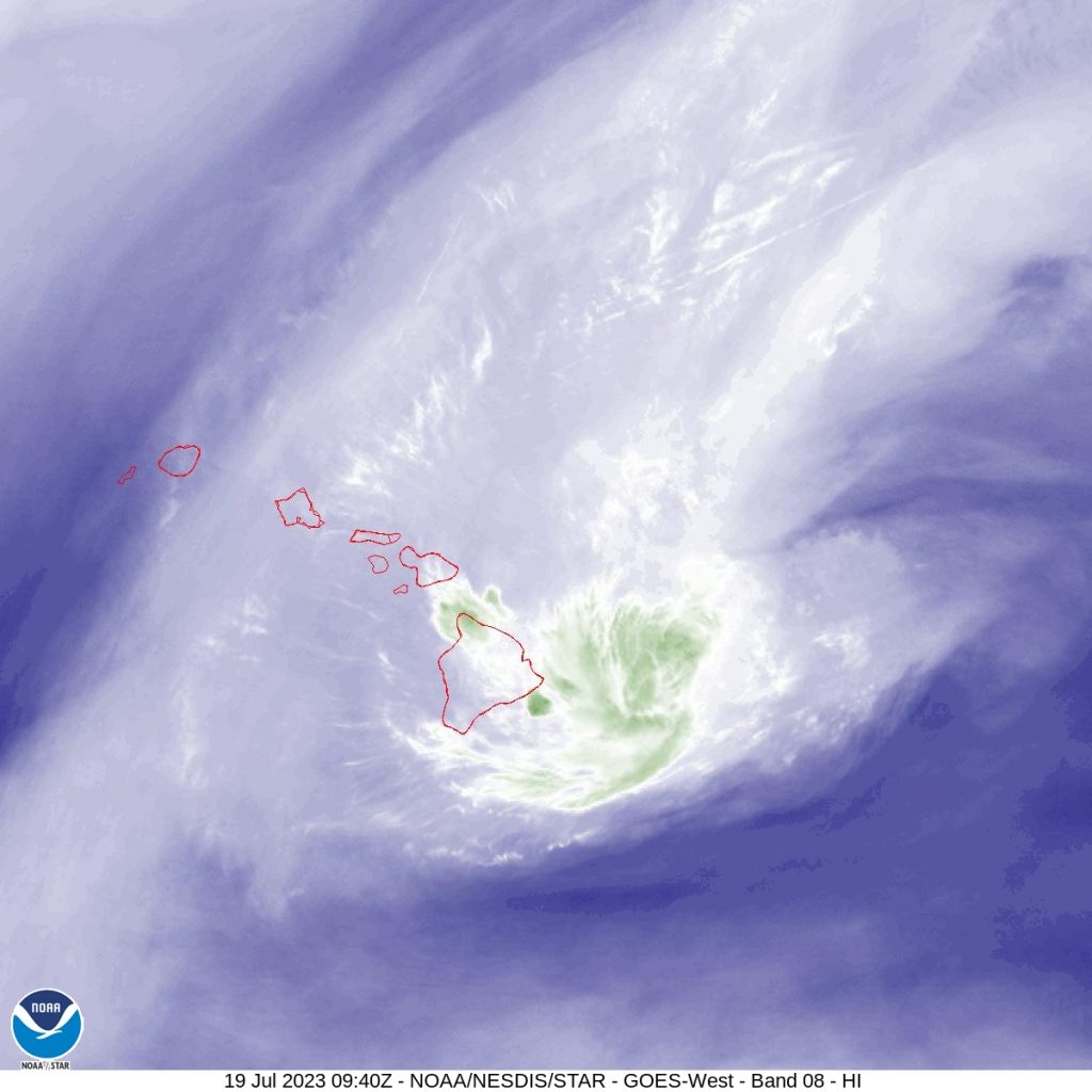
 Hawaiʻi satellite imagery as Tropical Storm Calvin moves to the west. 11 a.m. 7.19.23) PC: NOAA/NWS
- Hawaiʻi IR satellite imagery as Tropical Storm Calvin moves to the west. (11 a.m. 7.19.23) PC: NOAA/NWS
- Hawaiʻi water vapor satellite imagery as Tropical Storm Calvin moves to the west. (11 a.m. 7.19.23) PC: NOAA/NWS
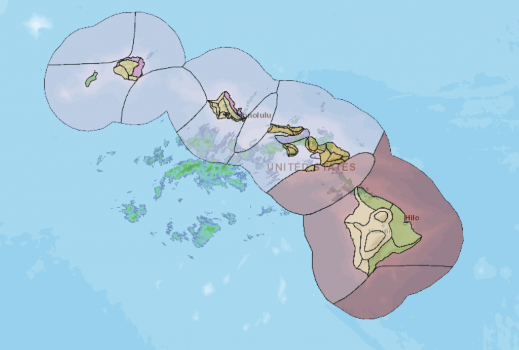
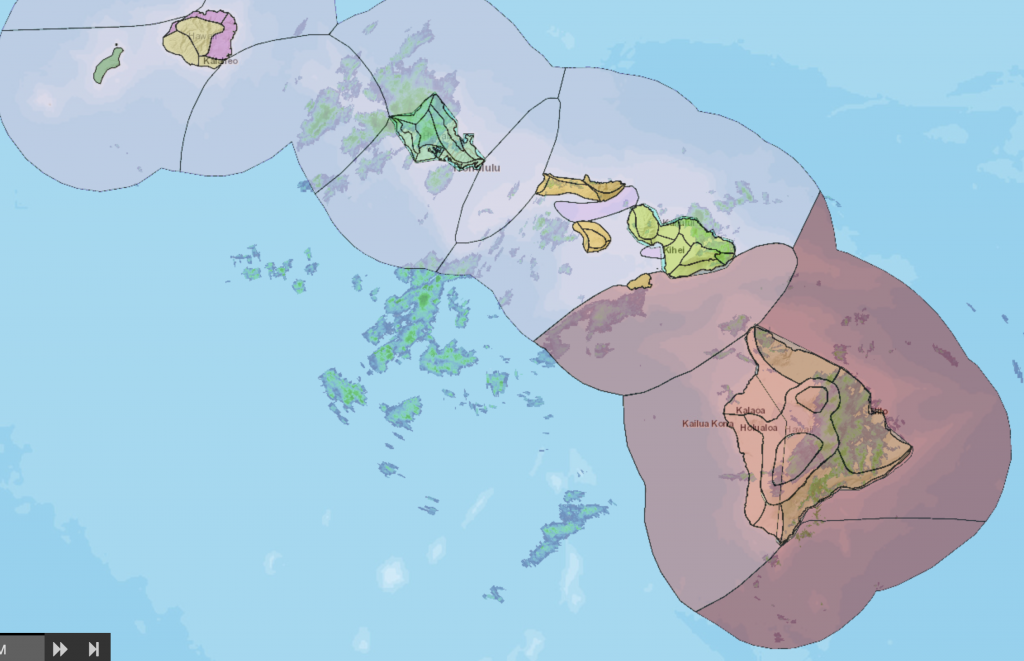
- Enhanced radar imagery of of Hawaiʻi as Tropical Storm Calvin moves to the west. (11 a.m. 7.19.23) PC: NOAA/NWS
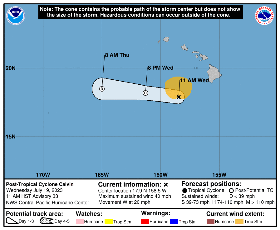
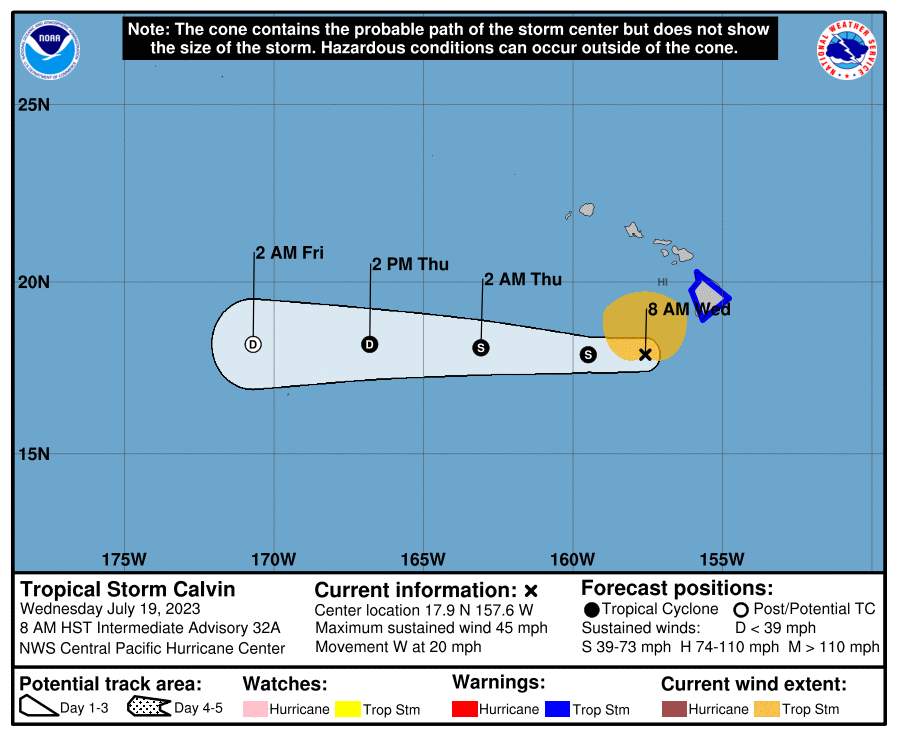
- Five day forecast. (11 a.m. 7.19.23) PC: NOAA/NWS/CPHC
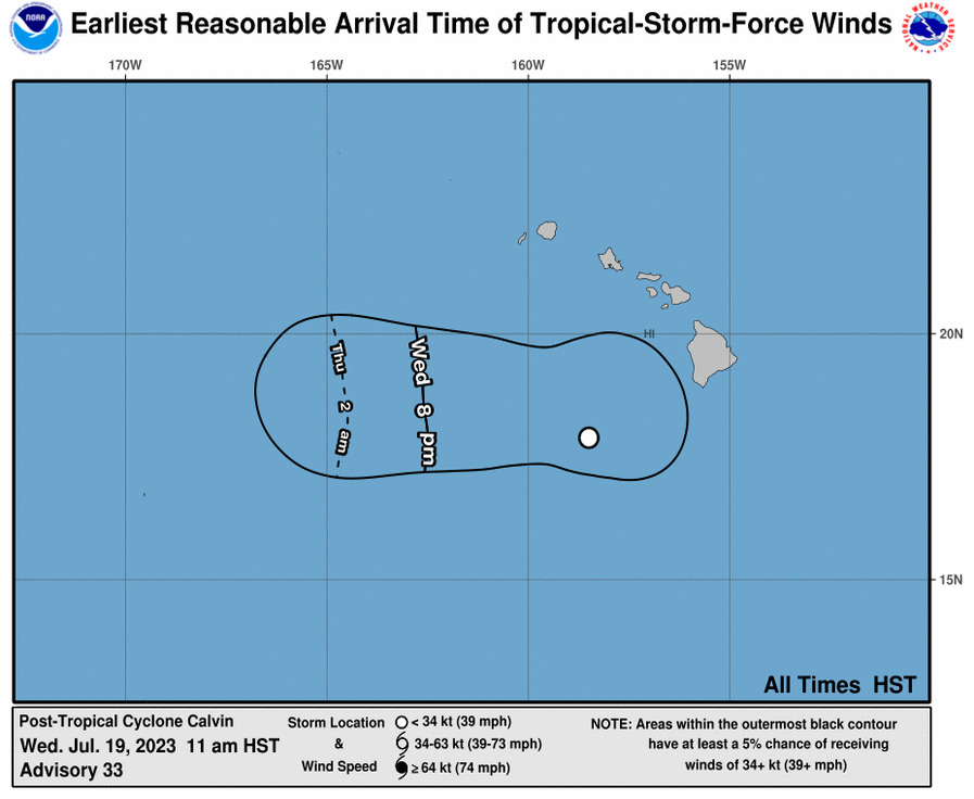
- Earliest Reasonable Arrival Time of Tropical-Storm-Force Winds. Calvin (11 a.m. 7.19.23) PC: NOAA/NWS/CPHC


Flood, wind and surf advisories canceled; only marine warnings remain
3:27 p.m. update:
The National Weather Service has canceled all flood watches, high wind and surf advisories as former Tropical Storm Calvin heads west away from Hawaiʻi. Only a small craft advisory and gale warning remain for island waters as of 3:30 p.m. The National Weather Service says breezy trades will continue around the islands “due to the pressure difference between Clavin and the subtropical high to the north and northeast.”
Partial road closure: Kamehameha Ave. at Hāna Hwy
1:31 p.m. update:
There is a partial road closure in place at the intersection of Kamehameha Ave. at Hāna Highway. Maui police say the traffic signal turn lane is without electricity. Crews with the state Highwayʻs Division are on scene, working to resolve the issue.
Traffic light flashing at Hāna Hwy/Hobron
1:07 p.m. update:
The state Department of Transportation reports that a traffic signal at the intersection of Hāna Highway (Route 36) and Hebron Ave. in Kahului is flashing. A technician is responding.
Traffic signal dark at Kahului intersection
12:12 p.m. update:
The state Department of Transportation is reporting traffic control underway at an intersection in Kahului. The traffic signal at Kahului Beach Road and Kanaloa Avenue was dark as of 12:2 p.m. A technician is on site, working to fix the issue.
Maui Wind Advisory, High Surf Advisory until 6 p.m.
11:07 a.m. update:
The National Weather Service has issued a Wind Advisory until 6 p.m. The NWS also canceled an earlier wind warning that was previously issued. The advisory calls for NE winds of 30-35 mph with gusts around 50 mph for portions of Kahoʻolawe, Lānaʻi, Maui and Molokaʻi.
A High Surf Advisory replaces a previous Surf Warning for the east facing shores of Maui, Molokaʻi, Kahoʻolawe and the Big Island. Surf is expected to be in the 7-10 foot range.
Calvin becomes Post-Tropical as it pulls away from Hawaiʻi; Tropical Storm Warning canceled for Hawaiʻi
11 a.m. update:
Calvin has become a Post-Tropical system as it pulls away from Hawaiʻi. The National Weather Service has since discontinued the Tropical Storm Warning for Hawaiʻi County.
The Central Pacific Hurricane Center reports that tropical storm wind conditions have ended in Hawaiʻi. The forecast calls for locally gusty winds to continue today before easing tonight.
As Calvin continues on a path away from the islands, additional rainfall totals of 1-3 inches are possible on the Big Island, with up to 2 inches possible in other spots throughout the state. The CPHC reports that flooding impacts are occurring on the Big Island, where 6 inches of rain has already fallen over the windward and southeast slopes.
As of 11 a.m., Calvin was about 225 miles WSW of Hilo, and about 240 miles S of Honolulu, Oʻahu.
A Flood Watch remains in effect for Maui and Hawaiʻi Island until 6 p.m.
The Central Pacific Hurricane Center reports that the information shared will be the final update for Calvin. Additional weather updates regarding warnings, advisories and watches will be updated in this post.
Tropical Storm Warning canceled for Hawaiʻi Island
10:41 a.m. update:
The National Weather Service has canceled the Tropical Storm Warning that was in effect for Hawaiʻi Island. The latest forecast calls for winds to fall below tropical-storm-force values. The peak wind forecast has winds at 25-35 mph, with gusts up to 50 mph. Tropical storm force winds are classified as sustained winds of between 39-73 mph.
Traffic light flashing at Honoapiʻilani Hwy / Kehalani Parkway intersection
10:19 a.m. update:
The state Department of Transportation is reporting that the traffic signal on the Honoapiʻilani Highway at Kehalani Parkway in Wailuku is flashing due to wet conditions. Technicians are responding. Motorists should treat the area as an all way stop for the interim.
Flood Advisory canceled for Maui
10:12 a.m. update:
The Flood Advisory that was in effect for Maui has since been cancelled as of 10:12 a.m. The National Weather Service reports that radar and rain gauges show diminished rainfall. A Flood Watch remains in effect until 6 p.m. for Maui County.
Flood Warning issued for Hawaiʻi Island until 12:15 p.m.
9:05 a.m. update:
The National Weather Service has issued a Flash Flood Warning for Hawaiʻi Island until 12:15 p.m.
At 9:05 a.m., rain gages indicated that rainfall is still occurring over the slopes of the Kaʻū District, but accumulations have been less than half an inch over the past hour. Hawaiʻi County Civil Defense reports that Kaʻalaiki Road and Wood Valley Road near Pahala remains closed.
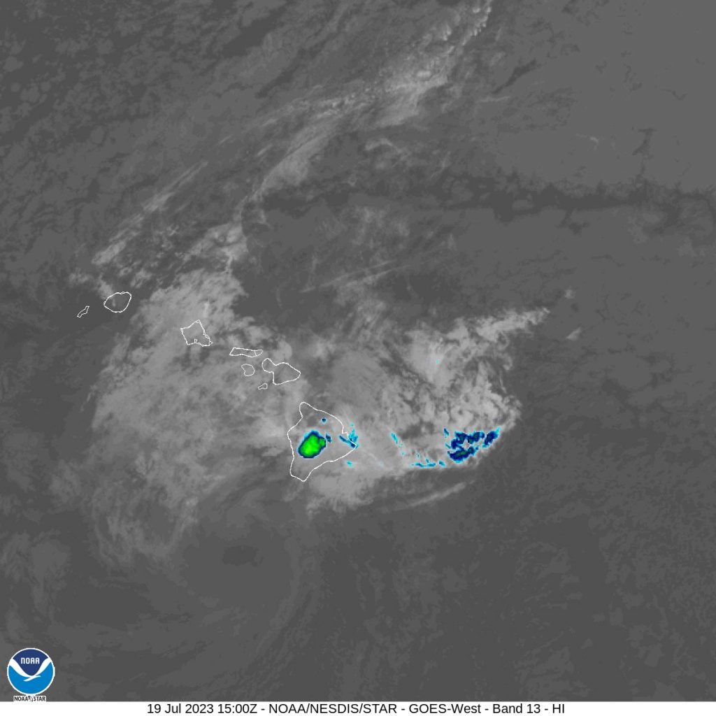
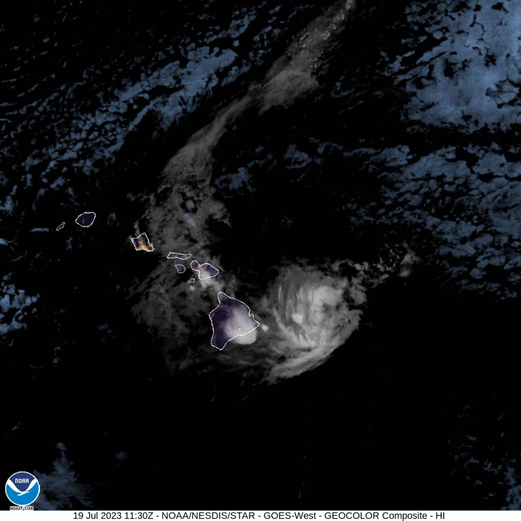
- (left) Hawaiʻi satellite imagery as Tropical Storm Calvin moves to the west. 8 a.m. 7.19.23) PC: NOAA/NWS; (right) Enhanced radar imagery of of Hawaiʻi as Tropical Storm Calvin moves to the west. (8 a.m. 7.19.23) PC: NOAA/NWS
- Hawaiʻi satellite imagery as Tropical Storm Calvin moves to the west. 8 a.m. 7.19.23) PC: NOAA/NWS
- Five day forecast. (8 a.m. 7.19.23) PC: NOAA/NWS/CPHC
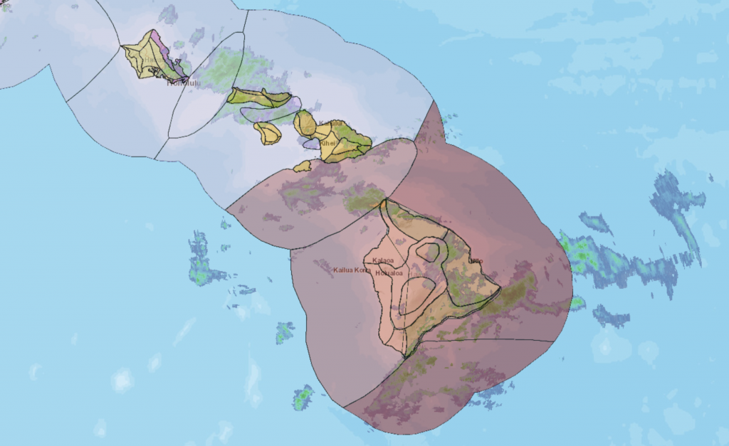
- Enhanced radar imagery of of Hawaiʻi as Tropical Storm Calvin moves to the west. (8 a.m. 7.19.23) PC: NOAA/NWS
- Hawaiʻi IR satellite imagery as Tropical Storm Calvin moves to the west. 8 a.m. 7.19.23) PC: NOAA/NWS
- Hawaiʻi water vapor satellite imagery as Tropical Storm Calvin moves to the west. 8 a.m. 7.19.23) PC: NOAA/NWS


Calvin continues on westward path well south of the islands; storm impacts continue
8 a.m. update:
Calvin continues on a westward path, well south of the islands with storm impacts continuing on Hawaiʻi Island. The system is moving away to the west and was last tracked at 205 miles SW of Hilo, Hawaiʻi and 235 miles S of Honolulu, Oʻahu.
Flood Advisories are in place for the Big Island of Hawaiʻi until 11:15 a.m. and for Maui until 10:30 a.m. On the Big Island, rain gauges at 8 a.m., showed continued rainfall over the windward slopes. Streams remain elevated on Maui, especially along the windward slopes of Haleakalā.
The Central Pacific Hurricane Center reports that little has changed in the forecast since the last full update issued at 5 a.m.
Maximum sustained winds are near 45 mph with higher gusts. The CPHC says weakening will continue over the next two days.
- (left) Hawaiʻi satellite imagery as Tropical Storm Calvin moves to the west. 5 a.m. 7.19.23) PC: NOAA/NWS; (right) Enhanced radar imagery of of Hawaiʻi as Tropical Storm Calvin moves to the west. (5 a.m. 7.19.23) PC: NOAA/NWS
- Hawaiʻi satellite imagery as Tropical Storm Calvin moves to the west. 5 a.m. 7.19.23) PC: NOAA/NWS
- Hawaiʻi IR satellite imagery as Tropical Storm Calvin moves to the west. 5 a.m. 7.19.23) PC: NOAA/NWS
- Hawaiʻi water vapor satellite imagery as Tropical Storm Calvin moves to the west. 5 a.m. 7.19.23) PC: NOAA/NWS
- Enhanced radar imagery of of Hawaiʻi as Tropical Storm Calvin moves to the west. (5 a.m. 7.19.23) PC: NOAA/NWS


Maui Flood Advisory until 10:30 a.m.
7:15 a.m. update:
The National Weather Service issued a Flood Advisory for the island of Maui until 10:30 a.m. At 7:15 a.m., radar showed rainfall has eased over Maui; however streams remain elevated, especially along the windward slopes of Haleakalā. The NWS reports that enhanced rainfall over the windward slopes is expected to continue for several more hours before bringing more relief.
Flood Warning issued for Hawaiʻi Island until 9:15 a.m.
6:20 a.m. update:
A Flood Warning is now in effect for Hawaiʻi Island until 9:15 a.m. At around 6:20, radar showed persistent rain along the slopes of the Kaʻū District. Hawaiʻi County Civil Defense reported that Wood Valley Road has been closed due to flooding. Flooding is also expected to close the Hawaiʻi Belt Road in the Kawa Flats area near Punaluʻu; and Kaʻalaiki Road near Pāhala.
Calvin makes overnight pass south of the Big Island, impacts continue
5 a.m. update
The National Weather Service has extended a Flood Advisory for the Big Island of Hawaiʻi until 8:15 a.m. At 4:32 a.m., radar showed heavy rain over the east through southeast slopes, falling at a rate of 1-2 inches per hour.
A Flood Advisory for Oʻahu has since been canceled. At 4:28 a.m., radar showed heavy rain over portions of Central and Windward Oʻahu, with the highest rain rates for Oʻahu at 1 to 2 inches per hour over Wahiawa, according to the NWS.
The Central Pacific Hurricane Center reports that Calvin continues to pass south of Hawaiʻi Island on a westward path at 20 mph. A Tropical Storm Warning remains in effect for the Big Island.
As of 5 a.m., Calvin was located: 175 miles SW of Hilo, Hawaiʻi; 105 miles SW of South Point, Hawaiʻi; 210 miles SSW of Hāna, Maui; 215 miles S of Kahului, Maui; 230 miles S of Kaunakakai, Molokaʻi; 205 miles S of Lānaʻi City, Lānaʻi; and 255 miles SSE of Honolulu, Oʻahu.
WIND: The Central Pacific Hurricane Center reports that maximum sustained winds are back down to 45 mph, with higher gusts, and tropical-storm-force winds extending outward up to 125 miles from the center. Weakening is forecast to continue over the next two days, according to the CPHC.
The National Weather Service says “damaging winds are expected through the first half of the day for the Big Island and Maui County… Advisory-level winds are anticipated for Oʻahu and Kauaʻi, with the strongest winds occurring over and downwind of terrain.”
RAIN: “Storm total rainfall amounts through Thursday are forecast to be 4-8 inches, with maximum amounts of 10 inches possible, mainly along the windward slopes and southeast flank of the Big Island of Hawaii. Storm total rainfall amounts of 3-6 inches are expected on the windward areas of Maui, and 2-4 inches elsewhere in the state. This rainfall could lead to localized flash flooding and mudslides,” according to the CPHC.
According to a local weather statement from the National Weather Service, “bands of heavy rainfall will continue to move ashore and impact portions of the Big Island through the early morning hours, especially for the southeast facing slopes of the Kaʻū district. Rainfall totals overnight have reached the 4 to 6 inch range on the Big Island and an additional 2 to 4 inches remain possible as Calvin begins to move away. Similar conditions are expected across the smaller islands today as Calvin passes far to the south.”
SURF: Swells generated by Calvin will affect all of the main Hawaiian Islands through today, generating life-threatening surf and sea conditions along exposed shorelines.
The National Weather Service reports that “significant coastal impacts will continue along exposed east facing shores of the Big Island and Maui this morning.” A High Surf Warning remains posted for the east facing shores of Hawaiʻi Island and Maui County with “dangerously large and disorganized waves of 14 to 18 feet.”
- Hawaiʻi satellite imagery as Tropical Storm Calvin moves to the west. 2 a.m. 7.19.23) PC: NOAA/NWS
- Hawaiʻi IR satellite imagery as Tropical Storm Calvin moves to the west. 2 a.m. 7.19.23) PC: NOAA/NWS
- Hawaiʻi water vapor satellite imagery as Tropical Storm Calvin moves to the west. 2 a.m. 7.19.23) PC: NOAA/NWS
- Enhanced radar imagery of of Hawaiʻi as Tropical Storm Calvin moves to the west. (2 a.m. 7.19.23) PC: NOAA/NWS


Calvin continues pass south of Big Island; impacts are “imminent or occurring”
2 a.m. update:
Tropical Storm Calvin continues its pass south of the Big Island. At 2 a.m., the storm was located about 160 miles south of Hilo, Hawaiʻi; 85 miles S of South Point, Hawaiʻi; 215 miles S of Hāna; 225 miles SSE of Kahului, Maui; 250 miles SSE of Kaunakakai, Molokaʻi; 230 miles SSE of Lānaʻi City, Lānaʻi; and 295 miles SE of Honolulu, Oʻahu.
Just before 2 a.m., the National Weather Service issued a Flood Advisory for Hawaiʻi Island until 5:15 a.m. At 1:56 a.m., radar showed heavy rain over north and southeast slopes of the Big Island, according to the NWS. “Heavy rain was falling at a rate of 1 to 2 inches per hour in some areas and increasing in coverage,” the NWS reports.
Calvin’s maximum sustained winds are 50 mph with higher gusts. Movement continues to the west at 20 mph. The National Weather Service reports that there is no change in the 2 a.m. update from the previous advisory issued three hours earlier.
The Central Pacific Hurricane Center is reporting a peak wind forecast for Hawaiʻi Island of 35-45 mph winds with gusts up to 65 mph. The threat of tropical-storm-force winds remains until Wednesday morning.
A Tropical Storm Warning remains in effect for Hawaiʻi Island (including Kailua-Kona, Captain Cook and Miloliʻi), and a Flood Watch remains in effect for Maui and Hawaiʻi Counties through Wednesday afternoon.
- Hawaiʻi satellite imagery as Tropical Storm Calvin moves to the west. 12 a.m. 7.19.23) PC: NOAA/NWS
- Hawaiʻi IR satellite imagery as Tropical Storm Calvin moves to the west. 12 a.m. 7.19.23) PC: NOAA/NWS
- Hawaiʻi water vapor satellite imagery as Tropical Storm Calvin moves to the west. 12 a.m. 7.19.23) PC: NOAA/NWS
- Enhanced radar imagery of of Hawaiʻi as Tropical Storm Calvin moves to the west. (12 a.m. 7.19.23) PC: NOAA/NWS


Calvin begins pass south of Big Island; impacts to Hawaiʻi County are imminent or occurring
12 a.m. update:
The latest forecast update from the Central Pacific Hurricane Center notes that while the center of Tropical Storm Calvin is passing south of the Big Island, most of the island “is well within” the radius for impacts from strong winds, heavy rainfall, and high surf, which are “imminent or occurring.”
As of 11 p.m., Tropical Storm Calvin was located 140 miles south of Hilo, Hawaiʻi; 90 miles SSE of South Point, Hawaiʻi; 215 miles SSE of Hāna, Maui; 235 miles SSE of Kahului, Maui; 260 miles SSE of Kaunakakai, Molokaʻi; 240 miles SSE of Lānaʻi City, Lānaʻi; and 305 miles SE of Honolulu, Oʻahu.
Calvin’s intensity weakened slightly in the latest forecast period to 50 mph maximum sustained winds and minimum central pressure of 29.62 inches, according to the Central Pacific Hurricane Center. Tropical-storm-force winds continue to extend outward up to 140 miles from the center.
Forward motion also dipped slightly to 20 mph from 21 mph in the last report.
According to the Central Pacific Hurricane Center’s Forecast Discussion, “Deep convection has decreased considerably near the center of Calvin since late this afternoon, but has begun to increase farther to the north along windward shores and slopes of the Big Island of Hawaiʻi. The low level circulation center is rapidly becoming unveiled again.”
The National Weather Service says the “most damaging wind and weather conditions” are currently focused over the Big Island and the islands in Maui County tonight through Wednesday. The NWS says each island will see about a 12-18 hour period of weather impacts.
MAUI SPECIFIC IMPACTS: According to an NWS Forecast Discussion, the island of Maui can expect the following:
“Strong easterly winds with deepening unstable tropical moisture will produce periods of heavy rain over the islands in Maui County, especially over the windward mountain slopes. Rainfall totals of 3 to 6 inches with isolated higher amounts will be possible tonight through Wednesday. A Flood Watch remains in effect through Wednesday. Damaging winds will also develop with the strongest winds downwind of terrain or leeward areas. Wind gusts of over 60 mph will be possible and a High Wind Warning remains in effect this evening with peak winds expected late tonight through Wednesday morning. Winds this strong will be capable of knocking down trees and causing power outages, so please limit travel if possible.”
A High Wind Warning is in effect until 6 p.m. Wednesday for Maui County. The NWS forecast says the strongest winds will likely occur in areas over and downwind of terrain.
On the water, a High Surf Warning remains in effect for east facing shores of the Big Island, Maui, Molokaʻi, and Kahoʻolawe tonight through Wednesday due to rapidly building surf generated by Calvin. The warning calls for “dangerously large and disorganized waves of 15-20 feet along affected shorelines.
The NWS reports that warning and advisory level surf heights will be “short-lived” and will likely occur late tonight into Wednesday morning for the Hawaiʻi Island, and through the afternoon Wednesday for the smaller islands.
The forecast calls for an increase in vertical shear through Wednesday night, which the CPHC says should result in weakening of the system to a post-tropical/remnant low by Friday.
Sponsored Content


