 Hawai'i Journalism Initiative
With 257 acres of dry Mā‘alaea landscape under public control, fire prevention is a key focus

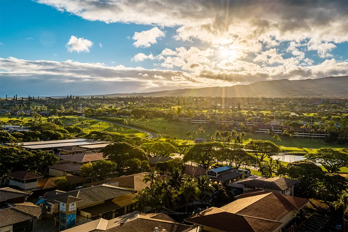
MĀ‘ALAEA — The expansive view from the Lahaina Pali Trail looking down at the 257-acre Pōhākea parcel shows a piece of land with a long list of potential uses and importance.
Its dry climate, sloping hillside and location between Central and West Maui have long made it a high-risk area for fire and a site of concern for erosion and runoff into the nearby bay.
But now the recent acquisition of the parcel that is also known as Mā‘alaea Mauka brings crucial opportunities for the state Department of Land and Natural Resources to manage the land in several ways, with fire mitigation efforts among the most essential.
“It’s important because it is connected to a much larger set of lands that go all the way to the summit (of the West Maui Mountains),” Scott Fretz, the Maui branch manager of DLNR’s Division of Forestry and Wildlife, said last week. “Fires often start at those mauka lands and come down in the direction toward the highway. And often they start at the highway and go up this parcel into the mauka lands. So, that connectivity is important.
“So, in other words, we need to prevent fires from moving from the road up and we need to prevent fires from moving down through this parcel to the road from the upper elevations.”
That’s why Fretz said that the parcel being protected in perpetuity — with the State Legacy Land Conservation Program and the County of Maui Open Space program contributing $1 million and $6.2 million to fund the conservation purchase, respectively — is a big step forward. The acquisition was announced in mid-June.
“If we can’t have access to management we don’t have control over the kinds of fuels that are on the property that can spread fire in both directions,” he said. “So, owning the land and having that under our management jurisdiction facilitates that.”
On Friday, the Pōhākea efforts got a big boost when the DLNR announced that a $9.9 million grant has been recommended for funding by the National Oceanic and Atmospheric Administration Office of Habitat Conservation, through the Bipartisan Infrastructure Law and Inflation Reduction Act.
The Transformational Habitat Restoration and Coastal Resilience Grant will be used to support a comprehensive approach to restoring and protecting West Maui reefs, particularly the 1,000-acre leeward Pāpālua to Olowalu reef, a news release from the DLNR said. DOFAW will lead the three-year grant, working in collaboration with the Division of Aquatic Resources and a half dozen conservation organizations to carry out an entire suite of actions.
Fretz confirmed to Hawai‘i Journalism Initiative on Friday that the Pōhākea parcel is included in the grant.
“The project area is Olowalu to Ukumehame. This is an area where we have effective land management in the upper elevations of state forest reserves,” Fretz said in a news release on the grant. “However, one of the real challenges resource managers have faced for many years in the project area, is that lower elevation lands have a number of issues that lead to erosion and sedimentation that impacts the coral reef ecosystem.”
The NOAA grant will include construction and/or maintenance of 10 miles of ungulate fencing to control pigs, goats and axis deer; construction and maintenance of 20 miles of fire breaks; construction and maintenance of a 3,500-foot riparian corridor in Olowalu Valley; establishment of five, 50-acre restoration sites and introduction of 30,000 plants to each, annually; and construction of a sediment detention basis at Manawaipueo.
The Pōhākea land acquisition sews the land to the sea in several key environmental ways.

Tapani Vuori, the president of the Maui Ocean Center that sits directly across the highway from the Pōhākea parcel, pointed out that the Mā‘alaea hillside is one of the top areas for fire risk on Maui. Hawai‘i Wildfire Management Organization maps show that the area encompassing Mā‘alaea to Waikapu saw some of the most acreage burned in the state from 1999-2022.
“I’ve been here at Maui Ocean Center since 2002,” Vuori said. “I have come through three different, separate fires and I remember very vividly one fire, it lasted like three days. The MFD, Maui Fire Department, they had helicopters and trucks and Goodfellow, everybody involved, so it took a lot of effort to put that out. So, clearly fire is a very, very, very important point.”
FIRE PREVENTION, EROSION GO HAND IN HAND
The purchase of the land at Pōhākea was a joint project between the Trust for Public Land, the state DLNR, the County of Maui and community supporters. The state and county had been eyeing the land for purchase when it was bought by developer Peter Martin in May 2022, prompting the Maui County Council to consider taking the land by eminent domain. Eventually the parties came to an agreement to have the Trust for Public Land buy the parcel and convey it to the state to put into conservation for perpetuity.
Lucienne de Naie is the president of the Maui Nui Marine Resource Council’s Board of Directors and has been pushing for the acquisition of the land for more than 20 years. She wrote a book titled “Mā‘alaea: The Untold Story of Maui’s Historic Crossroads.”
The land was designated for agricultural and urban uses for many years, but that has now been changed in perpetuity.
“All that has now been dealt with by the purchase of the 257 acres of the mauka land — it is not going to be developed, instead it is going to be managed as a conservation area,” de Naie said Monday. “And in fact the updated South Maui Community Plan, which just went through one layer of review, the citizen review last year 2023, they voted to put that land in conservation, not even ag.
“This is conservation land. So, it’s very heartening to have that recognized, to have this purchase affirm the fact that it should be managed as conservation land.”
De Naie knows that those efforts could take some time.
“The state has been realistic — they said getting the funding and the planning to actually implement the long-term conservation measures is going to take a few years,” she said. “It’s not a snap of the finger, but meanwhile there’s no plans to put more homes at risk of flood or fire, so that’s good, that’s a positive. … The state is really open to partnerships with other organizations.”
The public purchase enables the new owner of the land — the DLNR — to collaborate with county officials and community stakeholders to reduce wildfire risks, enhance public access to hiking trails, protect cultural and scenic resources and reduce stormwater runoff and erosion into Mā‘alaea Bay.
“With regards to sedimentation, this is what we do here at the Maui Ocean Center, we are very involved with the marine ecosystem,” Vuori said. “However, what happens on the land impacts the ocean, so if you were to walk that land today you would see actually four deep gulches there, three of them are over 30 feet in depth. That land is the point source for excessive sedimentation that has ended up in the bay and in the harbor.”
Vuori noted that excessive sediment in Mā‘alaea Harbor has seen some of the boats getting stuck entering and exiting the harbor.
“There’s a lot of sedimentation in the harbor,” Vuori said. “But again, logically it doesn’t make any sense to dredge the harbor if you don’t stop the sedimentation coming in.”

Erosion control and nearshore health have long been concerns for the area, with organizations like the Maui Nui Marine Resource Council trying efforts both on land and sea that include using oysters to filter the water in Mā‘alaea Harbor.
Fretz said that erosion is a problem that goes hand-in-hand with fire prevention. Part of that could be addressed with the three wells and a 750,000-gallon water tank that are already on the Pōhākea property.
“A lot of erosion that comes off of this property and the lands mauka of it, too, they come down through the gulches, they end up in these ditches, they get carried down into Mā‘alaea Bay where they damage coral reef habitat,” Fretz said. “It’s a huge problem. It has really damaged the coral reef in that area a lot. There were coral reef surveys from 20, 30 and 40 years ago that have shown now that the coral reef has declined a lot.”
“So, the water can help with that, too. It’s such a dry area that it’s really hard to, without water it’s very hard to revegetate and restore the habitat in that area. It’s just very slow. And then if you have a fire come through, it burns it anyway. So being able to bring water into the area, it helps to solve both the fire and erosion problems.”
Plans are also set to construct a dip tank to support aerial fire suppression operations, according to Fretz.
“That is really important for us to be successful in getting fire mitigation in place here because what that allows us to do is build green breaks — we can plant fire-resilient species, we can plant green breaks,” Fretz said. “Being able to use that water is really going to help us to get fire breaks in place and help with habitat restoration.”
Fretz said the recent Crater Road Fire near the 7,000-foot elevation range Upcountry is an example of DOFAW’s constant mission to keep learning about all fire conditions and possibilities.
“It very much reinforced our understanding of the need to improve management in these areas,” Fretz said.
Fire prevention is “one of many important things,” that can be achieved with careful management of the Pōhākea parcel. But the water resources and erosion control are a big part of it too.
“We are going to be working with partners and experts, engineers that can help us design and engineer the kinds of structures that we could put in place to slow the water down, slow the sediment down, capture the sediment so that it doesn’t end up in the ocean,” Fretz said.

The Lahaina Pali Trail runs through the Pōhākea parcel and there are new possibilities for the popular hiking trek as well.
“The Lahaina Pali Trail will be open and actually it gives us some more options for parking and access to the trail, too,” Fretz said. “When we didn’t own the parcel we were having to use a different road to get cars up and they’d park at the top. That might still work and it still might be the way to go, but it also gives us other options to enter at different points from the highway, create a parking area in a different location and things like that.”
Fretz said the long-term life of the parcel is the key.
“A lot of what we are talking about are urgent, immediate needs that we can begin doing in the short term right now because these are resource management concerns, fire and erosion are important, they are threats, they are damaging resources,” Fretz said. “But there is longer-term planning that we want to do with the community and recognizing that the community has been really strong advocates for this land and this parcel for a long time, for years, and they were a big part of the purchase. We actually came into this later in the process after the community had done a lot of the groundwork.
“So, the community is a really big part of this and what we want to do is put together a community-based management planning process where we can bring in people and hear from people on what kinds of compatible uses they would like to see on the land. That longer term is things like recreational uses, hiking, other trails, public access generally, and how would the public like to use the area in a way that is compatible with natural resource protection and what do they see as the priorities.”
IT TAKES A MĀ‘ALAEA VILLAGE
Fretz said that the entire project could not have happened without the efforts of community-led organizations and the tireless work of people like de Naie and Lynn Britton, the founder, past president and Board of Directors member of the Mā‘alaea Village Association.
Britton, a 50-year Maui resident and the first South Maui council member from 1993-94, acknowledged the work of MVA predecessor Mā‘alaea Community Association and community partners Sierra Club Maui Chapter, Maui Tomorrow, Maui Nui Marine Resource Council, the Haʻikū Community Association and the Kīhei Community Association.
“This effort was truly decades in the making and it took all of us and the community at large to bring it to this successful conclusion. None of this would be possible without the support and vision of DLNR DOFAW Maui Manager Scott Fretz who said ‘yes’ when MVA first asked for funding from the DLNR Legacy Lands funds,” Britton said in an emailed statement to HJI. “We thank TPL Hawaii Director Lea Hong for her leadership and commitment to preserving these important lands and the Hawaii Islands Land Trust for referring us to TPL.
“Mahalo to former South Maui Councilmember Kelly King who supported the community and led previous efforts toward the purchase, and current South Maui Councilmember Tom Cook and his staff for working with TPL, the Administration and the State to bring it to fruition.”
It’s been a community effort from the start and will continue to be, Vuori believes.
“The community has been actively involved in this process from the get-go — I would see no reason why the community couldn’t continue to be involved providing help because now the real work will start,” he said.