

Maui Flood Advisory until 10:30 p.m.; Flood Watch through Sunday afternoon
Maui Flood Advisory extended to 10:30 p.m.
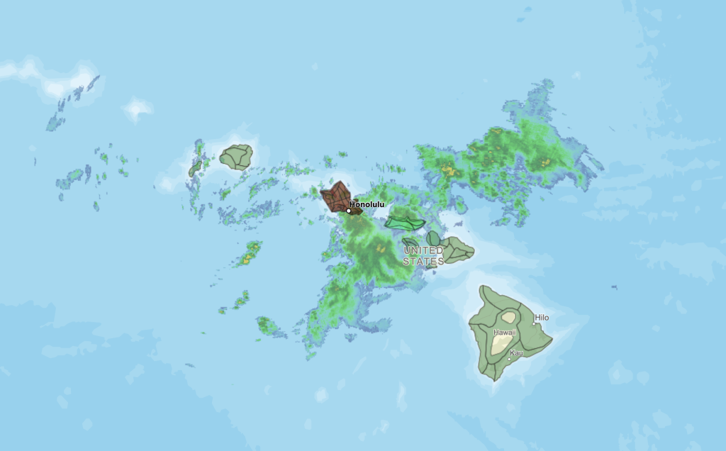
The National Weather Service has issued a Flood Advisory, now in effect for the island of Maui until 10:30 p.m. At 7:21 p.m., radar showed that moderate to locally heavy rain has briefly decreased over Maui. Additional bands of moderate to locally heavy rain is expected to move in from the south over the next few hours. Some locations that will experience flooding include: Kahului, Kīhei, Lahaina, Kula, Pukalani, Makawao, Kēōkea, Hāliʻimaile, Pāʻia, Puʻunēnē, Haʻikū-Paʻuwela, Wailea, Paʻuwela, Māʻalaea, ʻUlupalakua, Huelo, Mākena, Waikapū, Wailuku and
Waiehu.
At 4:02 p.m., radar indicated heavy rain over Maui with the heaviest rain rates across the western half of Maui. Rain was falling at a rate of 0.5 to 1.5 inches per hour. Additional bands of moderate to locally heavy showers are expected through this evening.
Flood Advisory for Lānaʻi until 5:15 p.m.
The National Weather Service has issued a Flood Advisory for the island of Lānaʻi until 5:15 p.m. At 2:02 p.m., radar showed heavy rain over moving over the island of Lānaʻi, falling at a rate of 1 to 2 inches per hour. Locations that will experience flooding include the entire island of Lānaʻi. The public should stay away from streams, drainage ditches and low-lying areas prone to flooding.
Molokaʻi Flood Advisory until 5:30 p.m.
The National Weather Service has extended a Flood Advisory for the island of Molokaʻi until 5:30 p.m. At 2:26 p.m., radar showed heavy rain moving over the island of Molokaʻi from the southwest. Rain was falling at a rate of 1 to 2 inches per hour. The most likely locations for
flooding impacts continue to be along Kamehameha V Highway between Kaunakakai and Pūkoʻo, with road closures likely. Some locations that will experience flooding include: Kaunakakai, Kualapuʻu, Hoʻolehua, Kalaupapa National Park, Kawela, Kamalō, Maunaloa, ʻUalapuʻe, Kepuhi, Pūkoʻo, Hālawa Valley and Molokaʻi Airport.
At 11:25 a.m., radar showed heavy rain moving over the island of Molokaʻi from the southwest. Rain was falling at a rate of 0.5 to 2 inches per hour. The most likely locations for flooding impacts would be along Kamehameha V Highway between Kaunakakai and Pūkoʻo, with road closures likely. Some locations that will experience flooding include: Kaunakakai, Kualapuʻu, Hoʻolehua, Kalaupapa National Park, Kawela, Kamalō, Maunaloa, ʻUalapuʻe, Kepuhi, Pūkoʻo, Hālawa Valley and Molokaʻi Airport.
The public should stay away from streams, drainage ditches and low-lying areas prone to flooding. This advisory may need to be extended beyond 2:30 p.m. if flooding persists.
Flood Watch in effect until Sunday afternoon for Oʻahu, Maui County and Hawaiʻi Island
The National Weather Service has issued a Flash Flood Watch through Sunday afternoon for Oʻahu, Maui, Molokaʻi, Lānaʻi, Kahoʻolawe and Hawaiʻi Island.
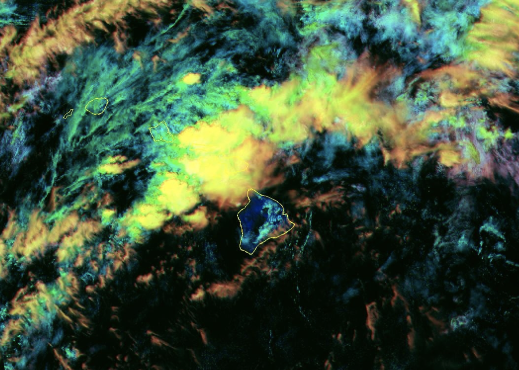
A kona low developing west of the islands will draw abundant moisture northward as it strengthens and eventually departs to north early next week. Several rounds of moderate to heavy rainfall and thunderstorms are expected. The heaviest rain is expected to last through Saturday, except for the Big Island where the heaviest rain is expected on Sunday.
The public should monitor later forecasts and be prepared to take action should Flash Flood Warnings be issued.
Maui Road advisories:
Access in East Maui remains limited to local traffic. The Road to Hāna is not currently accessible to visitors — travelers should not include this route in their itinerary until Maui County confirms full reopening. Both districts of Haleakalā National Park remain closed until further notice due to road repairs. Monitor the Maui County Road Closure Notifications page for updates.
Guidance for Travelers Currently in Hawaiʻi
- Flash flooding is possible even during moderate rainfall due to saturated grounds. Never drive through flowing or rising water, including streams and drainage ditches that may appear dry.
- Travelers should wait 48–72 hours after rain stops before swimming, particularly where ocean water appears brown or murky.
- Some state parks and facilities remain temporarily closed while safety assessments and cleanup continue. Visit dlnr.hawaii.gov/dsp for the latest reopening information.
- There are no weather-related closures of airport facilities. Allow extra time at the airport — at least 3 hours for transpacific flights and 90 minutes for interisland.
Guidance for Travelers with Upcoming Trips
There is no reason to cancel or postpone upcoming travel to Hawaiʻi. The state remains safe and welcoming, and conditions are expected to improve early next week.
Travelers are encouraged to:
- Ensure their airline has a current mobile number on file and enable app and SMS notifications.
- Confirm flight status directly with their airline before departing for the airport. Airlines are the best source of real-time information on delays and changes.
Flooding and Evacuation on O‘ahu’s North Shore
March 20, 2026, 1 p.m.
The National Weather Service has issued a flash flood warning for all of O‘ahu through 2 p.m. today, and a flash flood emergency is ongoing for northern areas of the island.
Due to emerging hazards caused by the ongoing storm on O‘ahu, please discourage visitors from entering the Wahiawā or North Shore area today, Friday, March 20. The areas to avoid include Hale‘iwa and Waialua. Please check weather and road conditions before leaving your hotel or accommodations because conditions can change quickly.
Visitors already on the North Shore are urged to shelter-in-place; however, they should be prepared to evacuate if the City and County of Honolulu issues an evacuation order for their area. See the current evacuation map for O‘ahu below.
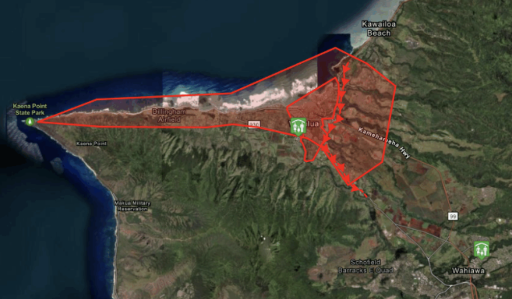
Credit: City and County of Honolulu
Some North Shore areas are being evacuated because of “extremely dangerous flooding” and rising water levels at the Wahiawa Dam, which is at risk of failure. Although rainfall has dropped, there is significant runoff that is keeping water levels high at the Wahiawa Reservoir (Lake Wilson).
Intermittent heavy rainfall is expected to continue throughout today, which could lead to renewed rises in water levels and worsening flooding conditions.
Resources
- For the latest weather information, visit the National Weather Service. For visitor information, visit GoHawaii.com, download the GoHawaii app, or call 1-800-GOHAWAII (available 24 hours a day).
- Visitors can also refer to HTA’s Visitor’s Guide to Kona Low Storms and the Visitor’s Guide to TV News, Radio and Weather Updates for additional information.
- For updates on road closures, go to the Hawai‘i Department of Transportation website and or their Instagram.
Sponsored Content


