Category 4 Hurricane Lowell to remain a powerful hurricane for the next several days

The trade winds are slowly edging upwards and are expected to build to strong and gusty levels over the windier spots across Maui County and the Big Island today. Winds will be on the uptick across Kauaʻi and Oʻahu as well, but not quite as strong as the southern islands. The uptick in winds is in response to Hurricane Lowell, currently about 460 miles east-southeast of Hilo. The system is passing to our south while a high pressure system is situated far to the north.
The National Weather Service says there remains large model spread and above average uncertainty regarding the details of this anticipated northward turn, so interests in Hawaiʻi should monitor the latest forecast updates.
Moisture being carried in on the trade winds will focus clouds and showers mostly to the windward and mauka areas, particularly during the overnight through early morning hours each day. The forecast remains uncertain for the upcoming Labor Day weekend due to both Lowell and Karina remaining in the central Pacific over the coming days.
At 5 a.m. HST, the center of Hurricane Lowell was located near latitude 13.4 North, longitude 153.2 West. Lowell is moving toward the west near 10 mph. This general motion with a gradual decrease in forward speed is expected during the next few days.
Maximum sustained winds have increased to near 155 mph with higher gusts. Lowell is a category 4 hurricane on the Saffir-Simpson Hurricane Wind Scale. Further strengthening is possible, and Lowell could become a category 5 hurricane later today or tonight. It is expected to remain a powerful hurricane for the next several days. Hurricane-force winds extend outward up to 35 miles from the center and tropical-storm-force winds extend outward up to 90 miles. The estimated minimum central pressure is 932 mb (27.53 inches).
Swells generated by Lowell are likely to affect portions of the Hawaiian Islands beginning today. These swells are likely to cause life-threatening surf and rip current conditions.
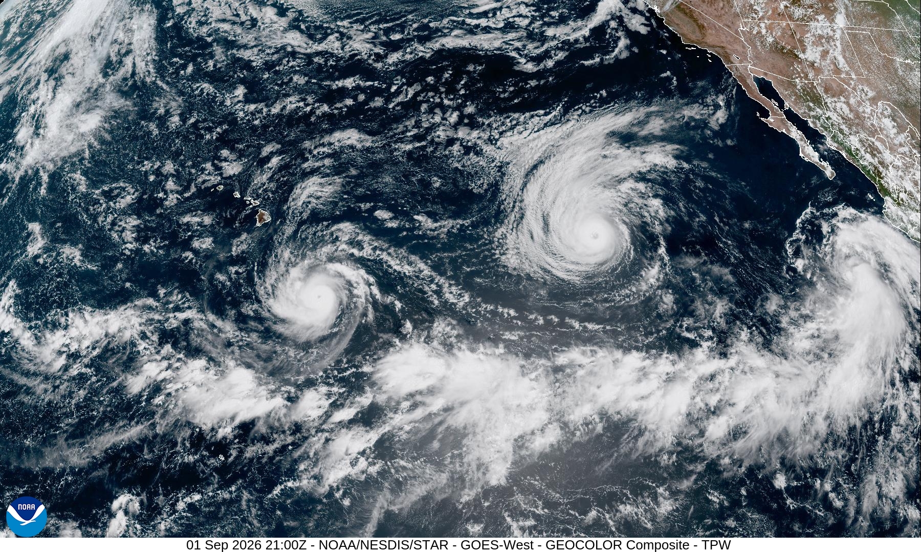
There also are two storms in the Eastern Pacific: Category 4 Hurricane Karina and Tropical Storm Marie.
Hurricane Karina now is a monster storm with winds of 145 mph, but it is expected to weaken within a few days to a tropical storm. It is now 1,440 miles west of the southern tip of Baja California.
Tropical Storm Marie with maximum sustained winds of 65 mph is about 435 miles south of the southern tip of Baja California.
Residents and businesses are encouraged to review or develop preparedness plans now, before the next storm arrives.
People should also continue to monitor local radio broadcasts for official advisories, watches or warnings issued in your area. Forecasts for specific locations can be found on the National Weather Service website.
Sponsored Content