

Forecasters Monitor 2 Disorganized Systems in Central Pacific
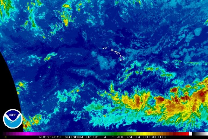
Satellite imagery, Central Pacific, 2:30 p.m. HST 7/23/2014. Image courtesy NOAA/NWS.
By Wendy Osher
The National Weather Service Central Pacific Hurricane Center is monitoring two disorganized areas of low pressure that are currently located south east of the state.
The systems are located about 1,300 miles SE, and 800 miles SSE of Hawaiʻi Island.
The larger system is producing “disorganized shower activity” and has a 30% chance of formation over the next 48 hours as it moves westward into the Central Pacific, according to a tropical weather outlook produced by the agency.
The smaller system has a low 10% chance of formation over the same period with gradual development possible as it moves westward, far south of the islands, the outlook forecast stated.
Forecasters with the National Weather Service say trade wind weather is expected through Thursday, with the chance of windward showers increasing later this weekend into early next week.
A small craft advisory is posted through 6 p.m. on Thursday, July 24, 2014, for the Pailolo Channel between Maui and Molokaʻi, the ʻAlenuihāhā Channel between Hawaiʻi Island and Maui, Māʻalaea Bay on Maui, and waters south of Hawaiʻi Island.
The NWS is forecasting east winds blowing at 25 knots and rough seas of 11 feet.
***Supporting information courtesy National Weather Service, National Oceanic and Atmospheric Administration, and Central Pacific Hurricane Center.
Sponsored Content


