No Tsunami Threat to Hawaiʻi After 6+ Indonesia Quake

Indonesia earthquake map courtesy Pacific Tsunami Warning Center.
By Wendy Osher
There is no tsunami threat to Hawaiʻi following a preliminary magnitude 6.5 earthquake reported at 4:36 p.m. HST on Tuesday, Sept. 9, 2014 in the Kepulauan Sula region of Indonesia, that according to the Pacific Tsunami Warning Center.
The PTWC issued an informational bulletin saying that based on all available data, a destructive Pacific-Wide tsunami is not expected, and there is no tsunami threat to Hawaiʻi.
The USGS reports that the quake occurred at a depth of 12.8 miles and was located: 76 miles SE of Modayag, Indonesia; 100 miles S of Tondano, Indonesia; 103 miles S of Tomohon, Indonesia; 109 miles S of Bitung, Indonesia; and 579 miles N of Dili, East Timor.
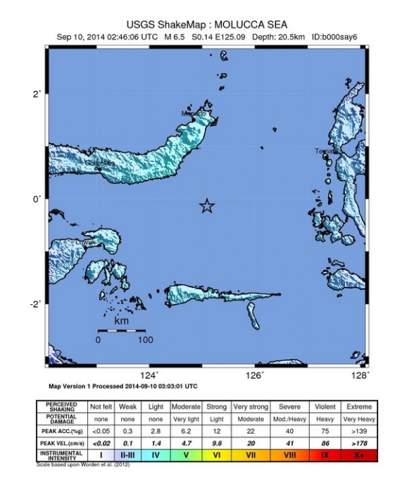
Indonesia earthquake 9/9/14 shake map courtesy USGS.
Sponsored Content