

Series of North Swells Expected, Small Craft Advisory Posted
By Meteorologist Malika Dudley / Email: malika@mauinow.com
**Click directly on the images to make them larger.**
A SMALL CRAFT ADVISORY has been posted for Māʻalaea Bay and the Pailolo and ʻAlenuihāhā channels from 9 a.m. today until 6 a.m. Thursday. Northeast winds of 25 knots are expected with rough seas up to 11 feet. Inexperienced mariners are cautioned to avoid navigating these conditions.
 North: Surf is expected in the waist to head high range. Best breaks could see overhead to a couple feet overhead set waves, especially later in the day.
West: Breaks that don’t catch the swells are forecasted to get smaller surf in the ankle high range. Spots that are open to the north swell should see waist to head high waves. Maybe even overhead from time to time, especially late in the day.
South: Ankle-slappers to possibly thigh high surf is expected.
Our current new northwest swell (315-335°) peaked overnight with a reinforcement on tap out of the north-northwest swell (330-360°) building today and Thursday and peaking Thursday in the chest to head high range with bigger sets at the best breaks. Maybe an even bigger swell (310-345°) on the horizon for next weekend, possibly peaking with waves well overhead. Super Typhoon Nuri could possibly bring us a series of solid swells starting around Nov. 11.
 Small swells generated in the South Pacific are expected to bring us waves in the thigh high or less range. You might see possible plusses at the best tides and exposures but they will be inconsistent at best and some west shores, blocked by other islands, will remain flat. There isn’t much on the horizon out of the South Pacific.
Keep in mind, surf heights are measured on the face of the wave from trough to crest. Heights vary from beach to beach, and at the same beach, from break to break.
**Click here for Malika’s full weather forecast.**

Image: Krannichfeld Photography
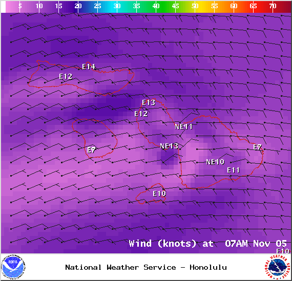
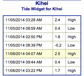
Image: NOAA / NWS
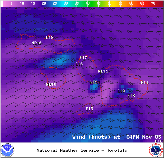
Image: NOAA / NWS
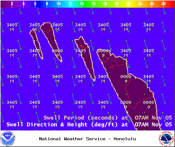
Image: NOAA / NWS
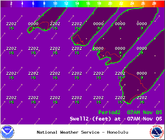
Image: NOAA / NWS
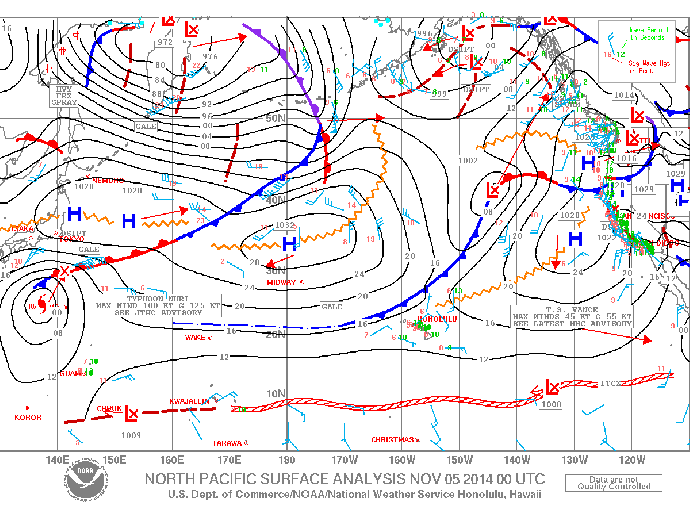
Image: NOAA / NWS
Sponsored Content


