

Weekend Surf: NW Fades, Warning Level Surf for Sunday
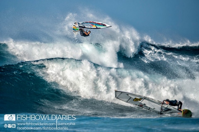
Levi Siver and Morgan Noireaux yesterday at Ho’okipa / Image: Sofie Louca of Fish Bowl Diaries
By Meteorologist Malika Dudley / Email: malika@mauinow.com
Alerts
A High Surf Warning is in effect for the north facing shores of Maui and Moloka’i (and also the west shores of Moloka’i) through 6:00 a.m. Tuesday for a large west-northwest swell. Warning level surf is expected for Maui County by midday Sunday with wave heights building up to 25 to 30 foot faces. The west side of Moloka’i is forecasted to get 15 to 20 foot faces Sunday night and Monday.
A Small Craft Advisory is in effect for all Maui County waters from 4:00 a.m. Sunday through 6:00 a.m. Tuesday as well.
**Click directly on the images below to make them larger. Charts include: Maui County projected winds, forecasted swell direction, height & period, tides, a surface map and expected wave heights.**
 Maui County Surf Report for Sunday December 21, 2014 (Updated at 11:30 p.m. 12/20)
North: Surf heights are expected chest to head high in the morning. New west-northwest will quickly build in the afternoon starting to close out certain breaks. By sundown we could see 20 foot faces for the best outer reef breaks.
West: Spots open to the swells that are wrapping are expected to get waves waist to maybe chest high. Otherwise, breaks that don’t catch the swells, and / or are shadowed from it, are forecasted to get smaller surf at ankle high or flat.
South: South-southwest peaks Sunday bringing waist to shoulder high wave heights possibly bigger on the sets at the best breaks.

A warning level west-northwest swell is expected to build quickly Sunday afternoon, peaking overnight on Sunday. We could see 20 to 25 foot faces by sundown. Mid-week another shot of energy out of the northwest is forecasted to build in as well.
An out of season boost out of the south will pick up Sunday with waist to chest high waves with some plusses on the sets at the best exposures. Swell is expected to slowly begin to fade Monday. Otherwise, nothing significant is expected out of the SPAC.
**Click here for your detailed Maui County weather report.**

Image: NOAA / NWS

Image: NOAA / NWS

Image: NOAA / NWS

Image: NOAA / NWS

Image: NOAA / NWS

Image: NOAA / NWS

Image: NOAA / NWS

Image: NOAA / NWS

Image: NOAA / NWS

Image: NOAA / NWS

Image: NOAA / NWS
Sponsored Content


