

WNW Slightly Smaller, Unsettled Weather

Pe’ahi “Jaws” 12/22/14 – Image: John Patao
By Meteorologist Malika Dudley / Email: malika@mauinow.com
Alerts
Throughout the current weather event, all weather alerts will be posted HERE.
**Click directly on the images below to make them larger. Charts include: Maui County projected winds, forecasted swell direction, height & period, tides, a surface map and expected wave heights.**
Maui County Surf Forecast, Tuesday December 23
North: Surf heights are expected double to triple overhead today with 10 to 15 foot faces expected and possible plusses.
West: Spots open to the swells are expected to get waves maybe up to waist high. Otherwise, breaks that don’t catch the swells, and / or are shadowed from it, are forecasted to get smaller surf at ankle high or flat.
South: South-southwest continues to fade bringing ankle to waist high wave heights at the best breaks.
Our current west-northwest swell is slightly smaller Tuesday into Wednesday. Surf fades through Wednesday and becomes messy as a front moves through. We will get some swell out of the north-northeast created by the frontal passage.
Another shot of surf energy out of the north-northwest is forecasted to combine with northeast wind swell on Christmas Day. A new northwest is forecasted for the weekend as well.
Super small trace amounts of swell expected out of the SPAC. Not much to get excited about.
Keep in mind, surf heights are measured on the face of the wave from trough to crest. Heights vary from beach to beach, and at the same beach, from break to break.
**Click here for your detailed Maui County weather report.**
**To see images from yesterday’s surf session at Pe’ahi “Jaws” click here.**
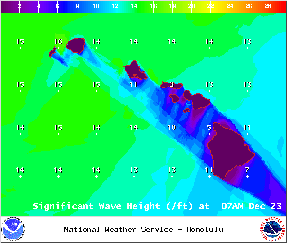
Image: NOAA / NWS

Image: NOAA / NWS

Image: NOAA / NWS
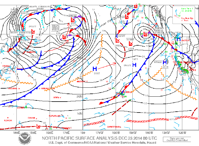
Image: NOAA / NWS
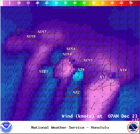
Image: NOAA / NWS
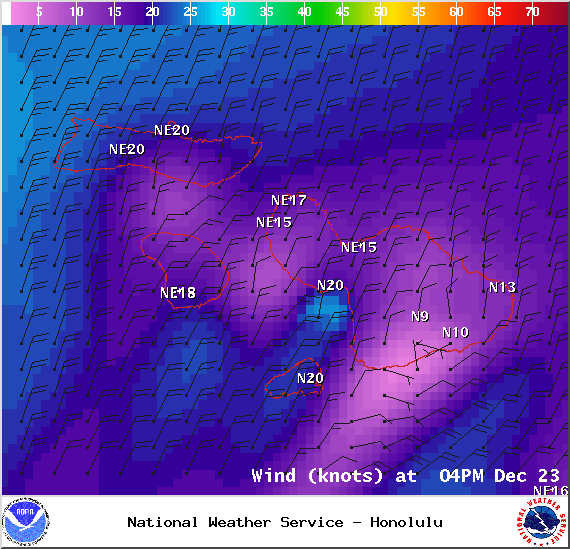
Image: NOAA / NWS
Sponsored Content


