

Current Swell Fades, Advisory Level Swell For Weekend
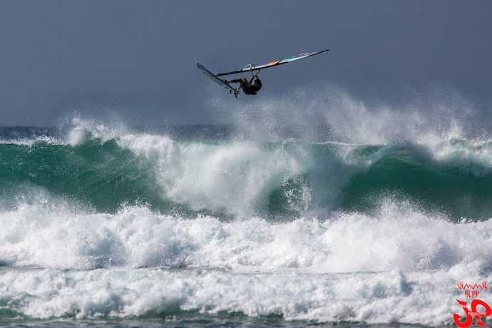
Ho’okipa / Image: Jimmie Hepp
Alerts
A High Surf Advisory is posted for the north facing shores of Maui and Molokai through 6:00 p.m. Saturday for a north swell building tonight and peaking Wednesday before gradually diminishing. Expect strong breaking waves, shore break and strong longshore and rip currents making swimming difficult and dangerous.
A Small Craft Advisory is posted for all Maui County windward waters from 6:00 p.m. Friday through 6:00 a.m. Saturday for northeast winds up to 20 knots with higher gusts. Rough seas of 5 to 10 feet are also forecasted. Inexperienced mariners should avoid navigating in these conditions.
**Click directly on the images below to make them larger. Charts include: Maui County projected winds, forecasted swell direction, height & period, tides, a surface map and expected wave heights.**
 Maui County Surf Forecast, Friday, January 9, 2015
North: Surf heights are expected about head high to a few feet overhead at the best breaks, especially for spots east of Ho’okipa.
West: Spots open to the swells are expected to get waist to chest high waves on the sets at the best exposures. Otherwise, breaks that don’t catch the swells, and / or are shadowed from them, are forecasted to get smaller surf at ankle high or flat.
South: Ankle to knee high surf is expected. Most spots are flat.
Our current north-northwest (330-360) swell is expected to continue to slowly fade.
 Another west-northwest is expected over the weekend, starting to build Friday night into Saturday morning. This swell will likely produce advisory level surf along north and west facing shores as early as Friday evening. The swell will gradually subside through the weekend.
Pending development of storms, another shot of energy is expected early next week as well, with surf likely well above the advisory level along north and west facing shores. That swell will slowly subside through midweek. A northwest swell arriving next midweek may be larger still when it peaks next Thursday.
Nothing of note out of the SPAC to get excited about.
Keep in mind, surf heights are measured on the face of the wave from trough to crest. Heights vary from beach to beach, and at the same beach, from break to break.
**Click here for your detailed Maui County weather report.**
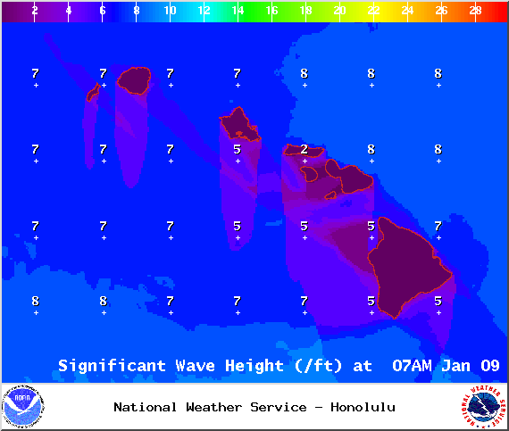
Image: NOAA / NWS
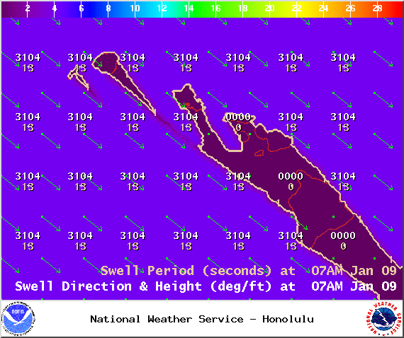
Image: NOAA / NWS
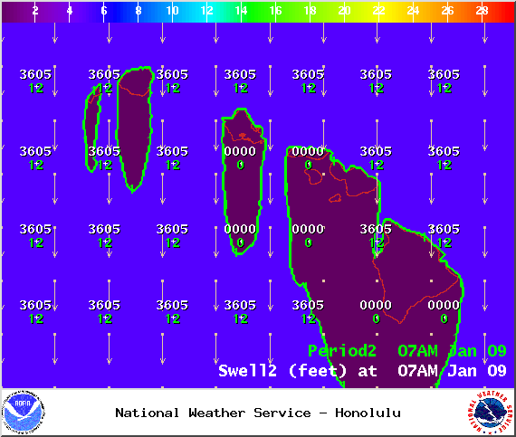
Image: NOAA / NWS
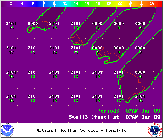
Image: NOAA / NWS

Image: NOAA / NWS

Image: NOAA / NWS
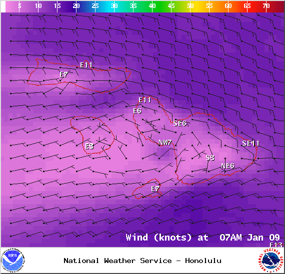
Image: NOAA / NWS
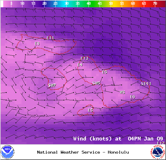
Image: NOAA / NWS
Sponsored Content


