

Advisory Level Swell Peaks Today

Imaikalani DeVault – Winner of the Pro-Am portion of the 25th annual Ho’okipa classic in memory of Justin Roberson / Image: Dooma Photos
By Meteorologist Malika Dudley / Email: malika@mauinow.com
Alerts
A High Surf Advisory is posted for the north facing shores of Maui and Moloka’i through 6:00 p.m. Tuesday. The west side of Moloka’i is also included in the advisory. Expect strong breaking waves, shore break and strong longshore and rip currents making swimming difficult and dangerous.
A Small Craft Advisory is posted for Maui County windward waters and the Kaiwi Channel through 6:00 a.m. Tuesday for seas of 8 to 11 feet. Inexperienced mariners should avoid navigating in these conditions.
**Click directly on the images below to make them larger. Charts include: Maui County projected winds, forecasted swell direction, height & period, tides, a surface map and expected wave heights.**
 Maui County Surf Forecast, Tuesday, January 13, 2015
North: Surf heights are expected double overhead or bigger. The best breaks, especially spots east of Ho’okipa, could get up to 18 foot faces early in the day. Nice conditions early with our light wind speeds.
West: Early in the day some spots will catch wrap from the peaking west-northwest swell. Otherwise, breaks that don’t catch the swells, and / or are shadowed from them, are forecasted to get smaller surf at ankle high or flat.
South: Ankle to knee high surf is expected. Most spots are flat.
 Our current west-northwest swell is expected to peak today (Tuesday) and will slowly subside through midweek. The north shore of Maui is partially shadowed from the swell but spots east of Ho’okipa will still see plenty action. The swell is expected to fade through midweek.
A new west-northwest swell is expected to arrive late Wednesday night. By Friday the direction should shift more northwest and this would allow for more north shore spots to build in size.
Nothing of note out of the SPAC to get excited about.
Keep in mind, surf heights are measured on the face of the wave from trough to crest. Heights vary from beach to beach, and at the same beach, from break to break.
**Click here for your detailed Maui County weather report.**
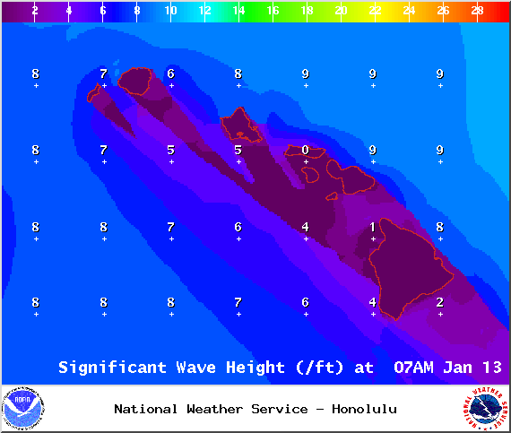
Image: NOAA / NWS

Image: NOAA / NWS
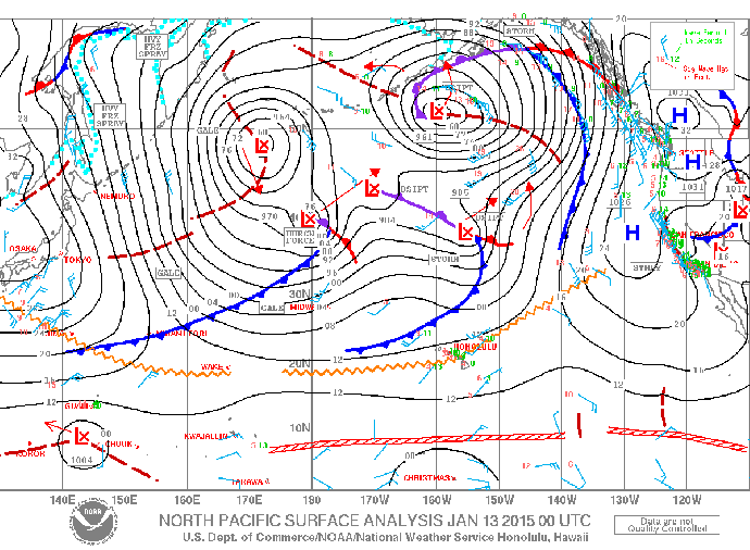
Image: NOAA / NWS
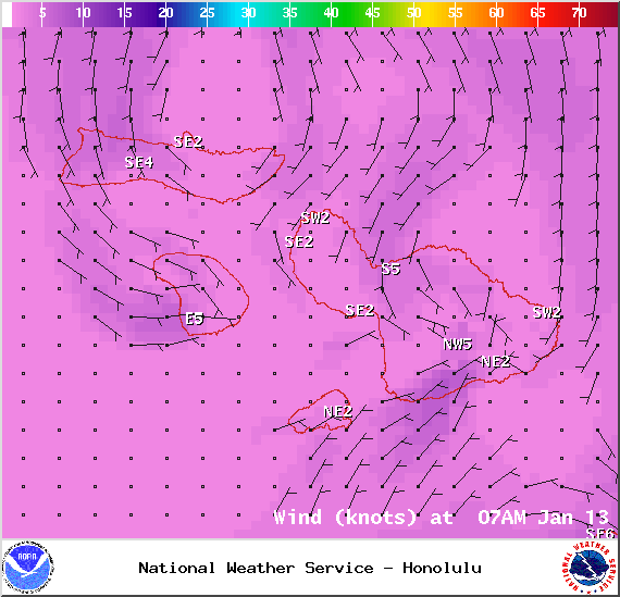
Image: NOAA / NWS

Image: NOAA / NWS
Sponsored Content


