

WEEKEND SURF: High Surf Warning Today, Swell Fades Sunday
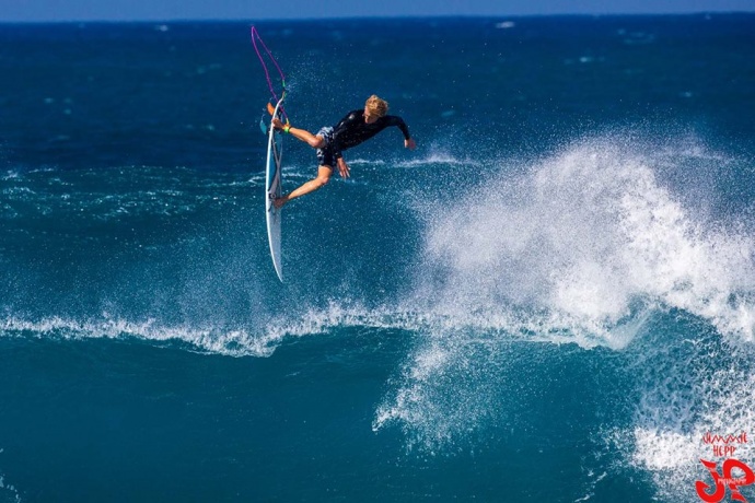
Ho’okipa 1.23.15 / Image: Jimmie Hepp
By Meteorologist Malika Dudley / Email: malika@mauinow.com
Alerts
A Marine Weather Statement has been issued by the National Weather Service for a very large west-northwest swell. The Weather Service in Honolulu says the very large swell will remain elevated through Saturday. They are warning of strong harbor surges and large breaking waves at harbor entrances exposed to the swell. Some locations that can expect such conditions are Kaumalapau harbor on Lāna’i.
The High Surf Warning has been extended for the north and west shores of Moloka’i and the north shore of Maui. The warning is posted through Sunday at 6:00 a.m. Wave heights of 20 to 30 foot faces are expected along the north shores while 12 to 18 foot faces are expected on the west side of Moloka’i. Expect ocean water occasionally sweeping across portions of beaches, very strong breaking waves and strong longshore and rip currents. Breaking waves may occasionally impact harbors making navigating the harbor channel difficult. Large breaking surf, significant shore break and dangerous currents will make entering the water very hazardous. Boaters should be aware of an increased number of surfers in the water.
The High Surf Advisory has also been extended for the west shores of Maui, Lāna’i and Kaho’olawe through 6:00 a.m. Sunday. Wave heights from 8 to 12 feet are expected on Maui. Surf heights of 6 to 9 feet are expected for Lāna’i and Kaho’olawe. Expect strong breaking waves, shore break and strong longshore and rip currents making swimming difficult and dangerous.
A Small Craft Advisory has been issued for all island waters through 6:00 a.m. Sunday for winds from 15 to 25 knots and rough seas of 7 to 17 feet.
**Click directly on the images below to make them larger. Charts include: Maui County projected winds, forecasted swell direction, height & period, tides, a surface map and expected wave heights.**
 Maui County Surf Forecast
North: Surf heights are expected to peak today with well overhead waves. The best breaks, especially spots east of Ho’okipa, could see double to possibly triple overhead waves. Ten to 15 foot faces at spots open to the swell. Outer reefs could get up to 25 foot faces (possibly more on the sets) early on.
West: Some spots will catch wrap from the west-northwest swell up to about waist high maybe bigger on the sets depending on the spot. Otherwise, breaks that don’t catch the swells, and / or are shadowed from them, are forecasted to get smaller surf at ankle high or flat.
South: Wrap from the west-northwest for select breaks could be from waist to chest high. Otherwise, waves should be ankle to knee high.
 Our current swell is expected to peak today at warning levels. This XL swell (290-330°) will possibly reach 25 foot faces or more at deepwater breaks. Swell begins to fade on Sunday. Monday wave heights should be in the overhead to double overhead range.
A storm developing off of Japan is expected to bring another solid west-northwest swell setting up for Tuesday and Wednesday of next week.
Small south-southwest brings knee to possibly thigh high waves at the best breaks. Today and tomorrow a fraction of the wrap from the west-northwest swell is expected to boost heights.
Keep in mind, surf heights are measured on the face of the wave from trough to crest. Heights vary from beach to beach, and at the same beach, from break to break.
**Click here for your detailed Maui County weather report.**
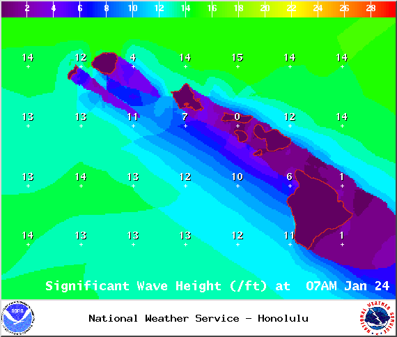
Image: NOAA / NWS
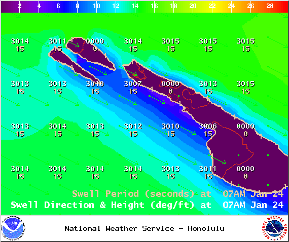
Image: NOAA / NWS
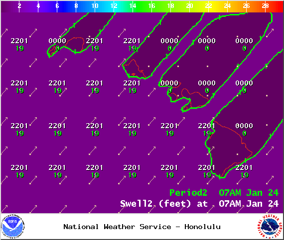
Image: NOAA / NWS
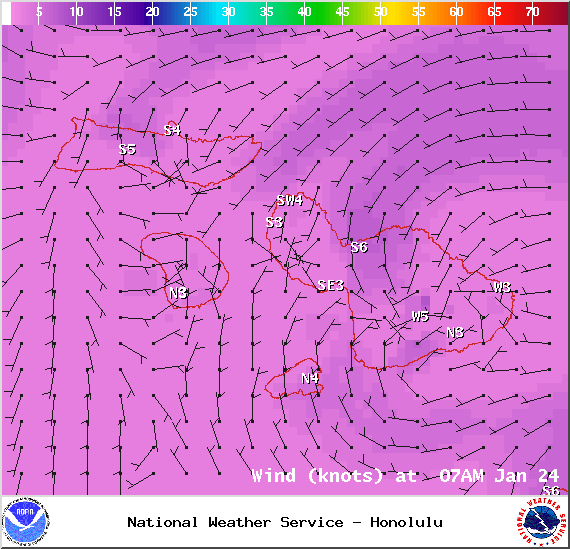
Image: NOAA / NWS

Image: NOAA / NWS
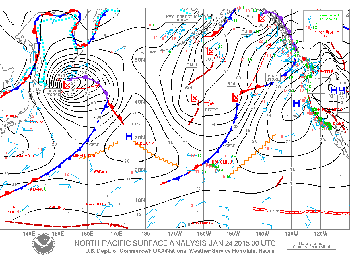
Image: NOAA / NWS
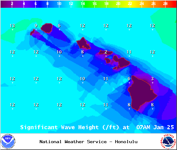
Image: NOAA / NWS

Image: NOAA / NWS

Image: NOAA / NWS
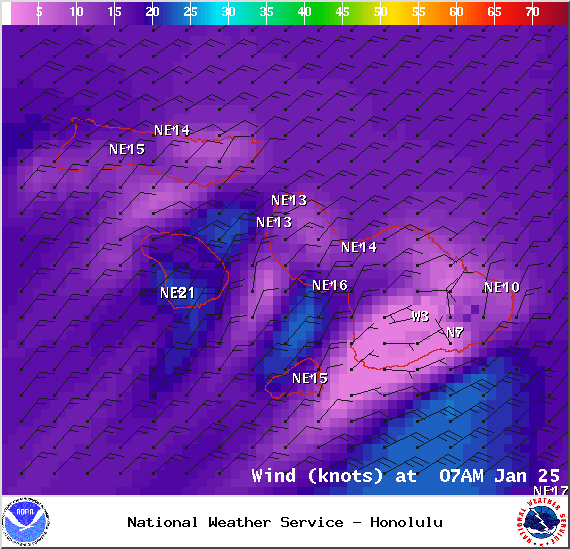
Image: NOAA / NWS
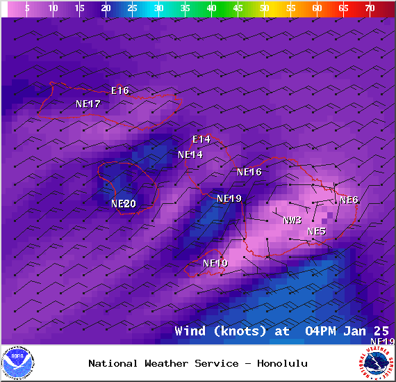
Image: NOAA / NWS
Sponsored Content


