

Advisory Level Swell Peaks This Afternoon
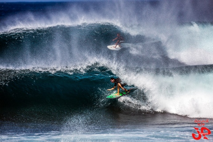
Ho’okipa this week / Image: Jimmie Hepp
By Meteorologist Malika Dudley / Email: malika@mauinow.com
Alerts
A High Surf Advisory is in effect through 6:00 a.m. Sunday for the north facing shores of Maui and Moloka’i. Wave heights of 14 to 18 feet are expected. Expect strong breaking waves, shore break and strong longshore and rip currents making swimming difficult and dangerous.
A Small Craft Advisory is in effect for Maui County windward waters and the Kaiwi channel through 6:00 a.m. Sunday for rough seas of 7 to 11 feet. Inexperienced mariners should avoid navigating in these conditions.
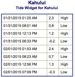
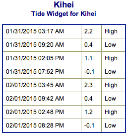
**Click directly on the images below to make them larger. Charts include: Maui County projected winds, forecasted swell direction, height & period, tides, a surface map and expected wave heights.**
 Maui County Surf Forecast
North: Surf heights are expected well overhead today. Best breaks east of Ho’okipa could see bigger waves on the sets possibly to double or even triple overhead, especially in the afternoon.
West: Spots open to the north could see wave heights of about chest high to overhead, bigger later in the day on the sets. Otherwise, breaks that don’t catch the swells, and / or are shadowed from them, are forecasted to get smaller surf at ankle high or flat.
South: We don’t expect much for southern exposures – flat to knee high.
 A new reinforcing swell is expected for the weekend. Another round of well overhead surf is expected. The swell is already building and is expected to peak Saturday afternoon possibly with waves up to double or triple overhead on the sets.
That same system could also possibly reorganize in the Gulf of Alaska bringing another shot of surf energy our way for the first week of February.
Nothing exciting out of the SPAC. Some wind swell is forecasted for next week.
Keep in mind, surf heights are measured on the face of the wave from trough to crest. Heights vary from beach to beach, and at the same beach, from break to break.
**Click here for your detailed Maui County weather report.**
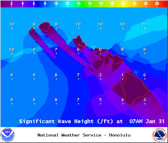
Image: NOAA / NWS

Image: NOAA / NWS
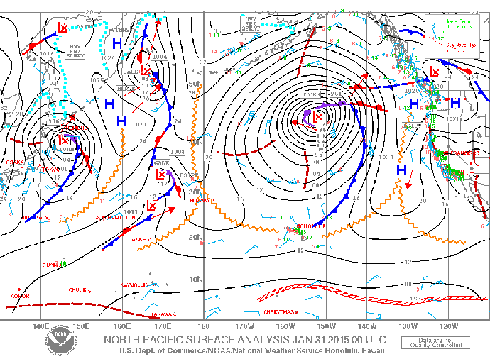
Image: NOAA / NWS

Image: NOAA / NWS
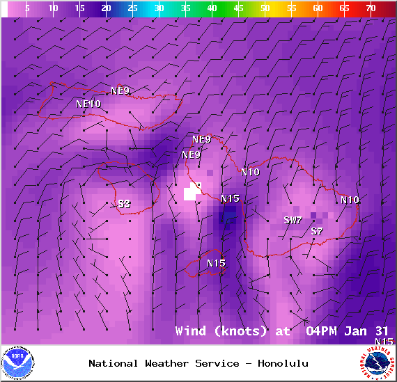
Image: NOAA / NWS

Image: NOAA / NWS
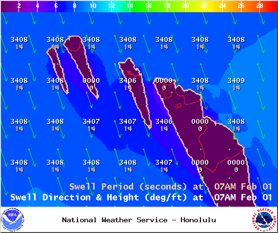
Image: NOAA / NWS
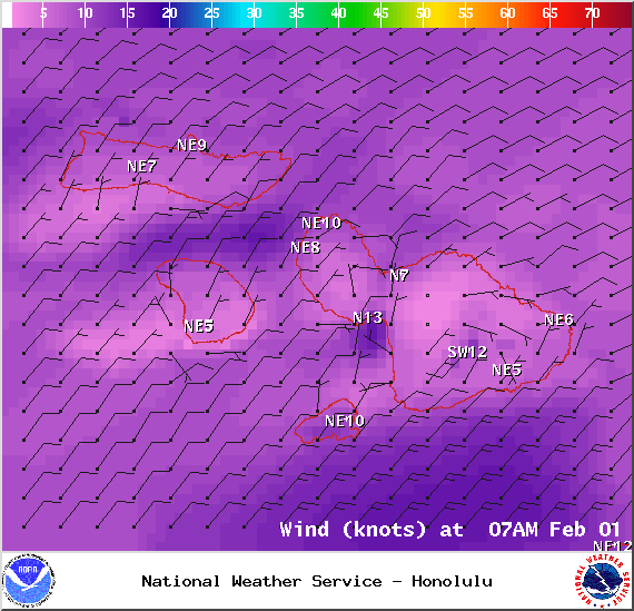
Image: NOAA / NWS
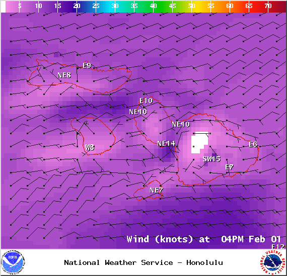
Image: NOAA / NWS
Sponsored Content


