

Large NW Swell Fading, New NW Expected
Image: John O’Leary
Alerts
A Small Craft Advisory is posted for all Maui County channels and windward waters through 7 p.m. Monday for northeast winds up to 30 knots and rough seas up to 13 feet.
A High Surf Advisory is posted through 7 p.m. Monday morning for 12 to 16 foot faces for north facing shores of Maui and Molokai and 8 to 12 foot waves for the west side of Molokai.
Check our breaking news section for any urgent weather alerts.
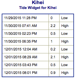
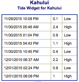
**Click directly on the images below to make them larger. Charts include: Maui County projected winds, tides, swell direction & period and expected wave heights.**
 Maui Surf Forecast
North: Wave heights are expected to be overhead to double overhead in the morning and dropping in the afternoon. Our trade swell continues for the Hana side with chest/shoulder high surf expected.
West: Wave heights knee high are expected today. The best breaks catching the northwest wrap could get up to double overhead for exposed spots.
South: Wave heights around knee high today.
 Our current northwest swell is expected to hold through the morning before beginning a steady fading trend. A reinforcing northwest swell is expected to arrive late Tuesday, and then peak on Wednesday. This swell could once again bring advisory level surf to exposed shores. An even larger northwest swell is possible for the next weekend, which could bring surf to warning levels.
Our current south-southwest is mainly leftovers today.
Trade swell continues but it’s bumpy and sloppy for most spots.
Keep in mind, surf heights are measured on the face of the wave from trough to crest. Heights vary from beach to beach, and at the same beach, from break to break.
**Click here for your detailed Maui County weather report.**
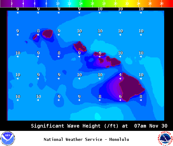
Image: NOAA / NWS
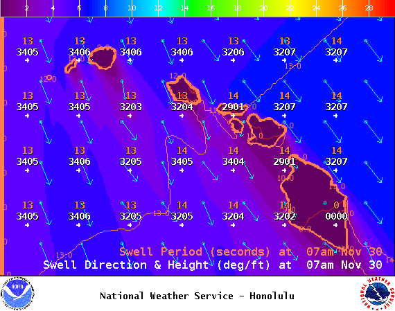
Image: NOAA / NWS
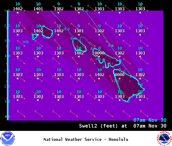
Image: NOAA / NWS
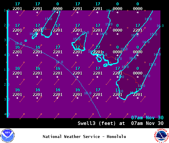
Image: NOAA / NWS
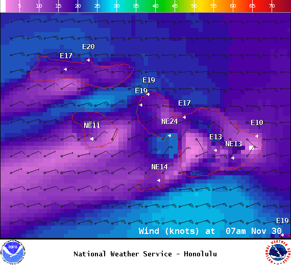
Image: NOAA / NWS
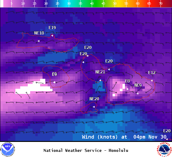
Image: NOAA / NWS
Image: NOAA / NWS
Sponsored Content


