

Trade Swell is Showing, SSW Bump Expected Soon

Image: Atlantis Submarines
Alerts (as of 1:00 a.m.)
There are no weather alerts posted at this time.
**Click directly on the images below to make them larger. Charts include: Maui County projected winds, tides, swell direction & period and expected wave heights.**
 Maui Surf Forecast
North: Wave heights are expected to be about waist/shoudler high today but messy.
West: Surf is pretty flat today for west shores without exposure to the swells. Exposures catching the swell will get up to knee/waist high or so.
South: Surf is knee/waist high today. The best breaks could get up to chest high on the sets.
 Storm activity isn’t expected and therefore there are no notable swells on the horizon out of the NPAC. Trade swell will show for northeastern exposures up to about shoulder high.
Small southerly swell is showing. A better southwest is forecast from Tuesday through Friday. We may get a fun swell for next week. Will keep an eye on it.
Keep in mind, surf heights are measured on the face of the wave from trough to crest. Heights vary from beach to beach, and at the same beach, from break to break.
**Click here for your detailed Maui County weather report.**
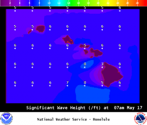
Image: NOAA / NWS

Image: NOAA / NWS
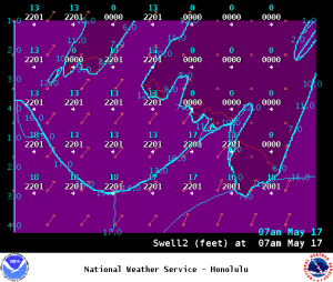
Image: NOAA / NWS
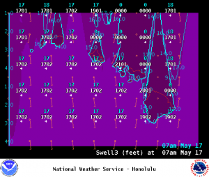
Image: NOAA / NWS
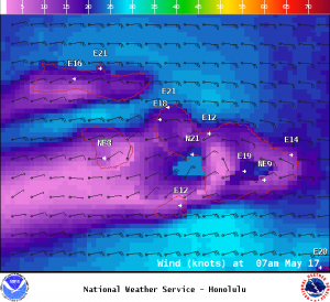
Image: NOAA / NWS
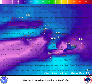
Image: NOAA / NWS

Image: NOAA / NWS
Sponsored Content


