

OLIVIA TUESDAY FORECAST UPDATES
OLIVIA WEDNESDAY 9.12.18 FORECAST UPDATES: http://mauinow.com/?p=280330
MAUI CLOSURES, CANCELLATIONS: http://mauinow.com/?p
Maui Power Outage Updates: http://mauinow.com/?p
Maui Traffic Advisories, Road Closures: http://mauinow.com/?p
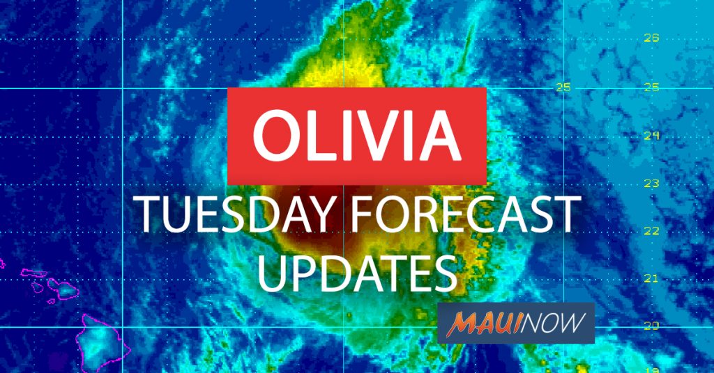
Maui Now graphic. PC: background image courtesy NOAA/CPHC.
*A NEW POST WITH OLIVIA FORECAST UPDATES FOR WEDNESDAY IS NOW POSTED AT: http://mauinow.com/?p=280330
UPDATE: 11 P.M. HST 9.11.18
Kauaʻi was dropped from the Tropical Storm Warning list in the latest forecast update issued at 11 p.m. on Tuesday, Sept. 11, 2018.
Maui still stands to bear the brunt of the storm, with heavy thunderstorms popping up on satellite imagery this evening on Olivia’s approach to the islands.
At 11 p.m. HST on Tuesday, Sept. 11, 2018, the center of Tropical Storm Olivia was located 80 miles NNE of Hilo; 120 miles NE of Kailua-Kona; 150 miles NNE of South Point; 90 miles E of Hāna; 120 miles E of Kahului; 155 miles E of Kaunakakai; 150 miles E of Lānaʻi City; 220 miles E of Honolulu (near latitude 20.8 North, longitude 154.6 West). Olivia is moving toward the west-southwest near 8 mph.
The Central Pacific Hurricane Center says a general WSW motion and a gradual increase in forward speed is expected overnight as the center of Olivia approaches Maui and the Big Island. After Olivia moves past the islands, a somewhat faster west-southwest motion is expected to resume and continue for the next couple of days.
Maximum sustained winds are near 45 mph with higher gusts with some weakening forecast during the next 48 hour. Despite that, Olivia is expected to remain a tropical storm for the next day or so. Tropical-storm-force winds extend outward up to 90 miles from the center, mainly to the north of the center.
As of 11 p.m., there were a total of 62 people being accommodated at shelters across Maui County with the greatest numbers at Maui High School were 30 people sought shelter and the Lahaina Civic Center were 16 people were spending the night.
LOCAL AREA FORECASTS: (Click here for a drop down menu of your local area forecast)
*The forecast below includes highlights as of 11 p.m. HST from the local area report for specific areas around Maui County: The next local area update is due out at 5:30 a.m. HST.
WEST MAUI: (Lahaina, Olowalu, Kāʻanapali and Nāpili) Peak Wind Forecast: 35-45 mph with gusts to 65 mph. Window for Tropical Storm force winds: until early Thursday morning. Peak Rainfall Amounts: Additional around 1 inch.
WINDWARD WEST MAUI (Including Wailuku) Peak Wind Forecast: 35-45 mph with gusts to 65 mph. Window for Tropical Storm force winds: until early Thursday morning. Peak Rainfall Amounts: Additional 3-6 inches, with locally higher amounts.
CENTRAL VALLEY: (Kahului, Puʻunēnē and Māʻalaea) Peak Wind Forecast: 35-45 mph with gusts to 70 mph. Window for Tropical Storm force winds: until early Thursday morning. Peak Rainfall Amounts: Additional 1-3 inches, with locally higher amounts.
WINDWARD HALEAKALA: (Haʻikū, Hāna and Kīpahulu) Peak Wind Forecast: 35-45 mph with gusts to 65 mph. Window for Tropical Storm force winds: until early Thursday morning. Peak Rainfall Amounts: Additional 6-10 inches, with locally higher amounts.
LEEWARD HALEAKALA (Kīhei and Mākena) Peak Wind Forecast: 35-45 mph with gusts to 65 mph. Window for Tropical Storm force winds: until early Thursday morning. Peak Rainfall Amounts: Additional 2-4 inches, with locally higher amounts.
HALEAKALA SUMMIT: Peak Wind Forecast: 35-45 mph with gusts to 70 mph. Window for Tropical Storm force winds: until early Thursday morning. Peak Rainfall Amounts: Additional 6-10 inches, with locally higher amounts.
LANAI MAKAI (Mānele): Peak Wind Forecast: 35-45 mph with gusts to 65 mph. Window for Tropical Storm force winds: until early Thursday morning. Peak Rainfall Amounts: Additional around 1 inch.
LANAI MAUKA (Lānaʻi City): Peak Wind Forecast: 35-45 mph with gusts to 65 mph.Window for Tropical Storm force winds: until early Thursday morning. Peak Rainfall Amounts: Additional 1-3 inches, with locally higher amounts.
MOLOKAI WINDWARD (Kalaupapa): Peak Wind Forecast: 30-40 mph with gusts to 60 mph. Window for Tropical Storm force winds: until early Thursday morning. Peak Rainfall Amounts: Additional 4-8 inches, with locally higher amounts.
MOLOKAI LEEWARD (Kaunakakai): Peak Wind Forecast: 30-40 mph with gusts to 60 mph. Window for Tropical Storm force winds: until early Thursday morning. Peak Rainfall Amounts: Additional 2-4 inches, with locally higher amounts.
Tropical Storm – winds 39-73 mph (34-63 kt)
Category 1 – winds 74-95 mph (64-82 kt)
Category 2 – winds 96-110 mph (83-95 kt)
Category 3 – winds 111-129 mph (96-112 kt)
Category 4 – winds 130-156 mph (113-136 kt)
Category 5 – winds 157 mph and up (137+ kt)
The following hazard projections were issued by forecasters with the Central Pacific Hurricane Center:
WIND: Tropical storm conditions are expected over portions of Maui County and the Big Island overnight and Wednesday. Tropical storm conditions are expected to begin over Oahu early Wednesday. Remember that wind gusts can be much stronger near higher terrain, and in the upper floors of high-rise buildings. Winds can also be especially gusty through gaps between mountains and where winds blow downslope.
RAINFALL: Showers will continue to increase over portions of the main Hawaiian Islands tonight and Wednesday. Olivia is expected to produce total rainfall accumulations of 5 to 10 inches in some areas, with isolated maximum amounts of 15 inches possible, especially in higher terrain. This rainfall may produce life-threatening flash flooding.
SURF: Large swells generated by Olivia will impact the main Hawaiian Islands over the next couple of days. This will result in dangerously high and potentially damaging surf, mainly along exposed east facing shores.
_________________________________________
_________________________________________
PREVIOUS POST:
UPDATE: 8 p.m. HST 9.11.18
Much of Maui is closed for business on Wednesday as Maui County stands to bear the brunt of the incoming storm. Olivia has been described as an “erratic” system, shifting in track, intensity and speed over the past 24 hours.
At 8 p.m. HST on Tuesday, Sept. 11, 2018, the center of Tropical Storm Olivia was located 85 miles NNE of Hilo; 130 miles NE of Kailua-Kona; 155 miles NNE of South Point; 105 miles E of Hāna; 135 miles E of Kahului; 170 miles E of Kaunakakai; 165 miles E of Lānaʻi City; and 230 miles E of Honolulu (near latitude 20.8 North, longitude 154.4 West).
Olivia’s forward speed has slowed once again, and it is moving toward the southwest near 8 mph. A general WSW motion and a gradual increase in forward speed is expected overnight as the center of Olivia approaches Maui and the Big Island. After Olivia moves past the islands, a somewhat faster WSW motion is expected to resume and continue for the next couple of days.
Maximum sustained winds are near 50 mph with higher gusts. Gradual weakening is forecast during the next 48 hours, but Olivia is expected to remain a tropical storm as it moves over the main Hawaiian Islands. Tropical-storm-force winds extend outward up to 105 miles, mainly to the north of the center.
The closest approach of Olivia is expected at around 2 a.m., with tropical storm conditions expected over portions of Maui County and the Big Island starting this evening. The latest forecast calls for an 70-90% chance of tropical storm force winds (39-73 mph) expected over much of Maui Island.
A Tropical Storm Warning is in effect as well as a Flood Watch for the entire state through Thursday evening.
The National Weather Service says moisture from Tropical Storm Olivia has started moving over the area. “Moisture from Tropical Storm Olivia has started moving over the area. Intense rainfall is possible, especially along the east facing slopes. Olivia is forecast to produce total rainfall amounts of 5 to 10 inches. Isolated maximum amounts of 15 inches will be possible along windward sections and in higher terrain. The heaviest rain threat may shift to Kauaʻi starting Thursday as a low aloft interacts with the moisture from Olivia. Total rainfall amounts of 4 to 6 inches with isolated amounts to 8 inches are possible on Kauaʻi.”
LOCAL AREA FORECASTS: (Click here for a drop down menu of your local area forecast)
*The forecast below includes highlights as of 5 p.m. HST from the local area report for specific areas around Maui County: The next local area update is due out at 11:30 p.m. HST.
WEST MAUI: (Lahaina, Olowalu, Kāʻanapali and Nāpili) Peak Wind Forecast: 40-50 mph with gusts to 70 mph. Window for Tropical Storm force winds: until Wednesday morning. Peak Rainfall Amounts: Additional 2-4 inches, with locally higher amounts.
WINDWARD WEST MAUI (Including Wailuku) Peak Wind Forecast: 40-50 mph with gusts to 70 mph. Window for Tropical Storm force winds: until Wednesday morning. Peak Storm Surge Inundation: The potential for up to 2 feet above ground somewhere within surge prone areas.Window of concern: through early Wednesday morning. Peak Rainfall Amounts: Additional 4-8 inches, with locally higher amounts.
CENTRAL VALLEY: (Kahului, Puʻunēnē and Māʻalaea) Peak Wind Forecast: 40-50 mph with gusts to 70 mph. Window for Tropical Storm force winds: until Wednesday morning. Peak Storm Surge Inundation: The potential for up to 2 feet above ground somewhere within surge prone areas. Window of concern: through early Wednesday morning. Peak Rainfall Amounts: Additional around 1 inch.
WINDWARD HALEAKALA: (Haʻikū, Hāna and Kīpahulu) Peak Wind Forecast: 40-50 mph with gusts to 70 mph. Window for Tropical Storm force winds: until early Wednesday morning. Peak Storm Surge Inundation: The potential for up to 2 feet above ground somewhere within surge prone areas. Window of concern: through early Wednesday morning. Peak Rainfall Amounts: Additional 4-8 inches, with locally higher amounts.
LEEWARD HALEAKALA (Kīhei and Mākena) Peak Wind Forecast: 40-50 mph with gusts to 70 mph. Window for Tropical Storm force winds: until early Wednesday morning. Peak Storm Surge Inundation: The potential for up to 2 feet above ground somewhere within surge prone areas. Window of concern: through early Wednesday morning. Peak Rainfall Amounts: Additional 3-6 inches, with locally higher amounts.
HALEAKALA SUMMIT: Peak Wind Forecast: 35-45 mph with gusts to 70 mph. Window for Tropical Storm force winds: until Wednesday morning. Peak Rainfall Amounts: Additional 8-12 inches, with locally higher amounts.
LANAI MAKAI (Mānele): Peak Wind Forecast: 35-45 mph with gusts to 70 mph. Window for Tropical Storm force winds: until Wednesday morning.
LANAI MAUKA (Lānaʻi City): Peak Wind Forecast: 35-45 mph with gusts to 70 mph. Window for Tropical Storm force winds: until Wednesday morning. Peak Rainfall Amounts: Additional around 1 inch.
MOLOKAI WINDWARD (Kalaupapa): Peak Wind Forecast: 40-50 mph with gusts to 70 mph. Window for Tropical Storm force winds: until Wednesday morning. Peak Rainfall Amounts: Additional 3-6 inches, with locally higher amounts.
MOLOKAI LEEWARD (Kaunakakai): Peak Wind Forecast: 40-50 mph with gusts to 70 mph.Window for Tropical Storm force winds: until late Wednesday morning. Peak Rainfall Amounts: Additional around 1 inch.
Tropical Storm – winds 39-73 mph (34-63 kt)
Category 1 – winds 74-95 mph (64-82 kt)
Category 2 – winds 96-110 mph (83-95 kt)
Category 3 – winds 111-129 mph (96-112 kt)
Category 4 – winds 130-156 mph (113-136 kt)
Category 5 – winds 157 mph and up (137+ kt)
Below is the latest Situation Overview (as of 5:12 p.m. provided by the Central Pacific Hurricane Center):
“Tropical Storm Olivia continues to approach the state from the east. Strong winds, heavy rainfall, and high surf will impact the islands over the next couple of days.
“Winds are already increasing over Maui County and the Big Island and will be on the increase over Oʻahu tonight. Widespread tropical storm force winds are expected to reach Maui and portions of the Big Island overnight, and Oʻahu early Wednesday morning as Olivia draws closer to the state. Kauaʻi will see winds on the increase late tonight, with widespread tropical storm force winds arriving Wednesday.
“The mountainous terrain of the islands will produce localized areas of highly enhanced winds well ahead of Olivia, which can cause damage before the onset of widespread tropical storm force winds. Additionally, hurricane force wind gusts are possible with Olivia and with the terrain enhanced winds, well away from the tropical cyclone center.
“It is important to not focus on the exact forecast track and intensity of Olivia. Regardless of the track that Olivia takes as it approaches the islands, significant impacts can be expected away from the center.
“Showers will continue to increase tonight with the chance for flooding rainfall increasing rapidly overnight, and remaining a significant threat through Thursday night. Expect rainfall totals of 5 to 10 inches, with isolated areas reaching up to 15 inches. Much of this rainfall will be focused on windward areas of the islands, especially from Oʻahu through the Big Island. However, flooding is still a significant threat for all areas, particularly as Olivia moves over the islands.
“Swells and surf generated by Olivia will continue to build along east facing shores tonight, reaching damaging levels tonight and Wednesday. Surf heights along east facing shores are expected to reach up to 20 feet on Oʻahu, Molokaʻi, Maui and the Big Island. Along the east facing shores of Kauaʻi and Lānaʻi, expect surf to reach 10 to 14 feet. This surf is expected to result in significant beach erosion and overwash onto vulnerable coastal roadways, particularly during high tides.”
______________________________________
______________________________________
Previous Post:
UPDATE: 5 p.m. HST 9.11.18
The track of Olivia has shifted back to the south in the latest forecast update issued by the Central Pacific Hurricane Center at 5 p.m. The system continues to pose a threat to Maui, but places the Big Island back in the cone of uncertainty.
There’s also a slight decrease in wind speeds, with maximum sustained winds now near 50 mph with higher gusts. The forward speed slowed a bit since the last update as the system moves toward the West near 15 mph.
The closest approach of Olivia has been moved to an earlier time frame at 2 a.m., with tropical storm conditions expected over portions of Maui County and the Big Island starting this evening. The latest forecast calls for an 70-90% chance of tropical storm force winds (39-73 mph) expected over much of Maui Island.
Showers will continue to increase over portions of the main Hawaiian Islands tonight and Wednesday. According to the Central Pacific Hurricane Center, Olivia is expected to produce total rainfall accumulations of 5 to 10 inches in some areas, with isolated maximum amounts of 15 inches possible, “especially in higher terrain.”
At 5 p.m. HST on Tuesday, Sept. 11, 2018, the center of Tropical Storm Olivia was located 100 miles NE of Hilo; 145 miles ENE of Kailua-Kona; 170 miles NE of South Point; 115 miles E of Hāna; 145 miles E of Kahului; 180 miles E of Kaunakakai; 175 miles E of Lānaʻi City; and 245 miles E of Honolulu (near latitude 20.9 North, longitude 154.2 West). Olivia is moving toward the west near 15 mph.
A general WSW motion with a slower forward speed is expected this evening as the center of Olivia approaches Maui and the Big Island. After Olivia moves past the islands, a somewhat faster WSW motion is expected to resume and continue for the next couple of days.
According to the latest forecast discussion issued by the CPHC, there was a rapid acceleration westward when Olivia’s low level circulation center “decoupled from the deep convection.” According to the 5 p.m. CPC forecast discussion, “Erratic motion is likely to continue overnight as the now shallow circulation of Olivia encounters terrain, but a general west-southwest motion is expected.”
Maximum sustained winds are near 50 mph with higher gusts. Gradual weakening is forecast during the next 48 hours, but Olivia is expected to remain a tropical storm as it moves over the main Hawaiian Islands.
Tropical-storm-force winds extend outward up to 105 miles, mainly to the north of the center. The estimated minimum central pressure is 1003 mb (29.62 inches).
The CPHC advises the public to take note that “As Olivia moves across the main Hawaiian Islands, it still bring worse impacts than recent Hurricane Lane to some areas. Those impacts could include flooding rainfall, damaging winds, and large and dangerous surf. Significant impacts can occur well away from the center. In particular, the mountainous terrain of Hawaii can produce localized areas of strongly enhanced wind gusts and rainfall.”
UPDATE: 2 p.m. HST 9.11.18
Olivia has picked up its forward speed yet again, and is now moving toward the WSW near 21 mph. The forward speed could be beneficial in part, as a slower moving system would mean more saturation of isolated areas. The WSW direction, however, continues to follow the forecast models that takes the system over Maui County tonight into tomorrow.
The maximum sustained winds also dropped again in the latest forecast with 55 mph winds and higher gusts reported.
At 2 p.m. HST on Tuesday, Sept. 11, 2018, the center of Tropical Storm Olivia was located 130 miles NE of Hilo; 175 miles NE of Kailua-Kona; 200 miles NE of South Point; 145 miles ENE of Hāna; 175 miles E of Kahului; 205 miles E of Kaunakakai; 205 miles E of Lānaʻi City; and 265 miles E of Honolulu (near latitude 21.2 North, longitude 153.8 West).
Olivia’s general motion will then continue for the next couple of days. Olivia will be moving across the main Hawaiian Islands tonight and Wednesday. The Central Pacific Hurricane Center says gradual weakening is forecast during the next 48 hours, but Olivia is expected to remain a tropical storm as it moves over the main Hawaiian Islands.
Tropical-storm-force winds extend outward up to 90 miles from the center.
LOCAL AREA FORECASTS: (Click here for a drop down menu of your local area forecast)
*The forecast below includes highlights as of 11:22 a.m. HST from the local area report for specific areas around Maui County: The next local area update is due out at 5 p.m. HST.
WEST MAUI: (Lahaina, Olowalu, Kāʻanapali and Nāpili) Peak Wind Forecast: 40-50 mph with gusts to 70 mph. Window for Tropical Storm force winds: early this evening until Wednesday morning. Peak Rainfall Amounts: Additional 3-6 inches, with locally higher amounts.
WINDWARD WEST MAUI (Including Wailuku) Peak Wind Forecast: 40-50 mph with gusts to 70 mph. Window for Tropical Storm force winds: early this evening until Wednesday morning. Peak Storm Surge Inundation: The potential for up to 2 feet above ground somewhere within surge prone areas. Window of concern: through early Wednesday afternoon. Peak Rainfall Amounts: Additional 4-8 inches, with locally higher amounts.
CENTRAL VALLEY: (Kahului, Puʻunēnē and Māʻalaea) Peak Wind Forecast: 40-50 mph with gusts to 70 mph. Window for Tropical Storm force winds: early this evening until Wednesday morning. Peak Storm Surge Inundation: The potential for up to 2 feet above ground somewhere within surge prone areas. Window of concern: through early Wednesday afternoon. Peak Rainfall Amounts: Additional 1-3 inches, with locally higher amounts.
WINDWARD HALEAKALA: (Haʻikū, Hāna and Kīpahulu) Peak Wind Forecast: 40-50 mph with gusts to 70 mph. Window for Tropical Storm force winds: early this evening until Wednesday morning. Peak Storm Surge Inundation: The potential for up to 2 feet above ground somewhere within surge prone areas. Window of concern: through early Wednesday afternoon. Peak Rainfall Amounts: Additional 6-10 inches, with locally higher amounts.
LEEWARD HALEAKALA (Kīhei and Mākena) Peak Wind Forecast: 40-50 mph with gusts to 70 mph. Window for Tropical Storm force winds: early this evening until Wednesday morning. Peak Storm Surge Inundation: The potential for up to 2 feet above ground somewhere within surge prone areas. Window of concern: through early Wednesday afternoon. Peak Rainfall Amounts: Additional 3-6 inches, with locally higher amounts.
HALEAKALA SUMMIT: Peak Wind Forecast: 35-45 mph with gusts to 70 mph. Window for Tropical Storm force winds: early this evening until Wednesday morning. Peak Rainfall Amounts: Additional 8-12 inches, with locally higher amounts.
LANAI MAKAI (Mānele): Peak Wind Forecast: 35-45 mph with gusts to 70 mph. Window for Tropical Storm force winds: early Wednesday morning until early Thursday morning. Peak Storm Surge Inundation: The potential for up to 2 feet above ground somewhere within surge prone areas. Window of concern: through early Wednesday afternoon.
LANAI MAUKA (Lānaʻi City): Peak Wind Forecast: 35-45 mph with gusts to 70 mph. Window for Tropical Storm force winds: early this evening until early Thursday morning. Peak Rainfall Amounts: Additional around 1 inch.
MOLOKAI WINDWARD (Kalaupapa): Peak Wind Forecast: 40-50 mph with gusts to 70 mph. Window for Tropical Storm force winds: early this evening until early Thursday morning. Peak Storm Surge Inundation: The potential for up to 2 feet above ground somewhere within surge prone areas. Window of concern: through early Wednesday afternoon. Peak Rainfall Amounts: Additional 4-8 inches, with locally higher amounts.
MOLOKAI LEEWARD (Kaunakakai): Peak Wind Forecast: 40-50 mph with gusts to 70 mph. Window for Tropical Storm force winds: early this evening until early Thursday morning. Peak Storm Surge Inundation: The potential for up to 2 feet above ground somewhere within surge prone areas. Window of concern: through early Wednesday afternoon. Peak Rainfall Amounts: Additional around 1 inch.
Tropical Storm – winds 39-73 mph (34-63 kt)
Category 1 – winds 74-95 mph (64-82 kt)
Category 2 – winds 96-110 mph (83-95 kt)
Category 3 – winds 111-129 mph (96-112 kt)
Category 4 – winds 130-156 mph (113-136 kt)
Category 5 – winds 157 mph and up (137+ kt)
________________________________________________
________________________________________________
PREVIOUS POST:
UPDATE; 11 a.m. HST 9.11.18
The forward movement of Olivia picked up significantly in the latest 11 a.m. forecast, with the system now moving to the West at near 17 mph. Maximum sustained winds also dropped to near 60 mph, with higher gusts. At that rate, Olivia is still considered a strong Tropical Storm (39-73 mph).
In the latest forecast, Kauai was added to the list of counties under a Tropical Storm Warning, joining the rest of the state which had already been under the warning status from earlier.
At 11 a.m. HST on Tuesday, Sept. 11, 2018, the center of Tropical Storm Olivia was located 220 miles NE of Hilo; 275 miles ENE of Kailua-Kona; 290 miles NE of South Point; 245 miles ENE of Hāna; 275 miles E of Kahului; 305 miles E of Kaunakakai; 305 miles E of Lānaʻi City; and 360 miles E of Honolulu (near latitude 21.6 North, longitude 152.3 West). Olivia is moving toward the west near 17 mph.
A slight turn toward the west-southwest is expected later today. This general motion will then continue for the next couple of days. Olivia will be moving across the main Hawaiian Islands tonight and Wednesday.
Maximum sustained winds are near 60 mph with higher gusts. Some weakening is forecast during the next 48 hours. Gradual weakening is forecast during the next 48 hours, but Olivia is expected to remain a tropical storm as it moves over the main Hawaiian Islands. Tropical-storm-force winds extend outward up to 90 miles from the center.
WIND: Winds will increase over parts of the main Hawaiian Islands this afternoon as Olivia approaches. Wind gusts can be much stronger near higher terrain, particularly through gaps between mountains and where winds blow downslope. Tropical storm conditions are expected over portions of Maui County and the Big Island starting later today or tonight. Tropical storm conditions are expected over Oahu starting tonight. Tropical storm conditions are possible over Kauai County starting late tonight or Wednesday morning.
RAINFALL: Showers will continue to increase over portions of the main Hawaiian Islands today ahead of Tropical Storm Olivia. Olivia is expected to produce total rainfall accumulations of 5 to 10 inches in some areas, with isolated maximum amounts of 15 inches possible, especially in higher terrain. This rainfall may produce life-threatening flash flooding.
_________________________________________________
_________________________________________________
PREVIOUS POST:
UPDATE: 8 a.m. HST 9.11.18
Olivia has maintained its strength in the latest 8 a.m. forecast as a strong tropical storm with maximum sustained winds of 65 mph, and higher gusts.
At 8 a.m. HST on Tuesday, Sept. 11, 2108, the center of Tropical Storm Olivia was located 240 miles ENE of Hilo; 295 miles ENE of Kailua-Kona; 310 miles NE of South Point; 270 miles ENE of Hāna; 300 miles E of Kahului; 330 miles E of Kaunakakai; 330 miles E of Lānaʻi City; 390 miles E of Honolulu (near latitude 21.6 North, longitude 151.9 West).
Olivia also maintained its forward movement toward the West near 10 mph. The current forecast track takes Olivia right over Maui County with the outermost bands already providing some moisture for windward areas this morning. The center of the system will be moving over the main Hawaiian Islands late tonight into Wednesday.
A turn to the WSW is expected later today, with a slight increase in forward speed. Forecasters with the Central Pacific Hurricane Center say this general motion will then continue for the next couple of days.
According to the CPHC, gradual weakening is forecast during the next 48 hours, but Olivia is expected to remain a tropical storm as it moves over the islands. Tropical-storm-force winds extend outward up to 90 miles from the center.
A Tropical Storm WARNING remains in effect for Maui County (including the islands of Maui, Molokaʻi, Lānaʻi and Kahoʻolawe) Oʻahu and Hawaiʻi Counties. A Tropical Storm Watch is now in effect for Kauaʻi and Niʻihau. The warning means that tropical storm conditions are expected somewhere within the warning area within 36 hours. A Tropical Storm Watch means that tropical storm conditions are possible within the watch area within 48 hours.
LOCAL AREA FORECASTS: (Click here for a drop down menu of your local area forecast)
*The forecast below includes highlights as of 5:11 a.m. HST from the local area report for specific areas around Maui County: The next local area update is due out at 11:30 a.m. HST.
WEST MAUI: (Lahaina, Olowalu, Kāʻanapali and Nāpili) Peak Wind Forecast: 40-50 mph with gusts to 75 mph. Window for Tropical Storm force winds: early Wednesday morning until early Thursday morning. Peak Rainfall Amounts: Additional 3-6 inches, with locally higher amounts.
WINDWARD WEST MAUI (Including Wailuku) Peak Wind Forecast: 40-50 mph with gusts to 75 mph. Window for Tropical Storm force winds: early Wednesday morning until early Thursday morning. Peak Storm Surge Inundation: The potential for up to 2 feet above ground somewhere within surge prone areas. Window of concern: early Wednesday morning until early Wednesday afternoon. Peak Rainfall Amounts: Additional 8-12 inches, with locally higher amounts.
CENTRAL VALLEY: (Kahului, Puʻunēnē and Māʻalaea) Peak Wind Forecast: 40-50 mph with gusts to 75 mph. Window for Tropical Storm force winds: early Wednesday morning until early Thursday morning. Peak Storm Surge Inundation: The potential for up to 2 feet above ground somewhere within surge prone areas. Window of concern: early Wednesday morning until early Wednesday afternoon. Peak Rainfall Amounts: Additional 1-3 inches, with locally higher amounts.
WINDWARD HALEAKALA: (Haʻikū, Hāna and Kīpahulu) Peak Wind Forecast: 40-50 mph with gusts to 75 mph. Window for Tropical Storm force winds: early Wednesday morning until early Thursday morning. Peak Storm Surge Inundation: The potential for up to 2 feet above ground somewhere within surge prone areas. Window of concern: early Wednesday morning until early Wednesday afternoon. Peak Rainfall Amounts: Additional 6-10 inches, with locally higher amounts.
LEEWARD HALEAKALA (Kīhei and Mākena) Peak Wind Forecast: 40-50 mph with gusts to 75 mph. Window for Tropical Storm force winds: early Wednesday morning until early Thursday morning. Peak Storm Surge Inundation: The potential for up to 2 feet above ground somewhere within surge prone areas. Window of concern: early Wednesday morning until early Wednesday afternoon. Peak Rainfall Amounts: Additional 3-6 inches, with locally higher amounts.
HALEAKALA SUMMIT: Peak Wind Forecast: 40-50 mph with gusts to 75 mph. Window for Tropical Storm force winds: early Wednesday morning until early Thursday morning. Peak Rainfall Amounts: Additional 8-12 inches, with locally higher amounts.
LANAI MAKAI (Mānele): Peak Wind Forecast: 40-50 mph with gusts to 75 mph. Window for Tropical Storm force winds: early Wednesday morning until early Thursday morning. Peak Storm Surge Inundation: The potential for up to 2 feet above ground somewhere within surge prone areas. Window of concern: early Wednesday morning until early Wednesday afternoon. Peak Rainfall Amounts: 1-3 inches, with locally higher amounts.
LANAI MAUKA (Lānaʻi City): Peak Wind Forecast: 40-50 mph with gusts to 75 mph. Window for Tropical Storm force winds: early Wednesday morning until early Thursday morning. Peak Rainfall Amounts: 3-6 inches, with locally higher amounts.
MOLOKAI WINDWARD (Kalaupapa): Peak Wind Forecast: 40-50 mph with gusts to 75 mph. Window for Tropical Storm force winds: early Wednesday morning until early Thursday morning. Peak Storm Surge Inundation: The potential for up to 2 feet above ground somewhere within surge prone areas. Window of concern: early Wednesday morning until early Wednesday afternoon. Peak Rainfall Amounts: Additional 8-12 inches, with locally higher amounts.
MOLOKAI LEEWARD (Kaunakakai): Peak Wind Forecast: 40-50 mph with gusts to 75 mph. Window for Tropical Storm force winds: early Wednesday morning until early Thursday morning. Peak Storm Surge Inundation: The potential for up to 2 feet above ground somewhere within surge prone areas. Window of concern: early Wednesday morning until early Wednesday afternoon. Peak Rainfall Amounts: Additional 3-6 inches, with locally higher amounts.
___________________________________________
___________________________________________
PREVIOUS POST:
UPDATE: 5 a.m. HST 9.11.18
Overnight, Olivia began showing signs of much anticipated weakening with the latest 5 a.m. forecast showing maximum sustained winds of 65 mph, which is still on the upper parameters of Tropical Storm status (39-73 mph). The system has also picked up some forward speed overnight, and was last tracked at moving toward the West near 10 mph.
At 5 a.m. HST on Tuesday, Sept. 11, 2018, the center of Tropical Storm Olivia was located 295 miles ENE of Hilo; 350 miles ENE of Kailua-Kona; 360 miles NE of South Point; 325 miles ENE of Hāna; 350 miles E of Kahului; 385 miles E of Kaunakakai; 385 miles E of Lānaʻi City; and 440 miles E of Honolulu (near latitude 21.9 North, longitude 151.1 West).
A turn to the WSW is expected later today, with a slight increase in forward speed. This general motion will then continue for the next couple of days.
Forecasters with the Central Pacific Hurricane Center say the center of Olivia will be moving over portions of the main Hawaiian Islands late tonight into Wednesday. According to the agency, gradual weakening is forecast during the next 48 hours, but Olivia is expected to remain a tropical storm as it moves over the islands.
Tropical-storm-force winds extend outward up to 90 miles from the center.
According to the latest forecast discussion provided by the Central Pacific Hurricane Center, “Olivia is being steered by a mid-level ridge centered to the distant northeast, but a mid-level ridge building to the northwest of Olivia will induce a motion toward the west-southwest later today. Once this occurs, this motion is expected to persist as Olivia crosses the Hawaiian Islands.”
A Tropical Storm WARNING remains in effect for Maui County (including the islands of Maui, Molokaʻi, Lānaʻi and Kahoʻolawe) Oʻahu and Hawaiʻi Counties. A Tropical Storm Watch is now in effect for Kauaʻi and Niʻihau. The warning means that tropical storm conditions are expected somewhere within the warning area within 36 hours. A Tropical Storm Watch means that tropical storm conditions are possible within the watch area within 48 hours.
The forecast discussion also included information on the impact of sheer: “The shear is expected to induce slow weakening as indicated by nearly all intensity guidance, with interaction with island terrain potentially contributing to weakening as well.”
CPHC forecasters say, “Although Olivia is expected to move over the islands as a tropical storm, it could still bring significantly worse impacts than recent Hurricane Lane. Those impacts could include intense flooding rainfall, damaging winds, and large and dangerous surf.”
The Central Pacific Hurricane Center released a situation overview at 6 a.m. saying:
“Tropical Storm Olivia is expected to bring strong winds, heavy rainfall, and high surf to parts of the state during the next couple of days. Olivia is forecast to close in on the main Hawaiian Islands through this evening, then move across portions of the island chain late tonight and Wednesday. Maui and parts of the Big Island will be the first to experience impacts from Olivia tonight, with impacts then spreading westward to the rest of Maui County and Oahu late tonight into Wednesday. Do not focus on the exact forecast track or intensity of the storm, and be prepared for changes in future forecasts. Also, keep in mind that although Olivia is forecast to be a weaker storm near the islands than Lane, the impacts of Olivia could be significantly worse for some areas due to its passage directly over the islands.
“Damaging tropical storm force winds are expected to begin as soon as this evening across Maui and parts of the Big Island, spreading across the other islands of Maui County during the night into early Wednesday morning, and across Oahu on Wednesday. Wind gusts to hurricane force will be possible as Olivia moves across the state late tonight and Wednesday. Remember that the mountainous terrain of Hawaii can produce localized areas of highly enhanced winds, even well away from the tropical cyclone center.
“The chance for flooding rainfall will increase rapidly tonight and remain a significant threat through Thursday night. Storm total rainfall amounts of 10 to 15 inches are expected, with isolated maximum amounts up to 20 inches. Much of this rainfall will be focused on windward areas of the islands, especially from Oahu through the Big Island. However, flooding is still a significant threat for all areas.
“Swells and surf generated by Olivia will continue to slowly build through today, and reach damaging levels on some east facing shores later today through Wednesday. Surf heights along east facing shores are expected to reach up to 20 feet across Maui County and the Big Island, and 10 to 15 feet on all other islands. This surf is expected to result in significant beach erosion and overwash onto vulnerable coastal roadways, particularly during high tides.”
______________________________________________________
______________________________________________________
PREVIOUS POST:
UPDATE: 2 a.m. HST 9.11.18
Olivia is showing signs of much anticipated weakening in the latest 2 a.m. forecast, with maximum sustained winds dropping to 65 mph, which is still on the upper parameters of Tropical Storm status (39-73 mph). The system has also picked up some forward speed, and was last tracked at moving toward the West near 10 mph.
At 2 a.m. HST on Tuesday, Sept. 11, 2018, the center of Tropical Storm Olivia was located 320 miles ENE of Hilo; 375 miles ENE of Kailua-Kona; 385 miles ENE of South Point; 350 miles ENE of Hāna; 375 miles E of Kahului; 410 miles E of Kaunakakai; 410 miles E of Lānaʻi City; and 465 miles E of Honolulu (near latitude 21.9 North, longitude 150.7 West).
Forecasters with the Central Pacific Hurricane Center say a turn to the WSW is expected later today, with this general motion continuing for the next couple of days. Forecasters with the CPHC say the center of Olivia will be moving over portions of the main Hawaiian Islands late tonight into Wednesday.
Gradual weakening is forecast during the next 48 hours, but Olivia is expected to remain a tropical storm as it moves over the islands, according to the CPHC.
Tropical-storm-force winds extend outward up to 105 miles from the center.
A Tropical Storm WARNING remains in effect for Maui County (including the islands of Maui, Molokaʻi, Lānaʻi and Kahoʻolawe) Oʻahu and Hawaiʻi Counties. A Tropical Storm Watch is now in effect for Kauaʻi and Niʻihau. The warning means that tropical storm conditions are expected somewhere within the warning area within 36 hours. A Tropical Storm Watch means that tropical storm conditions are possible within the watch area within 48 hours.
LOCAL AREA FORECASTS: (Click here for a drop down menu of your local area forecast)
*Below are some highlights as of 11:13 p.m. HST from the local area report for specific areas around Maui County:
WEST MAUI: (Lahaina, Olowalu, Kāʻanapali and Nāpili) Peak Wind Forecast: 45-55 mph with gusts to 80 mph. Window for Tropical Storm force winds: early Wednesday morning until early Thursday morning. Peak Rainfall Amounts: 3-6 inches, with locally higher amounts
WINDWARD WEST MAUI (Including Wailuku) Peak Wind Forecast: 45-55 mph with gusts to 80 mph. Window for Tropical Storm force winds: early Wednesday morning until early Thursday morning. Peak Storm Surge Inundation: The potential for up to 2 feet above ground somewhere within surge prone areas. Window of concern: early Wednesday morning until early Wednesday afternoon. Peak Rainfall Amounts: Additional 8-12 inches, with locally higher amounts.
CENTRAL VALLEY: (Kahului, Puʻunēnē and Māʻalaea) Peak Wind Forecast: 40-50 mph with gusts to 75 mph. Window for Tropical Storm force winds: early Wednesday morning until early Thursday morning. Peak Storm Surge Inundation: The potential for up to 2 feet above ground somewhere within surge prone areas. Window of concern: early Wednesday morning until early Wednesday afternoon. Peak Rainfall Amounts: 1-3 inches, with locally higher amounts.
WINDWARD HALEAKALA: (Haʻikū, Hāna and Kīpahulu) Peak Wind Forecast: 40-50 mph with gusts to 75 mph. Window for Tropical Storm force winds: Tuesday evening until early Thursday morning. Peak Storm Surge Inundation: The potential for up to 2 feet above ground somewhere within surge prone areas. Window of concern: early Wednesday morning until early Wednesday afternoon. Peak Rainfall Amounts: Additional 6-10 inches, with locally higher amounts.
LEEWARD HALEAKALA (Kīhei and Mākena) Peak Wind Forecast: 35-45 mph with gusts to 70 mph. Window for Tropical Storm force winds: early Wednesday morning until early Thursday morning. Peak Storm Surge Inundation: The potential for up to 2 feet above ground somewhere within surge prone areas. Window of concern: early Wednesday morning until early Wednesday afternoon. Peak Rainfall Amounts: 3-6 inches, with locally higher amounts.
HALEAKALA SUMMIT: Peak Wind Forecast: 35-45 mph with gusts to 70 mph. Window for Tropical Storm force winds: early Wednesday morning until early Thursday morning. Peak Rainfall Amounts: Additional 8-12 inches, with locally higher amounts.
LANAI MAKAI (Mānele): Peak Wind Forecast: 45-55 mph with gusts to 80 mph. Window for Tropical Storm force winds: early Wednesday morning until early Thursday morning. Peak Storm Surge Inundation: The potential for up to 2 feet above ground somewhere within surge prone areas. Window of concern: early Wednesday morning until early Wednesday afternoon. Peak Rainfall Amounts: 1-3 inches, with locally higher amounts.
LANAI MAUKA (Lānaʻi City): Peak Wind Forecast: 40-50 mph with gusts to 75 mph. Window for Tropical Storm force winds: early Wednesday morning until early Thursday morning. Peak Rainfall Amounts: 3-6 inches, with locally higher amounts.
MOLOKAI WINDWARD (Kalaupapa): Peak Wind Forecast: 45-55 mph with gusts to 80 mph. Window for Tropical Storm force winds: early Wednesday morning until early Thursday morning. Peak Storm Surge Inundation: The potential for up to 2 feet above ground somewhere within surge prone areas. Window of concern: early Wednesday morning until early Wednesday afternoon. Peak Rainfall Amounts: Additional 8-12 inches, with locally higher amounts.
MOLOKAI LEEWARD (Kaunakakai): Peak Wind Forecast: 45-55 mph with gusts to 80 mph. Window for Tropical Storm force winds: early Wednesday morning until early Thursday morning. Peak Storm Surge Inundation: The potential for up to 2 feet above ground somewhere within surge prone areas. Window of concern: early Wednesday morning until early Wednesday afternoon. Peak Rainfall Amounts: 3-6 inches, with locally higher amounts.
According to the latest situation overview issued by the Central Pacific Hurricane Center at 11:30 p.m. on 9.10.18:
“Olivia is expected to bring strong winds, heavy rainfall, and high surf to parts of the state this week. Olivia is forecast to close in on the main Hawaiian Islands Tuesday, then move over portions of the island chain Tuesday night and Wednesday. Maui and the Big Island will be the first to experience impacts from Olivia. Do not focus on the exact forecast track or intensity of the storm and be prepared for changes in future forecasts. Also, keep in mind that although Olivia is forecast to be a weaker storm near the islands than Lane, the impacts of Olivia could be significantly worse due to its passage directly over the islands.
“Damaging tropical storm force winds are expected to begin as soon as late Tuesday afternoon or Tuesday evening across Maui and the Big Island. Additionally, hurricane force wind gusts are possible as Olivia moves across the state Tuesday night and Wednesday. Remember that the mountainous terrain of Hawaiʻi can produce localized areas of highly enhanced winds, even well away from the tropical cyclone center.
“The chance for flooding rainfall will increase rapidly Tuesday night and remain a significant threat through Thursday. Storm total rainfall amounts are expected to be around 10 to 15 inches, with isolated areas up to 20 inches. Much of this will be focused on windward areas of the islands, especially from Oahu through the Big Island, however, flooding is still a significant threat for all areas.
“Swells and surf generated by Tropical Storm Olivia will continue to slowly build through Tuesday, and reach damaging levels on some east facing shores Tuesday and Wednesday. Surf heights along east facing shores are expected to reach up to 20 feet across Maui County and the Big Island, and 10 to 15 feet on all other islands. This surf is expected to result in significant beach erosion and overwash onto vulnerable coastal roadways, particularly during high tides.”
_____________________________________
_____________________________________
PREVIOUS POST:
UPDATE: 11 P.M. HST 9.10.18
Olivia remains a strong tropical storm with maximum sustained winds near 70 mph and higher gusts, according to the latest 11 p.m. update issued by the Central Pacific Hurricane Center.
At 11 p.m. HST on Monday, Sept. 10, 2018, the center of Tropical Storm Olivia was located by aircraft 355 miles ENE of Hilo; 415 miles ENE of Kailua-Kona; 420 miles ENE of South Point; 390 miles ENE of Hāna; 415 miles E of Kahului; 450 miles E of Kaunakakai; 450 miles E of Lānaʻi City; 505 miles E of Honolulu (near latitude 22.0 North, longitude 150.1 West).
Olivia continues on a forward path toward the west near 9 mph. A turn to the west and WSW is expected early Tuesday, with this general motion continuing for the next couple of days.
According to the latest forecast from the CPHC, the center of Olivia will be moving over the main Hawaiian Islands late Tuesday night into Wednesday. Gradual weakening is forecast during the next 48 hours, but Olivia is expected to remain a tropical storm as it moves over the islands.
Tropical-storm-force winds extend outward up to 105 miles from the center.
A Tropical Storm WARNING remains in effect for Maui County (including the islands of Maui, Molokaʻi, Lānaʻi and Kahoʻolawe) Oʻahu and Hawaiʻi Counties. A Tropical Storm Watch is now in effect for Kauaʻi and Niʻihau. The warning means that tropical storm conditions are expected somewhere within the warning area within 36 hours. A Tropical Storm Watch means that tropical storm conditions are possible within the watch area within 48 hours.
According to the latest forecast discussion issued by the Central Pacific Hurricane Center, “The updated track forecast is shifted just slightly to the south of the previous, mostly after day 2, so the track forecast near the islands has changed little.”
WIND: Tropical storm conditions are expected over Maui County and the Big Island starting late Tuesday or Tuesday night. Tropical storm conditions are expected over Oʻahu starting late Tuesday night or Wednesday morning. Tropical storm conditions are possible over Kauaʻi County starting Wednesday afternoon or evening.
RAINFALL: Olivia is expected to produce total rainfall accumulations of 10 to 15 inches, with isolated maximum amounts of 20 inches possible. This rainfall may produce life-threatening flash flooding.
SURF: Large swells generated by Olivia will impact the main Hawaiian Islands over the next couple of days. This will cause surf to build, mainly along exposed east facing shores, and surf may become damaging.
Tropical Storm – winds 39-73 mph (34-63 kt)
Category 1 – winds 74-95 mph (64-82 kt)
Category 2 – winds 96-110 mph (83-95 kt)
Category 3 – winds 111-129 mph (96-112 kt)
Category 4 – winds 130-156 mph (113-136 kt)
Category 5 – winds 157 mph and up (137+ kt)

Olivia 5-day cone of uncertainty. PC: (9.11.18, 11 p.m. HST) NOAA/CPHC

Olivia satellite imagery. PC: (9.11.18, 11 p.m. HST) NOAA/CPHC

Olivia satellite imagery. PC: (9.11.18, 11 p.m. HST) NOAA/CPHC

Olivia satellite imagery. PC: (9.11.18, 11 p.m. HST) NOAA/CPHC

Olivia most likely arrival time of tropical storm force winds. PC: (9.10.18, 11 p.m. HST) NOAA/CPHC

Olivia earliest arrival time of tropical storm force winds. PC: (9.10.18, 11 p.m. HST) NOAA/CPHC
Sponsored Content

