

Update: Kiko becomes a major Category 4 hurricane, located well ESE of Hawaiʻi
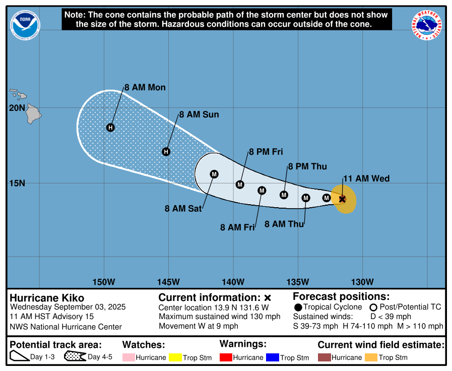
Kiko has strengthened to a major Category 4 hurricane as it moves west about 1,600 miles east of Hilo.
The hurricane is intensifying in the general direction of Hawaiʻi and is expected to make a gradual turn toward the west-northwest late this week, according to the National Weather Service (NWS) forecasters in Honolulu.
As of 11 a.m. Wednesday, Sept. 3, Hurricane Kiko is moving west at 9 mph with maximum sustained winds near 130 mph with higher gusts. Some additional strengthening is possible over the next day or two followed by fluctuations in intensity.
A gradual shift towards the west-northwest is expected at a slightly faster forward speed over the next few days.
Hurricane-force winds extend outward up to 25 miles from the center, and tropical-storm-force winds extend outward up to 80 miles.
Kiko is expected to cross into the central Pacific basin over the weekend.
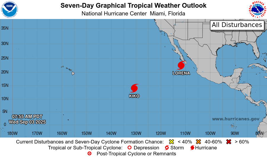
The National Hurricane Center is also tracking Lorena, which is located about 115 miles WSW of Cabo San Lucas, Mexico. The system has sustained winds of 80 mph and is bringing heavy rainfall and flash flooding northward across Baja California Sur.
It is currently classified as a Category 1 hurricane.
The government of Mexico has extended the Tropical Storm Warning northward along the west coast of Baja California Sur from Cabo San Lazaro to Punta Abreojos. There’s also a Tropical Storm Watch along the west coast of Baja California Sur from north of Punta Abreojos to Punta Eugenia.
Sponsored Content


