


Update: Tropical Storm Kiko continues on path north of the Hawaiian Islands today and Wednesday
Update: 9:56 p.m., Tuesday, Sept. 9, 2025
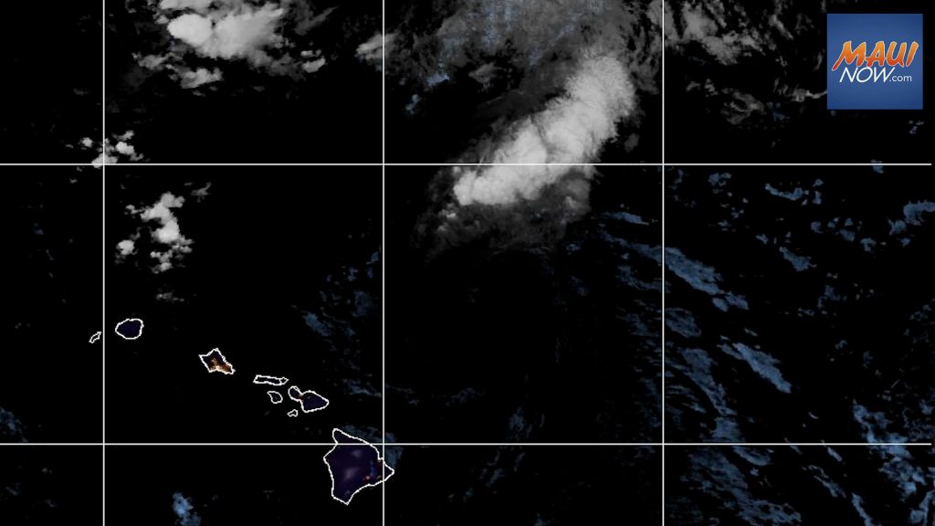
Showers are forecast to spread over Windward Big Island and Maui tonight and then transition to locally heavy interior showers over Molokaʻi through Kauaʻi tomorrow afternoon, according to the National Weather Service. Locally breezy trades are expected to return Wednesday night.
Update: 5 p.m., Sept. 9, 2025
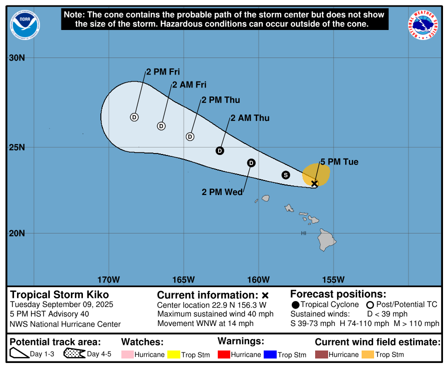
Kiko remains a tropical storm and is producing life-threatening rip currents and high surf across portions of the Hawaiian Islands, according to the latest update from the Central Pacific Hurricane Center.
As of 5 p.m., Kiko was located 150 miles NE of Honolulu and had maximum sustained winds of 40 mph. Present movement is toward the WNW at 14 mph. The CPHC forecast calls for this motion to continue for the next few days, while passing north of the main Hawaiian Islands.
The CPHC reports that weakening is expected, and the system is forecast to become post-tropical in a couple days.
Tropical-storm-force winds extend outward up to 90 miles to the north of the center, according to the latest forecast update.
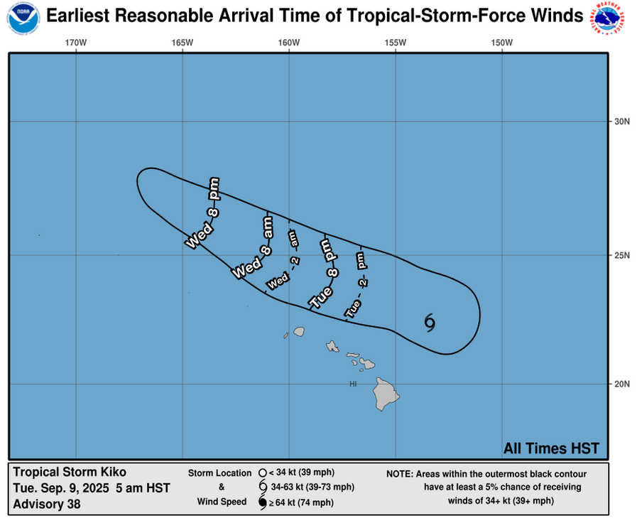
On the water, swells generated by Kiko are building from east to west across the exposed Hawaiian waters and are forecast to peak tonight through Wednesday, potentially producing life-threatening surf and rip currents, according to the CPHC.
Previous post:
Update: 11 a.m., Sept. 9, 2025
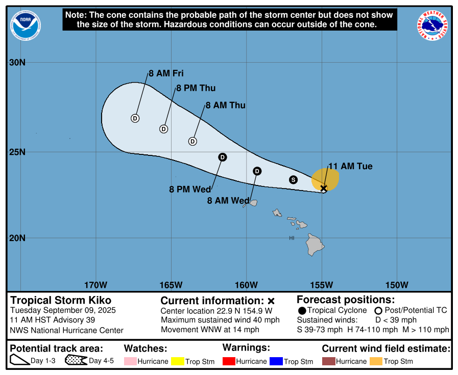
Tropical Storm Kiko is producing life-threatening rip currents and high surf across portions of the Hawaiian Islands.
At 11 a.m. HST, the center of Tropical Storm Kiko was located 220 miles north of Hilo and 220 miles ENE of Honolulu. The Central Pacific Hurricane Center reports that Kiko is moving toward the WNW near 14 mph, a motion that is expected to continue for the next few days as the system continue son a path north of the main Hawaiian Islands.
Maximum sustained winds have decreased to near 40 mph with higher gusts. Additional weakening is expected, and the system may become post-tropical in a couple days, according to the CPHC.
The CPHC reports that tropical-storm-force winds extend outward up to 90 miles from the center.
A High Surf Warning remains in effect from 6 a.m. to 6 p.m. today for the east facing shores of Kauaʻi and Oʻahu. Dangerously large breaking waves of 10-15 feet are int eh forecast.
Kiko was downgraded to a tropical storm, with additional weakening forecast in the next few days. The system will continue to pass north of the islands today and Wednesday, disrupting the trade winds, producing areas of heavy rainfall, and generating large surf along the east facing shores, according to the National Weather Service.
The NWS forecast calls for moderate trade winds and a typical pattern of windward rainfall to return on Thursday through early next week.
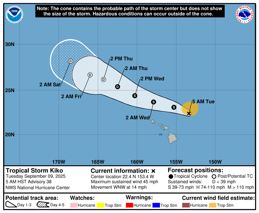
The latest forecast from the Central Pacific Hurricane Center places Kiko 215 miles NNE of Hilo and 300 miles ENE of Honolulu with maximum sustained winds of 75 mph. The CPHC reports that tropical-storm-force winds extend outward up to 105 miles from the center.
The system continues on a path WNW at 14 mph, a motion that is expected to continue for the next few days, according to the CPHC.
On the water, life-threatening rip currents and high surf is possible across parts of the islands, impacting the east facing shores. The CPHC says swells are expected to peak today through Wednesday.
A High Surf Warning is in effect for the east facing shores of Molokaʻi, Maui, and Hawaiʻi Island until 6 p.m. today. The NWS is forecasting dangerously large breaking waves of 10 to 15 feet along affected shorelines.
The CPHC reports that: “Additional weakening is expected, and the threat of direct impacts on the islands continues to diminish, though interests should still monitor Kiko’s progress and the latest forecasts.”
Forecasters say Kiko may become a post-tropical system in a few days.
*Maui Now’s Wendy Osher contributed to this report.
Sponsored Content


