

National Weather Service: Advisory for coastal flooding with high tides
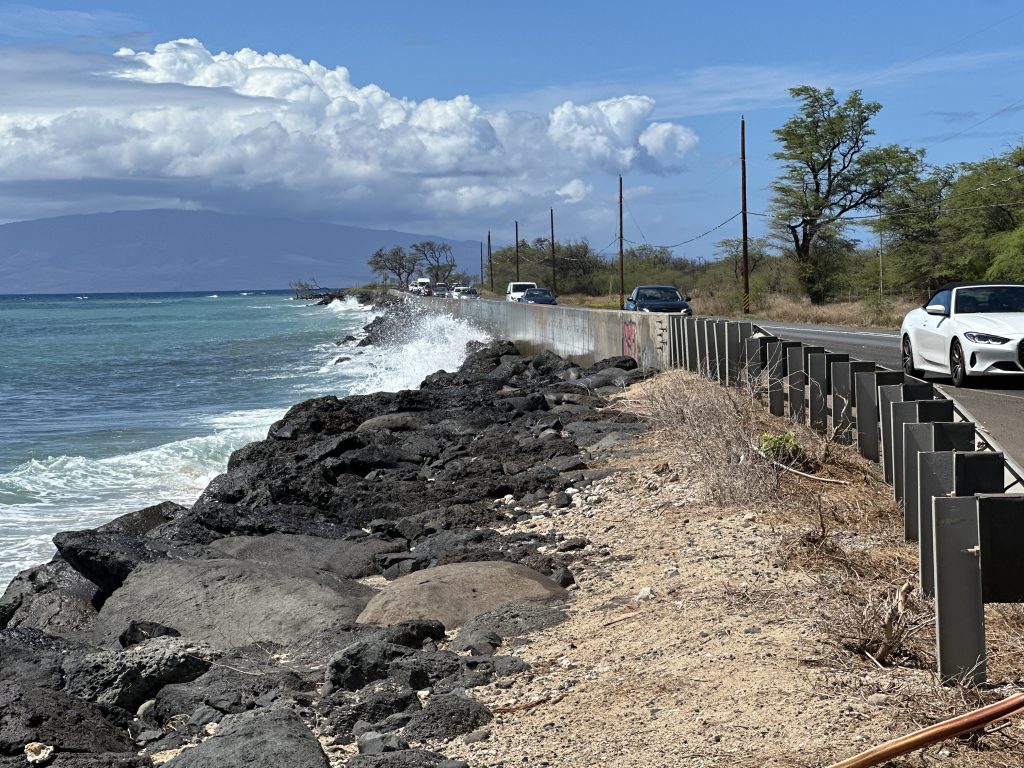
National Weather Service forecasters issued a coastal flood statement Friday morning as peak monthly high tides and higher-than-predicted water levels threaten low-lying areas in the Hawaiian Islands.
The forecasters’ advisory remains in effect through late Saturday night. According to the service, isolated minor coastal flooding is most likely to occur around the daily peak high tides in the early morning hours.
While all Hawaiian Islands may experience these conditions, weather forecasters noted that northern low-lying coastal areas are especially vulnerable due to an incoming northerly swell. Potential impacts include the flooding of normally dry beaches, minor coastal erosion and saltwater inundation.
Forecasters advise residents to avoid driving through flooded roadways. Those forced to drive through saltwater should rinse their vehicles with fresh water to prevent damage. Other recommended precautions include moving electronics, vehicles and valuables to higher ground.
Owners of watercraft stowed on beaches should secure their vessels, and mariners are encouraged to monitor mooring lines to ensure they do not become too tight during the high tides.
In addition to the tidal flooding, the service previously noted that a building north-northeast swell could produce moderate surges for north-facing harbors, particularly in Kahului.
The service has also posted a small-craft advisory until 6 a.m. Saturday for Hawaiian waters as far south as the windward side of Maui. Seas are predicted to be from 8 to 10 feet. Inexperienced mariners, especially those in smaller boats, should avoid going out to sea in the current conditions.
Meanwhile, forecasters say radar shows isolated to scattered showers moving west across the state, with most of the rainfall over southern and central Kauaʻi. The band of rain is expected to make its way across the state on Friday. The rain is on the leading edge of stronger trade winds.
Overall, most of the islands are covered in cloudy skies. Winds are blowing generally out of the east or northeast at 5 to 15 mph. Some showers are expected in normally dry leeward areas, although the amount of rain is expected to be modest.
Sponsored Content


