

Heavy Rains Anticipated with Tropical Storm Wali
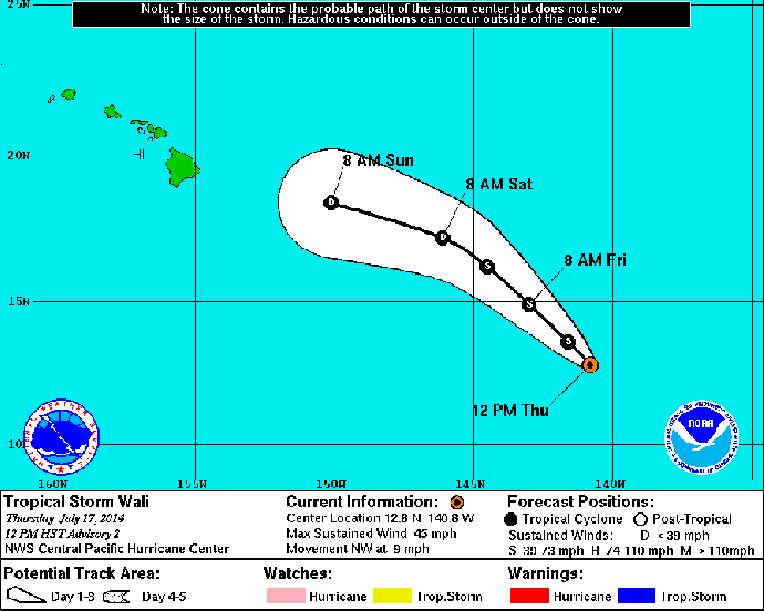
Tropical Storm Wali projected track. Image courtesy National Weather Service / National Oceanic and Atmospheric Administration.
By Wendy Osher
Tropical Depression One-C strengthened into Tropical Storm Wali, the first named system in the Central Pacific this hurricane season.
Wali formed southeast of the Hawaiian islands earlier today, and the National Weather Service issued an advisory saying heavy rains and potential flooding are anticipated over the islands.
At 12 p.m. HST on Thursday, July 17, the National Weather Service said the center of Tropical Storm Wali was located at coordinates 12.8 N and 140.8 W and was: 1055 miles ESE of Hilo; 1115 miles ESE of Kailua-Kona; 1075 miles ESE of South Point; 1175 miles ESE of Kahului, Maui; 1220 miles ESE of Kaunakakai; 1195 miles ESE of Lānaʻi City; 1265 miles ESE of Honolulu; 1370 miles ESE of Līhue; and 1415 miles ESE of Niʻihau.
According to the NWS, Wali was moving toward the northwest near 9 mph, and the motion is expected to continue for the next couple of days. As of 12 p.m. on Thursday July 17, there were no tropical cyclone watches or warnings in effect.
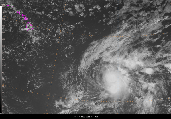
GOES visible satellite image from 2200 UTC on 07/17/14 of Tropical Storm Wali in the central Pacific SE of Hawaii. Image courtesy NOAA/NWS.
The agency says maximum sustained winds are near 45 mph with higher gusts. The tropical storm force winds extend outward from the center of the system up to 90 miles, the agency reports. The NWS forecasts some additional strengthening over the next 24 hours, followed by weakening.
The National Weather Service forecast calls for deep tropical moisture spreading across the state from the east, bringing humid conditions and the potential for heavy rainfall Saturday night through Monday.
The Hawaiʻi Emergency Management Agency, along with the county civil defense agencies continue to monitor the situation and encourage members of the public to be alert and to take appropriate precautions.
“We are preparing for potential effects of One-C,” said Doug Mayne, administrator for Emergency Management in a department press release. “We recommend residents and visitors take the time to prepare and be informed.”
The Hawaiʻi Emergency Management Agency recommended that the following actions be taken to prepare for the system and other heavy rain events:
- Have redundant means of warning (e.g., sign up for local notification systems and get a battery or crank-operated radio). Information on local emergency notification systems can be found at: Kauaʻi – www.kauai.gov; Oʻahu – www.nixle.com; Maui – www.co.maui.hi.us/list.aspx; and Hawaiʻi Island – Email civildefense@hawaiicounty.gov and request enrollment to the emergency notification system. Include your mobile phone number.
- Find out if you live or work in a flood zone by checking sites like www.floodsmart.gov.
- Make sure drainage systems on or near your property are properly maintained.
- Monitor local news broadcasts for the latest information.
Sponsored Content


