

Cold Front to Bring Increased Rain, Cool Temps
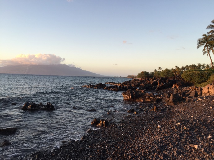
Wailea Beach Walk / Image: Malika Dudley
By Meteorologist Malika Dudley / Email: malika@mauinow.com
Alerts
A High Surf Advisory is posted for the north facing shores of Maui and Molokaʻi for a large north-northwest swell. Surf along north facing shores could reach heights of 10 to 15 feet through Tuesday. The advisory is set to expire at 6 p.m. on Tuesday.
Expect strong breaking waves, shore break and dangerous currents that make getting into the water hazardous and swimming difficult.
A Small Craft Advisory is posted for all Maui County waters until 6 a.m. Tuesday. Winds from 25 knots to 30 knots are expected out of the north and rough seas of 8 to 15 feet. Inexperienced mariners should avoid navigating in these conditions.
**Click directly on the images below to make them larger. Charts include: Maui County high/low forecasted temperatures, projected winds, chance of cloud cover, projected localized weather conditions and expected wave heights.**
Today, Monday November 24, 2014
Moderate rainfall and stiff north winds are expected as the front pushes down the island chain today. There is potential for brief periods of heavy localized rainfall. Scattered showers are expected starting in the morning, pushing through from west to east and ending from west to east. Clouds will also decrease from west to east after frontal passage. Ahead of the front we could see hazy conditions. After the front passes through, we expect breezy winds shifting out of the north from 15 to 25 mph and gusting to 35 mph. Cool weather is in store for us as this occurs. High temperatures should fall in the range of 80° to 85° with highs from 64 – 69° at 5000 feet.
Sunrise: 6:42 a.m.
Sunset: 5:43 p.m.
UV index at 6 (“high” exposure level)
Tonight
Tonight we expect cool conditions, isolated showers and mostly clear skies. Low temperatures should fall in the range of 66° to 71° with a low of about 49° at 5000 feet. Winds are expected out of the northeast from 15 to 20 mph.
Moonrise: 8:47 a.m.
Moonset: 8:14 p.m.
Next Full Moon: Dec. 6 at 2:27 a.m.
Next New Moon: Dec. 21 at 3:36 p.m.
Looking Ahead
A weakening front is pushing through the island chain today. Ahead of the front winds will be southwest and west. Behind the front winds will shift out of the north. Cooler temperatures and dry conditions are forecasted in the wake of the front. By Wednesday we expect a return to more typical trade wind weather with showers again favoring windward and mauka terrain.
Almanac for Kahului Airport
Maximum Temperature for today:
Normal 83°
Record 90° / Set in 1984
Minimum Temperature for today:
Normal 67°
Record 59° / Set in 1972 and tied in 2013
**Click here for your detailed Maui County surf report.**
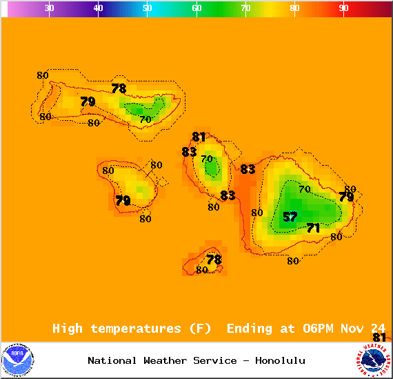
Image: NOAA / NWS
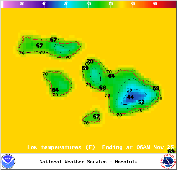
Image: NOAA / NWS

Image: NOAA / NWS
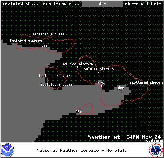
Image: NOAA / NWS
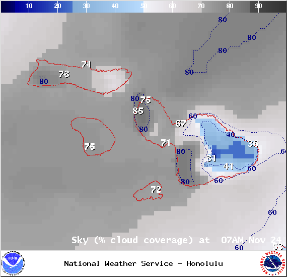
Image: NOAA / NWS
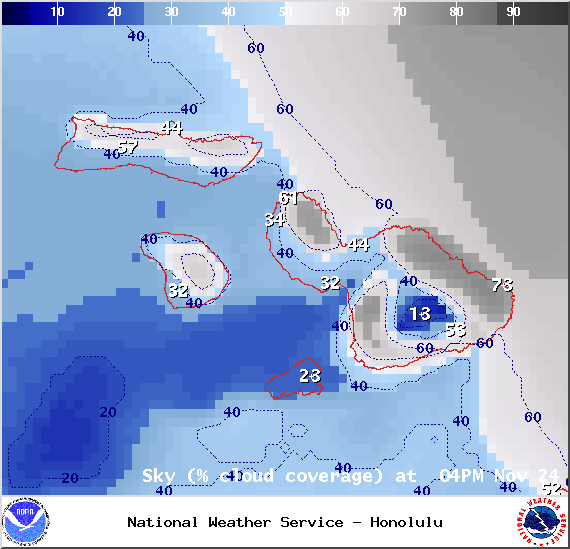
Image: NOAA / NWS
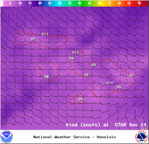
Image: NOAA / NWS
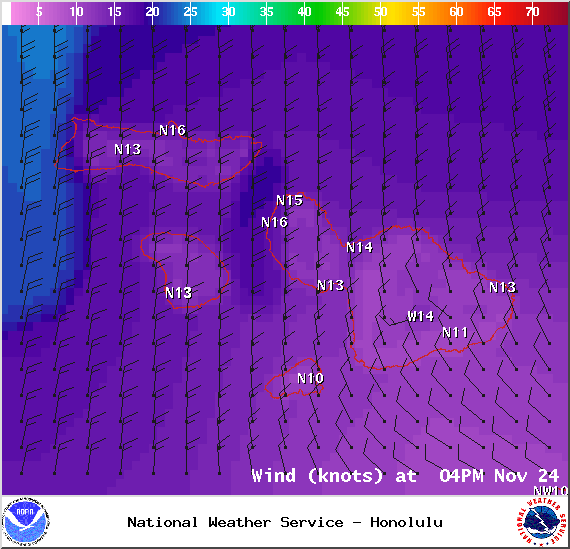
Image: NOAA / NWS
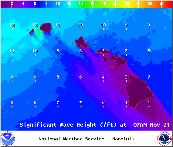
Image: NOAA / NWS
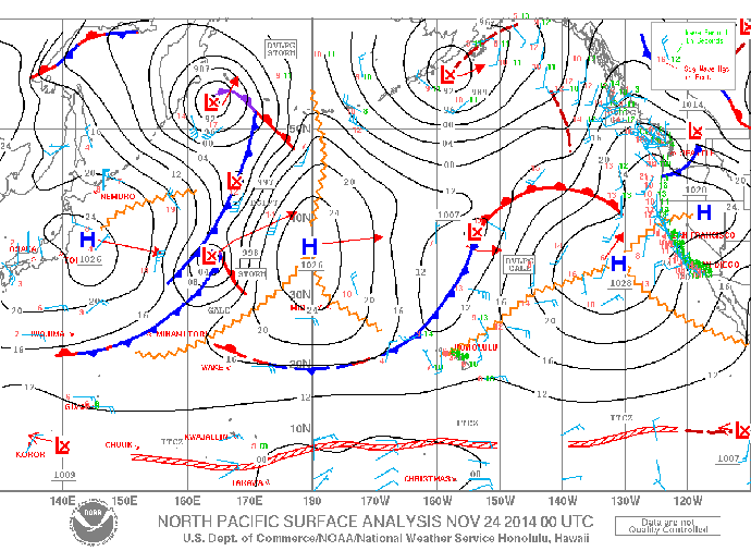
Image: NOAA / NWS
Image: UHSOEST
Sponsored Content


