

Hilda Swell Expected to Peak Thursday
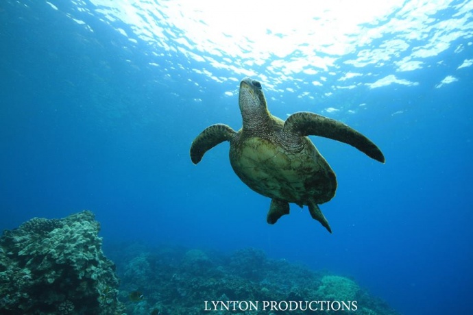
Image: Aaron Lynton
By Meteorologist Malika Dudley / Email: malika@mauinow.com
Alerts
A Hydrologic Outlook has been issued by the National Weather Service. Heavy rain and flash flooding are possible Thursday and Friday as Hilda approaches the state. The NWS warns that regardless of its strength, the system will have the potential to produce very heavy rainfall and flash flooding.
A High Surf Advisory is posted for Maui as swell generated by Hilda continues to affect easterly exposures. The advisory is posted through 6:00 a.m. Thursday. Wave heights of 8 to 12 feet are expected Wednesday. Expect strong breaking waves, shore break and strong longshore and rip currents making swimming difficult and dangerous.
A Tropical Storm Warning is posted for Hawaiian offshore waters from 40 nautical miles out to 240 nautical miles until further notice.
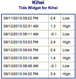
**Click directly on the images below to make them larger. Charts include: Maui County projected winds, tides, swell direction & period and expected wave heights.**
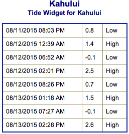 Maui Surf Forecast
North: Wave heights of about chest/head high are expected today. Well overhead waves could occur at the best breaks on the sets.
West: Wave heights ankle/knee high are expected for spots open to the southwest swells.
South: Wave heights ankle/thigh/waist high are expected at the best breaks.
Hilda has generated a ESE/E swell for the islands. The swell is expected to continue through the end of the work week. The swell is expected to peak Thursday.
 Our current south-southwest swell is expected to continue fading. A very small southwest swell is also mixing in. No significant swells are on the horizon out of the SPAC. Small swells are expected the second half of the week but a bigger swell is possible late next week if a storm near New Zealand develops as expected.
Keep in mind, surf heights are measured on the face of the wave from trough to crest. Heights vary from beach to beach, and at the same beach, from break to break.
**Click here for your detailed Maui County weather report.**
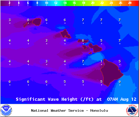
Image: NOAA / NWS
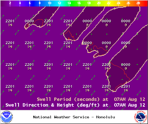
Image: NOAA / NWS
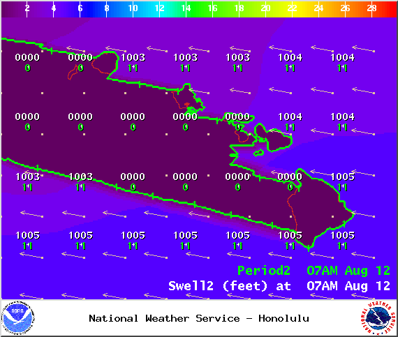
Image: NOAA / NWS
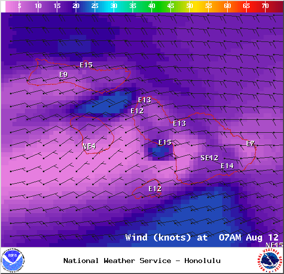
Image: NOAA / NWS
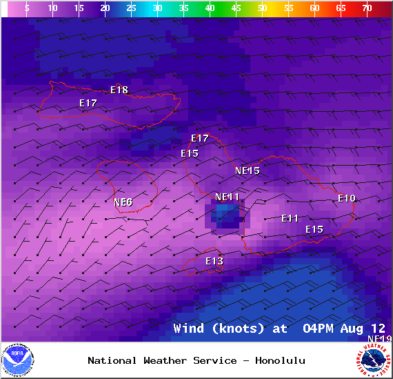
Image: NOAA / NWS

Image: NOAA / NWS
Sponsored Content


