

Flash Flood Watch in Effect, Heavy Showers Expected

Image: Chris Archer
By Meteorologist Malika Dudley / Email: malika@mauinow.com
Alerts
A Flash Flood Watch is in effect for all Hawaiian islands through tonight at 6 p.m. The National Weather Service says an extremely moist and unstable atmosphere could again spawn the development of slow-moving heavy downpours that could lead to flash flooding.
Any more urgent flood alerts will be posted at this link >> CURRENT FLOOD ADVISORIES / WARNINGS.
**Click directly on the images below to make them larger. Charts include: Maui County high/low forecasted temperatures, projected winds, projected localized weather conditions and expected wave heights.**
Looking Ahead
Winds will be rather light for the next few days. Today could be a replay of yesterday with tropical humidity and daytime sea breezes giving way to locally heavy afternoon showers and even thundershowers. There will also be the possibility for volcanic haze over the smaller islands through the middle part of the week. More stable weather and trade winds are expected to return late in the week as the disturbance moves away from the state.
Today
Partly to mostly sunny skies are expected in the morning with mostly cloudy skies for the afternoon and scattered to numerous showers. Some of the rainfall could be heavy with a chance of thunderstorms into the evening. Winds will be light and variable up to 15 mph so our high temperatures, expected from 85° to 90°, will likely feel warmer due to the humidity.
UV index at 12 (“extreme” exposure level)
Tonight
Variable winds are expected tonight up to 15 mph. Partly cloudy skies are forecasted with scattered showers in windward and mauka spots in the evening. After midnight the showers will taper off some. Leeward areas could get some isolated showers. Low temperatures from 73° to 78° are expected.
Our Maui Now Weather homepage always includes daily: Sunrise | Sunset | Moonrise | Moonset | Moon Phase | Live Weather Cams | 5-day Forecast | Current Temperature & Conditions
***Click here for your marine outlook and surf report.***
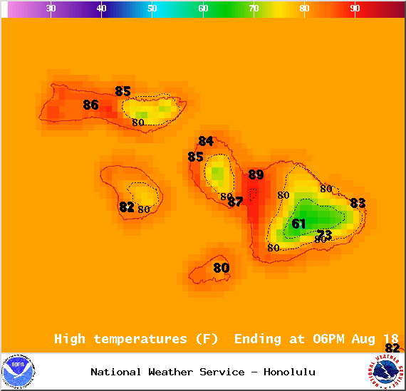
Image: NOAA / NWS
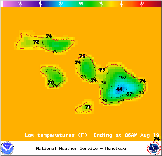
Image: NOAA / NWS
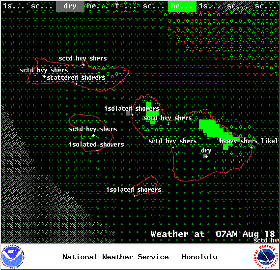
Image: NOAA / NWS
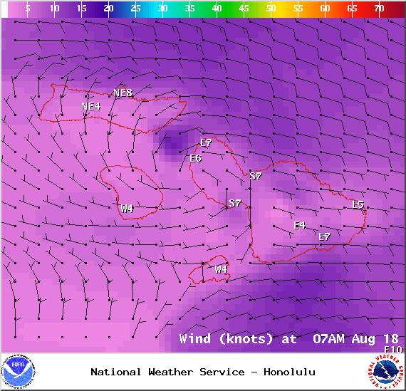
Image: NOAA / NWS
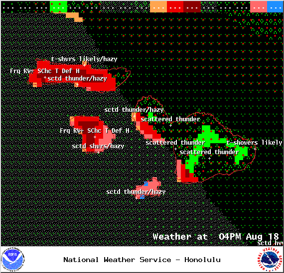
Image: NOAA /NWS
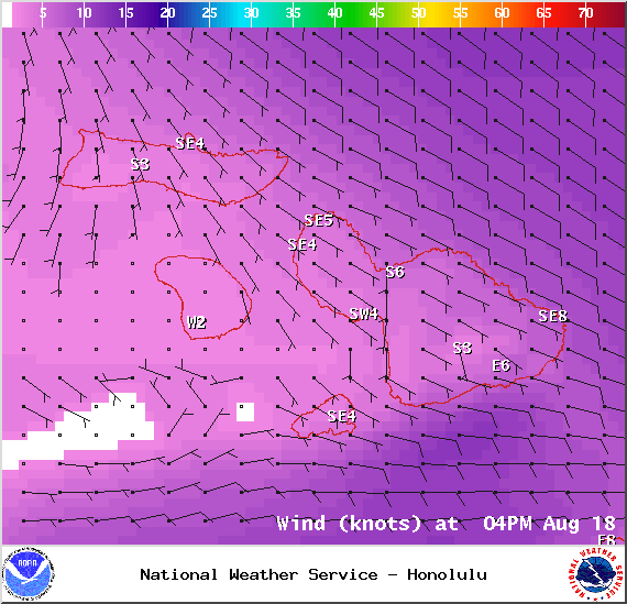
Image: NOAA / NWS
Image: UHSOEST

Image: NOAA / NWS
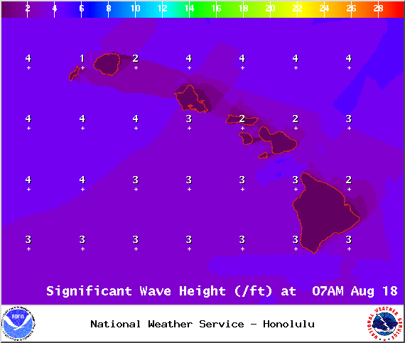
Image: NOAA / NWS
Sponsored Content


