


Ignacio, Kilo and Jimena Expected to Generate Swells
Image: Jimmie Hepp
By Meteorologist Malika Dudley / Email: malika@mauinow.com
Alerts
A High Surf Warning is posted for east facing shores of Maui through 6 a.m. Wednesday with wave heights rising to 12 to 18 foot faces in some spots Tuesday. Windward Maui and Molokai are expected to get wave heights of 10 to 15 foot faces. Expect ocean water occasionally sweeping across portions of beaches, very strong breaking waves and strong longshore and rip currents. Breaking waves may occasionally impact harbors making navigating the harbor channel difficult. Large breaking surf, significant shore break and dangerous currents will make entering the water very hazardous. Boaters should be aware of an increased number of surfers in the water.
A Small Craft Advisory is posted for Maui County windward waters as well as all channels through 6 a.m. Wednesday for rough seas of up to 12 feet. Inexperienced mariners should avoid navigating in these conditions.
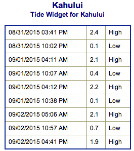
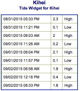
**Click directly on the images below to make them larger. Charts include: Maui County projected winds, tides, swell direction & period and expected wave heights.**
 Maui Surf Forecast
North: Spots that are pulling in the Ignacio swell could get up to overhead or maybe even double overhead on the sets at the best exposures.
West: Wave heights knee/waist high are expected. Spots shadowed by other islands will be smaller or even flat.
South: Wave heights knee/thigh/waist high are expected at the best breaks. Spots catching the Ignacio swell could get up to waist/chest/shoudler high on the sets at the best breaks.
Our current east swell from hurricane Ignacio peaked Monday and will hold today. We expect a secondary swell from Ignacio with northeast, shifting north-northwest swell to also get pumped out of this system for the first half of next week but this is highly dependent on the track and intensity Ignacio ends up taking.
 Hurricane Kilo is expected to generate fun westerly swell to the islands starting Wednesday into Thursday and Friday, then fading over the weekend. Also highly dependent on Kilo’s strength and track.
Hurricane Jimena should deliver a solid shot of east-southeast swell to the islands for the second half of this week. Also highly dependent on future track and strength.
Swell from typhoon Atsani is fading.
Keep in mind, surf heights are measured on the face of the wave from trough to crest. Heights vary from beach to beach, and at the same beach, from break to break.
**Click here for your detailed Maui County weather report.**
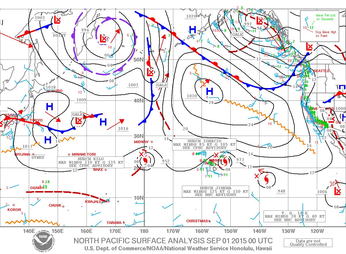
Image: NOAA / NWS
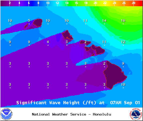
Image: NOAA / NWS
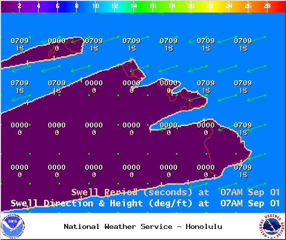
Image: NOAA / NWS
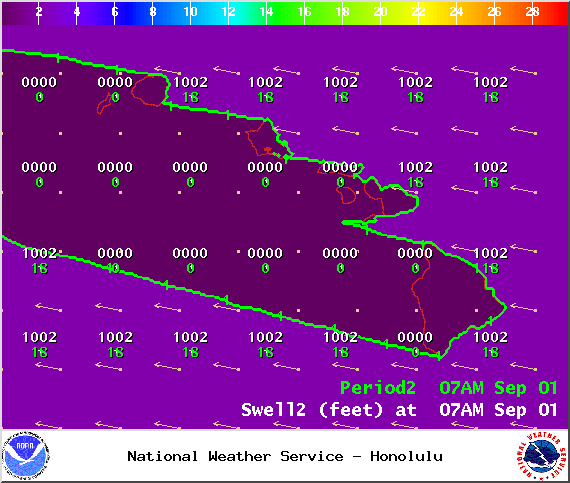
Image: NOAA / NWS
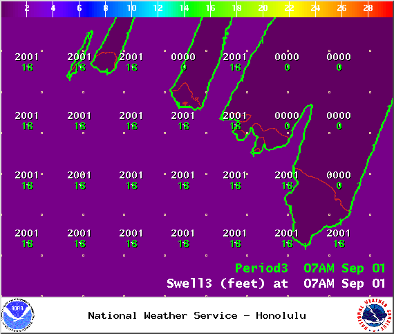
Image: NOAA / NWS
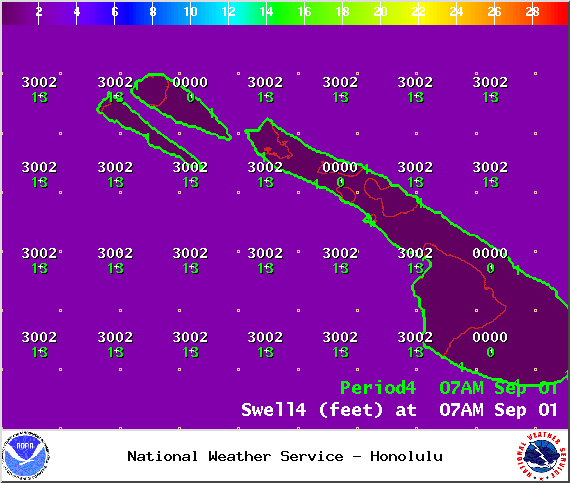
Image: NOAA / NWS
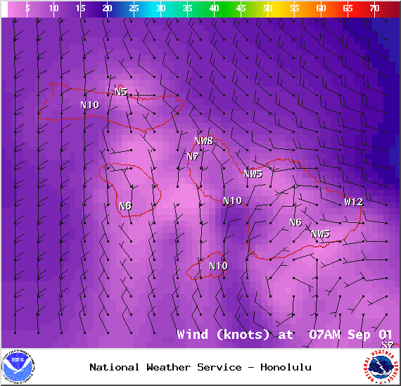
Image: NOAA / NWS
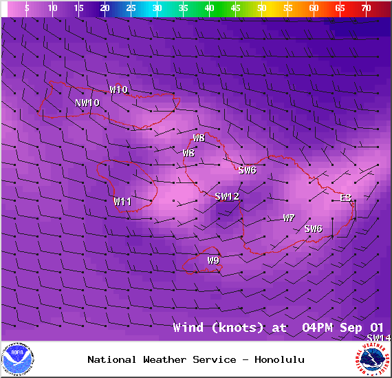
Image: NOAA / NWS
Sponsored Content


