

High Surf Warning Posted for Northern Spots
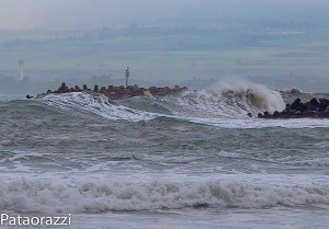
Image: John Patao “Pataorazzi” / Kahului
Alerts (as of 1:00 a.m.)
A Small Craft Advisory is posted for all island waters through 6 p.m Saturday.
A High Surf Warning is posted through 6 p.m. Saturday for rising surf along north shores of Maui and Molokai.
A Marine Weather Statement has been issued by the National Weather Service for a large north swell and strong northeast winds. Waves will likely produce moderate surges and large breaking waves at harbor entrances. Areas that will potentially be impacted are Maliko Boat Ramp and Kahului Harbor.
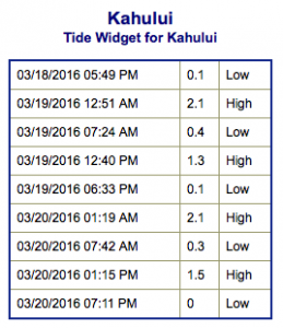
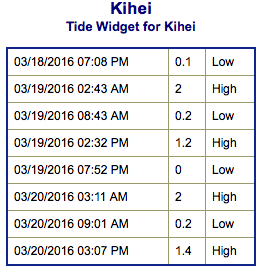
**Click directly on the images below to make them larger. Charts include: Maui County projected winds, tides, swell direction & period and expected wave heights.**
 Maui Surf Forecast
North: Many spots are expected to be double overhead to triple overhead today depending on the amount of exposure the spot is getting. In the morning the best breaks could even be in the 20 foot face range or more.
West: Ankle/waist high surf is expected. A mix of trade swell and north swell will be up to double overhead or more for exposed breaks.
South: Wave heights are waist high or less today.
 Our current south-southwest bump continues to fade as a new small south-southwest swell fills in into the weekend. Sunday this swell will begin a fading trend.
A solid north swell is expected to continue through the weekend. Another good dose of northwest swell is expected to move in late Saturday and peak Sunday before fading out early next week.
Keep in mind, surf heights are measured on the face of the wave from trough to crest. Heights vary from beach to beach, and at the same beach, from break to break.
**Click here for your detailed Maui County weather report.**
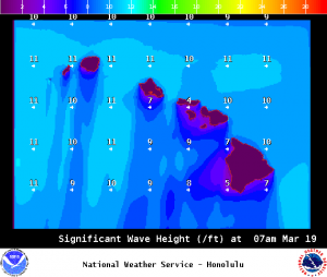
Image: NOAA / NWS
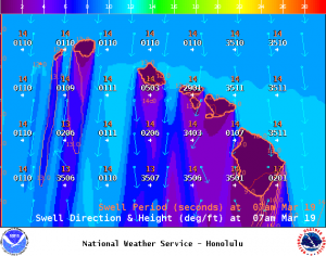
Image: NOAA / NWS
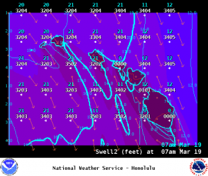
Image: NOAA / NWS
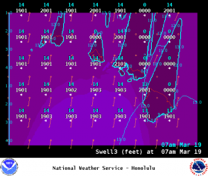
Image: NOAA / NWS
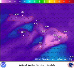
Image: NOAA / NWS
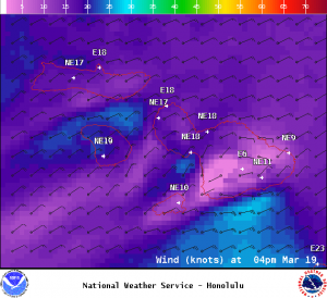
Image: NOAA / NWS
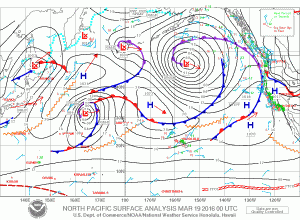
Image: NOAA / NWS
Sponsored Content


