

Light Winds Today as Front Approaches
File photo from Up Country / Image: Maui Roadsters
By Meteorologist Malika Dudley / Email: malika@mauinow.com
Alerts
A High Surf Advisory is posted for the north shores of Maui and Moloka’i and the west side of Maui through 6:00 a.m. Thursday. Surf along north facing shores of Maui and Moloka’i could reach heights of 12 to 18 feet while the west side of Moloka’i is forecasted to get 8 to 14 foot faces.
**Click directly on the images below to make them larger. Charts include: Maui County high/low forecasted temperatures, projected winds, chance of cloud cover, projected localized weather conditions and expected wave heights.**
Today
Today our weather pattern is expected to change to a local land and sea breeze pattern. That means we expect mostly sunny mornings with afternoon cloud cover as the land heats up and spawns a sea breeze. Some isolated light showers may accompany the afternoon clouds. Winds are variable up to 15 mph. High temperatures are forecasted to fall in the range of 78° to 83°.
UV index at 8 (“very high” exposure level)
Tonight
Mostly clear skies are forecasted. Any afternoon/evening cloud cover due to convection should clear up as the land breeze takes hold and pushed them back out to sea. Low temperatures from 67° to 72° degrees are expected. Variable winds up to 15 mph are expected.
Next Full Moon: 1:09 p.m. on Feb. 3
Next New Moon: 1:47 p.m. on Feb. 18
Looking Ahead
Weakening trade winds will turn southeasterly on Wednesday, as a weak front approaches from the west. This front is expected to bring some showers and light winds to the islands Thursday and Friday, then light northeasterly trades will fill back on over the weekend. A stronger front may approach the islands early next week.
Our Maui Now Weather homepage always includes daily: Sunrise | Sunset | Moonrise | Moonset | Moon Phase | Live Weather Cams | 5-day Forecast | Current Temperature & Conditions
**You can also click here for your detailed Maui County surf report.**
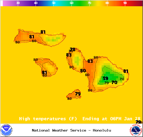
Image: NOAA / NWS

Image: NOAA / NWS
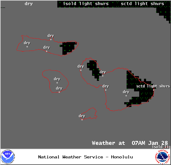
Image: NOAA / NWS
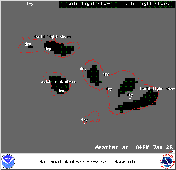
Image: NOAA / NWS
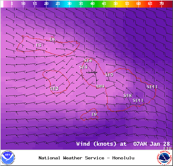
Image: NOAA / NWS
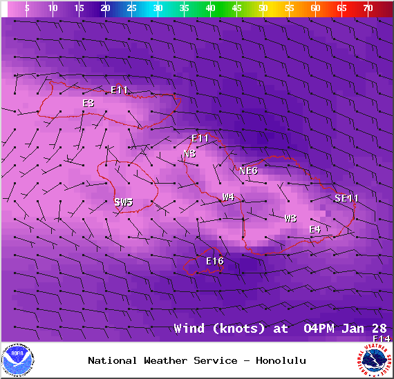
Image: NOAA / NWS
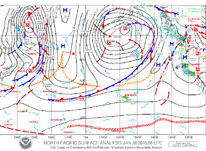
Image: NOAA / NWS

Image: NOAA / NWS
Sponsored Content


