

Iselle Update: 9 a.m. Press Conference Highlights

Satellite imagery of Iselle at 6:30 a.m. HST, Thursday, Aug. 7, 2014. Image courtesy CPHC/NOAA/NWS.
By Wendy Osher
Forecasters with the Central Pacific Hurricane Center say they still expect Iselle to make landfall on the Big Island of Hawaiʻi later today as a hurricane.
The impacts — in the form of heavy rain, strong winds, and storm surge — are anticipated to begin as early as 4 p.m. on Hawaiʻi Island today, with the center of the storm passing over the Big Island of Hawaiʻi in the late afternoon to evening hours.
The northern edge of the system will carry the strongest winds at 60 to 70 mph, and 85 mph gusts on Hawaii Island, according to Mike Cantin, meteorologist in charge with the National Weather Service Forecast Office in Tucson, AZ.
According to Cantin, the terrain on Hawaii Island is expected to zap some of the strength of the system as it approaches Maui later tonight and into tomorrow.
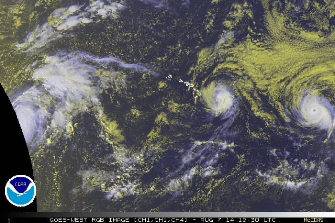
Satellite imagery of Iselle at 9:30 a.m. HST, Thursday, Aug. 7, 2014. Image courtesy CPHC/NOAA/NWS.
Winds will be 45 to 55 mph on Maui with 65 mph gusts. Rain will be 5 to 8 inches, and as much as 12 inches in isolated locations. Dangerous surf will be 15-25 along the E and NE sides of the Big Island of Hawaiʻi, and 12-18 feet elsewhere in the state, mainly for E & NE sides.
According to Cantin, the terrain of the Big Island will act to grab the bottom portion of the storm and hold it back while the top continues to move — this will separate the system and weaken it dramatically. Rain will remain focused over the windward areas with prolonged periods of heavy rainfall, he said.
At 11 a.m., Iselle was located: 190 miles ESE of Hilo; 255 miles ESE of Kailua-Kona; 230 miles E of South Point; 305 miles ESE of Kahului; 360 miles ESE of Kaunakakai; 335 miles ESE of Lānaʻi City; 405 miles ESE of Honolulu; 505 miles ESE of Līhue; and 550 miles ESE of Niʻihau, according to the CPHC.
(Posted 11 a.m. HST, Thursday, Aug. 7 2014)
Iselle continues to gradually weaken according to the latest forecast released by the Central Pacific Hurricane Center. Forecasters with the CPHC say the eye is no longer evident in satellite imagery, and reconnaissance aircraft found the surface pressure at the center had risen a couple of millibars.
According to the agency, maximum light level winds on the NE side of the cyclone were 69 knots, which suggests maximum surface winds near 60 knots.
The latest forecast discussion indicates that Iselle is still located in a region of relatively weak shear and will start to feel increasing northerly shear over the next 12 hours, which is expected to maintain a weakening trend despite gradual increasing sea surface temperatures.
Even if Iselle reaches the Big Island of Hawaiʻi as a Tropical Storm, significant impacts will still be felt from rain, wind, and surf, CPHC forecaster said.
According to the Central Pacific Hurricane Center, the forecast beyond 12 hours, calls for additional weaken due to a combination of much stronger northerly shear and interaction with the Big Island terrain.
The forecast calls for a slight southward shift of the system track beyond 24 hours.
Tropical Storm Warning Remains in Effect for Maui County:
The Central Pacific Hurricane Center has continued the TROPICAL STORM WARNING for MAUI COUNTY.
A Tropical Storm Warning means that tropical storm conditions are expected in the warning area within 36 hours.
EFFECTS: The onset of tropical storm conditions are expected over Maui County tonight. Very large damaging surf is expected along mainly east and south shores starting late tonight.
Rainfall totals of 5 to 8 inches, with isolated maximum amounts to 12 inches, are expected along the track of Iselle. These rains could cause life-threatening flash floods and rock and mud slides.
The combination of a dangerous storm surge and the tide will cause normally dry areas near the coast to be flooded by rising waters. The surge will be accompanied by large and damaging waves. Surge related flooding depends on the relative timing of the surge and the tidal cycle, and can vary greatly over short distances.
A flash flood watch is also in effect for the state from 4 a.m. today to 6 a.m. on Saturday.
Precautionary Measures:
The National Weather Service says it is vital that the public not focus on the exact track of the storm. Forecast movement, direction and speed are only estimates. Even small errors in the forecast track can mean major differences in where the worst conditions will occur. Damaging effects can extend far from the center of the storm.
Now is the time to prepare. Do not wait until it is too late. Stay calm and keep informed. Closely monitor radio or other local news outlets for official storm information. Listen for warnings or changes to the forecast.
Loose objects such as lawn furniture, garbage cans, and other items should be secured or stored indoors. Have supplies on hand and be ready for power outages.
Be ready to evacuate if necessary. Heed the advice of local officials and comply with any orders that are issued. Persons living near the shore should be prepared to evacuate quickly should building surf threaten.
___
Here on Maui, the The state Department of Transportation announced the closure of ports across the state. The port of Kahului closed at 9 a.m.. Ports on Molokai and Lanai will close at noon.
As of this morning, the Hawaii Tourism Authority was advised that American Airlines, Island Air, Mokulele, United Airlines and US Airways have made flight cancellations. The agency is encouraging anyone traveling through the weekend to contact their airline carriers directly to confirm their flights and make any changes.
***A full list of closures and cancellations is posted on at the following link.
Sponsored Content


