

Malika Dudley’s Maui County Forecast (11/02/14)
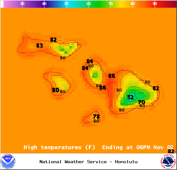
Map of expected high temperatures in Maui County on Sunday Nov. 2, 2014 / Image: NOAA / NWS
Maui Rainbow / Image: Cindy Cabera
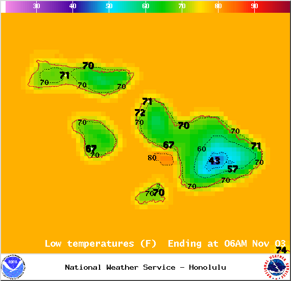
Map of expected low temperatures in Maui County on Sunday Nov. 2, 2014 / Image: NOAA / NWS

Weather conditions in Maui County at 7am on Sunday Nov. 2, 2014 / Image: NOAA / NWS
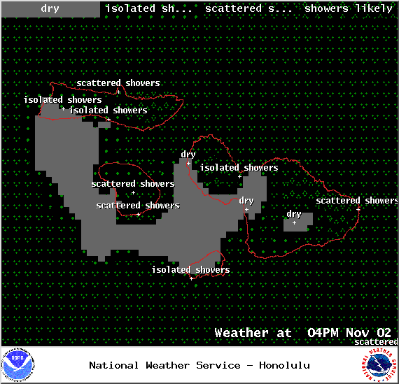
Weather conditions in Maui County at 4pm on Sunday Nov. 2, 2014 / Image: NOAA / NWS
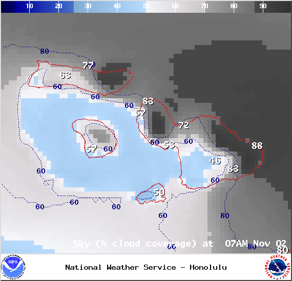
Chance of cloud cover in Maui County at 7am on Sunday Nov. 2, 2014 / Image: NOAA / NWS
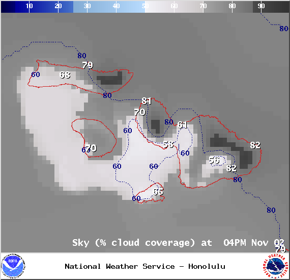
Chance of cloud cover in Maui County at 4pm on Sunday Nov. 2, 2014 / Image: NOAA / NWS
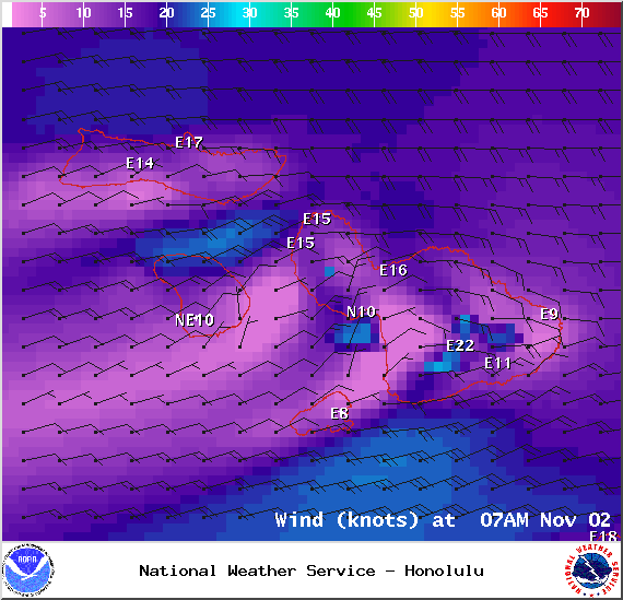
Wind conditions in Maui County at 7am on Sunday Nov. 2, 2014 / Image: NOAA / NWS
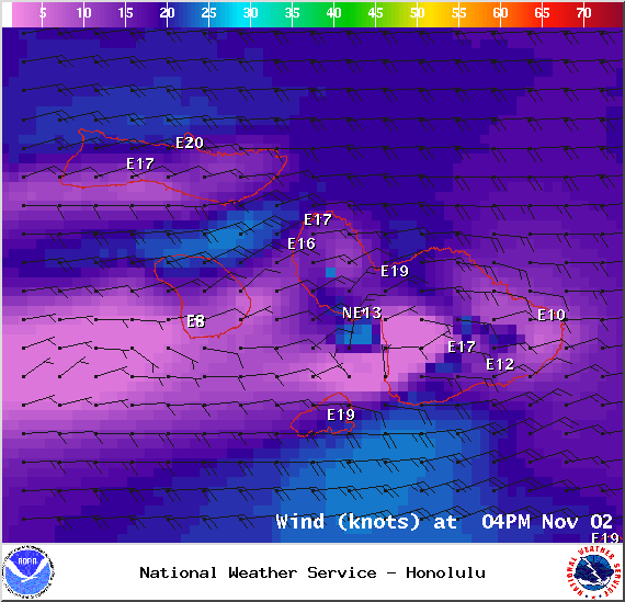
Wind conditions in Maui County at 4pm on Sunday Nov. 2, 2014 / Image: NOAA / NWS
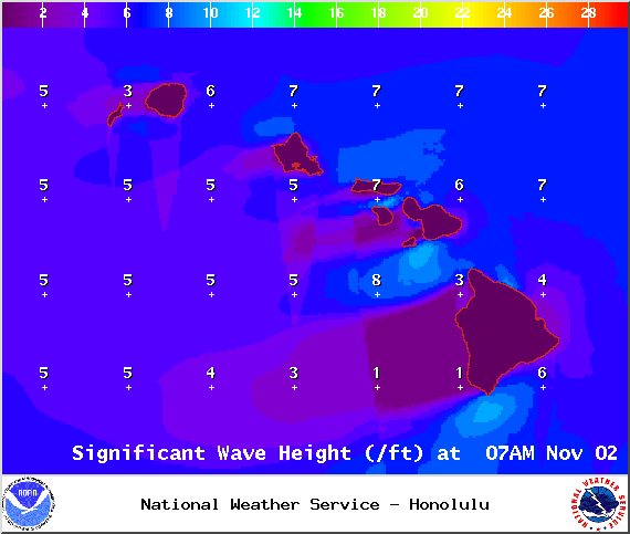
Surf heights on Sunday Nov. 2, 2014 / Image: NOAA / NWS

Swell 1 on Sunday Nov. 2, 2014 / Image: NOAA / NWS
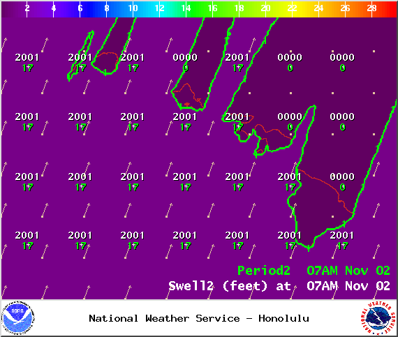
Swell 2 on Sunday Nov. 2, 2014 / Image: NOAA / NWS
Surface Map – Sunday Nov. 2, 2014 / Image: NOAA / NWS

Tides – Maui County on Sunday Nov. 2, 2014 / Image: NOAA / NWS
By Meteorologist Malika Dudley / Email: malika@mauinow.com
**A breakdown of expected conditions specific to Maui County is presented below in graphical form. All graphics are provided by the National Weather Service in Honolulu.**
Alerts
The SMALL CRAFT ADVISORY has been extended yet again for Maui County windward waters, the Pailolo Channel and Māʻalaea Bay until 6 p.m. Monday, Nov. 3, 2014. Rough seas are expected from 6 to 12 feet. Winds are forecasted out of the east from 20 to 25 knots, with higher gusts. Inexperienced mariners are cautioned to avoid navigating in these conditions.
Today
The weather today is expected to be partly sunny for leeward areas. In the afternoon a sea breeze is likely to develop due to daytime heating. That means clouds are expected to build. Only isolated showers are expected. For windward and mauka areas cloudy skies are in the forecast for much of the day with scattered showers forecasted. Localized downpours are possible due to instability in our area. High temperatures should fall in the range of 83° to 88° with a high of about 68° at 5000 feet. Generally we expect trade winds from 10 – 20 mph with higher gusts. Molokai’s leeward side could see gusts up to 35 mph, in the afternoon for leeward Maui in Kihei and Makena. Lanai City could see gusts up to 30 mph. While windward Maui including Wailuku, Makawao and Hana areas could see gusts up to 40mph.
Sunrise: 6:29am
Sunset: 5:49pm
UV index at 7 (“high” exposure level)
Tonight
Tonight we should get trade winds from 10 – 20 mph. Showers are likely for windward and mauka areas overnight. Leeward spots may get scattered showers. Low temperatures should fall in the range of 71° to 76° with a low of about 51° at 5000 feet.
Moonrise: 2:57 p.m.
Moonset: 3:20 a.m.
Next Full Moon: Nov 6, 2014 at 12:23 p.m.
Next New Moon: Nov 22, 2014 at 2:33 a.m.
Looking Ahead
Trade winds are expected to gradually weaken over the next couple of days. Trade showers are expected to continue through the weekend dampening windward sides and even pushing some showers over to leeward areas from time to time. The forecast is a bit tricky though because of a weather feature in our area that is making conditions unstable. This upper low should shift west over the next 30 hours or so. On Monday, trade winds are expected to decrease further. By midweek trades should start filling back in. Another front is expected to affect us next week as well.
Surf & Seas
North: Surf is expected in the waist to chest high range occasionally bigger at the best breaks exposed to the swell.
West: Breaks that don’t catch the north or south-southwest swells are forecasted to get smaller surf in the ankle high range. Spots that are open to the swell should see waist to chest high waves with occasional plusses.
South: Ankle-slappers to possibly waist high surf is expected. Generally the farther south you go, the bigger the waves. The best southern exposures could see waves in the waist to chest high range.
Our north swell (350-360°) is fading through Monday. A new northwest swell (315-350°) is expected to peak in the chest to head high range late afternoon on Tuesday. Best exposures along the northwest coast could see overhead waves with this swell. The swell is expected to hold through the end of the work week.
A moderate trade wind swell is affecting our eastern shores.
Our current south-southwest swell (200-180°) is expected to hold today before fading out early next week. After that swell subsides, surf goes quiet with not much on the horizon out of the South Pacific.
Keep in mind, surf heights are measured on the face of the wave from trough to crest. Heights vary from beach to beach, and at the same beach, from break to break.
Almanac for Kahului Airport
Maximum Temperature for today:
Normal 86°
Record 93° / Set in 1950
Minimum Temperature for today:
Normal 69°
Record 59° / Set in 1953
Sponsored Content


