

Malika Dudley’s Maui County Forecast – 11/07/14
By Meteorologist Malika Dudley / Email: [email protected]
**A breakdown of expected conditions specific to Maui County is presented below. All graphics are provided by the National Weather Service in Honolulu. Click directly on the image to make it larger.**
Today
Partly sunny skies are expected today throughout Maui County. Leeward and interior spots could see afternoon cloud cover as daytime heating kicks up the sea breeze and spawns late day clouds with a slight possibility of showers. High temperatures should fall in the range of 84° to 89° with a high of about 72° at 5000 feet. Generally we expect variable winds up to 15 mph across Maui County.
Sunrise: 6:31 a.m.
Sunset: 5:47 p.m.
UV index at 7 (“high” exposure level)
Tonight
Tonight we should get variable winds up to 15 mph. Scattered showers are possible in the early evening for leeward and interior areas. Skies will clear as the evening goes on and the land breeze takes hold pushing any clouds and showers we may get out to sea. Low temperatures should fall in the range of 70° to 75° with a low of about 51° at 5000 feet.
Moonrise: 6:52 p.m.
Moonset: 8:15 a.m.
Next New Moon: Nov 22, 2014 at 2:33 a.m.
Next Full Moon: Dec 6 at 2:27 a.m.
Looking Ahead
At this point the front is expected to impact Maui County on Saturday and recent model runs are suggesting that the front could stall over Maui County instead of pushing all the way down to the Big Island. Will keep an eye on this feature and bring you the latest. Briefly strong northerly winds are expected to follow the front but become lighter and more easterly into next week as frontal showers diminish.
 Surf & Seas
North: Surf is expected in the chest to head high range at the best breaks, especially early in the day.
West: Breaks that don’t catch the swells are forecasted to get smaller surf at ankle high or less. Spots that are open to the north-northwest swell should see waist to chest high waves at the best breaks, especially early in the day.
South: Ankle-slappers to possibly thigh high surf is expected.
Our current north-northwest swell (325-355°) is fading today. An even bigger swell (320-345°) is expected to build tomorrow and peak overnight into Sunday morning. Waves could peak at double to triple overhead on the sets at the best breaks. Typhoon Nuri is expected to bring us a solid swell starting late Monday and peaking mid day on Veteran’s day with 15 to 25 foot faces possible at the best big wave spots on Maui like Peʻahi.
 Small swells generated in the South Pacific are expected to bring us waves in the thigh high or less range. You might see possible plusses at the best tides and exposures but they will be inconsistent at best and most west side spots will remain flat since they lie in the shadow of other islands. There isn’t much on the horizon out of the South Pacific.
Keep in mind, surf heights are measured on the face of the wave from trough to crest. Heights vary from beach to beach, and at the same beach, from break to break.
Almanac for Kahului Airport
Maximum Temperature for today:
Normal 85°
Record 93° / Set in 1984 and tied in 1990
Minimum Temperature for today:
Normal 69°
Record 61° / Set in 1952
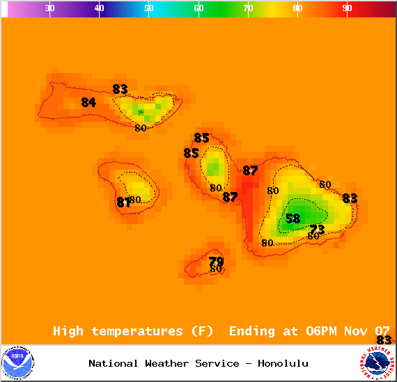
Image: NOAA / NWS

Image: NOAA / NWS
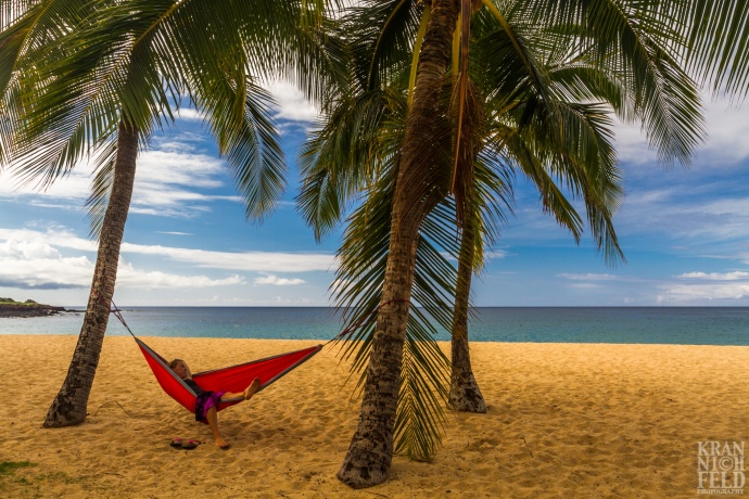
Image: Krannichfeld Photography
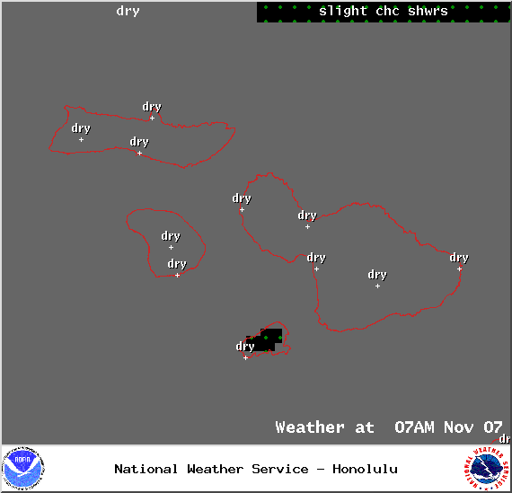
Weather at 7am – Image: NOAA / NWS
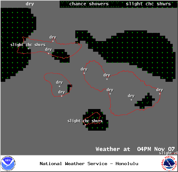
Weather at 4pm – Image: NOAA / NWS
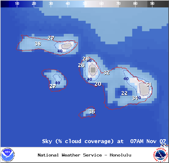
Chance of cloud cover at 7am – Image: NOAA / NWS
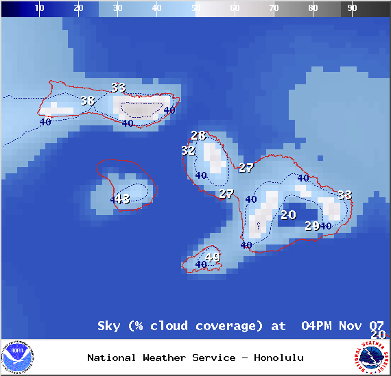
Chance of cloud cover at 4pm – Image: NOAA / NWS
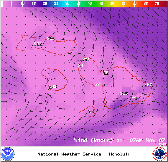
Winds at 7am – Image: NOAA / NWS
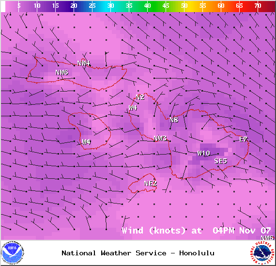
Winds at 4pm – Image: NOAA / NWS

Surf heights – Image: NOAA / NWS

Swell 1 – Image: NOAA / NWS
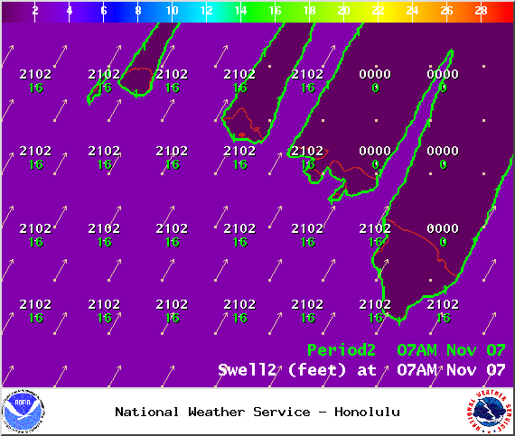
Swell 2 – Image: NOAA / NWS
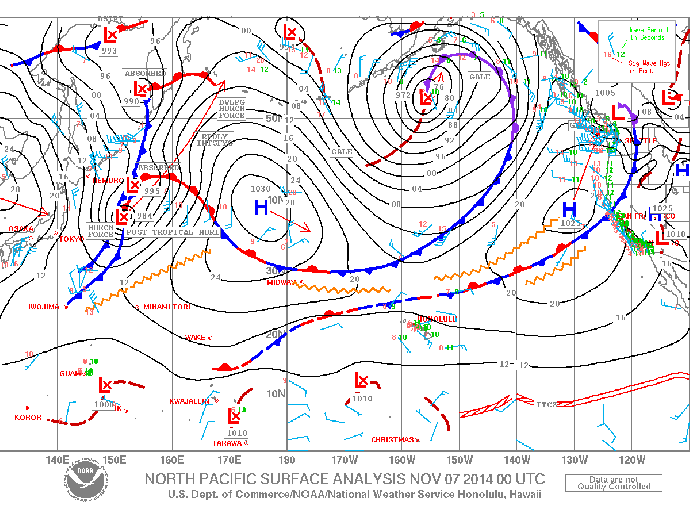
Surface map – Image: NOAA / NWS
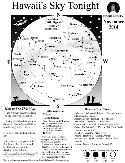
Image: Bishop Museum
Sponsored Content


