

High Surf Advisory Posted for North Shores of Maui County
By Meteorologist Malika Dudley / Email: malika@mauinow.com
A HIGH SURF ADVISORY has been issued by the National Weather Service for the north facing shores of Molokai and Maui from 6 a.m. this morning until 6 p.m. on Sunday.
Expect strong breaking waves, shore break and strong currents making swimming difficult and dangerous. Anyone entering the water could face significant injury due to the dangerous hazards this swell will pose. Boaters are asked to be aware of the increased number of surfers likely to be in the water.
A SMALL CRAFT ADVISORY is also posted for all waters surrounding Maui County through 6 a.m. Sunday. North to northeast winds of 25 knots are expected with rough seas up to 15 feet. Inexperienced mariners should avoid navigating in these conditions.
**Click on the images below to make them larger.**
North: Surf is expected in the shoulder to head high range, building in the afternoon with overhead to possibly double overhead waves at the best exposures.
 West: Breaks that don’t catch the swells are forecasted to get smaller surf at ankle high or less. Spots that are open to the north-northwest swell will get some wrap with waves expected head high and possibly larger by the end of the day.
South: Ankle-slappers to possibly thigh high surf is expected.
A new north-northwest swell (320-345°) is expected to build tomorrow and peak Sunday morning at double to triple overhead on the sets at the best breaks. That’s 15 to 20 foot faces.
Models are showing former typhoon Nuri is expected to bring us a solid swell building in and peaking in the afternoon on Veteran’s day with 15 to 25 foot faces possible at the best exposures. Deepwater, big wave spots like Peʻahi could possibly even see 30 foot faces. We’ll watch this one to see if the storm develops as the models are predicting.
 Small swells generated in the South Pacific are expected to bring us waves in the thigh high or less range. You might see possible pluses at the best tides and exposures but they will be inconsistent at best and most west side spots will remain flat since they lie in the shadow of other islands.
There isn’t much on the horizon out of the South Pacific.
Keep in mind, surf heights are measured on the face of the wave from trough to crest. Heights vary from beach to beach, and at the same beach, from break to break.
**Click here for Malika’s detailed Maui County weather report.**
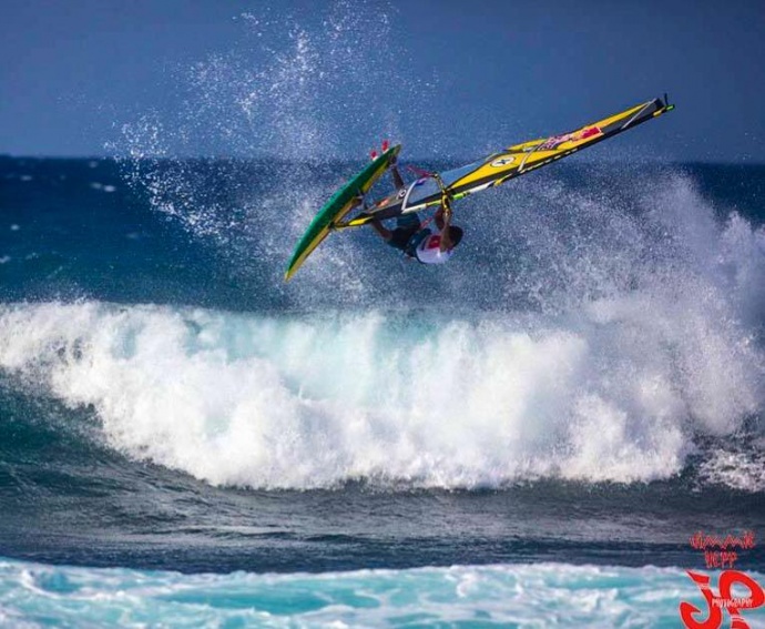
Kai Lenny wind-surfing at Ho’okipa / Image: Jimmie Hepp
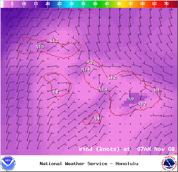
Wind conditions at 7am – Image: NOAA / NWS
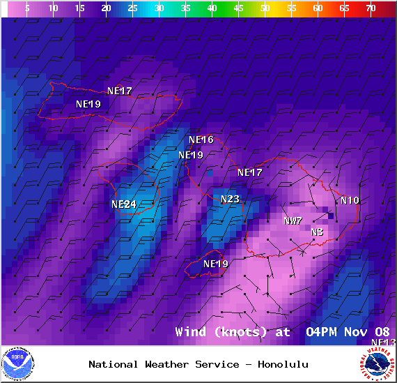
Wind conditions at 4pm – Image: NOAA / NWS
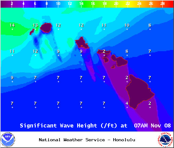
Surf heights – Image: NOAA / NWS

Swell 1 at 7am – Image: NOAA / NWS
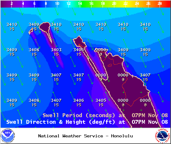
Swell 1 at 7pm – Image: NOAA / NWS
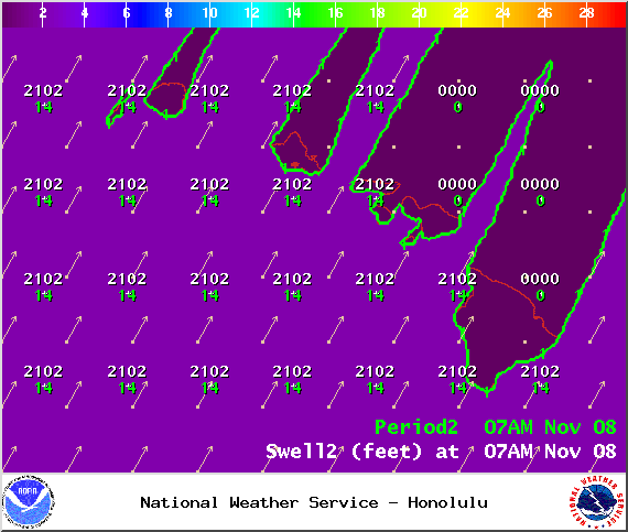
Swell 2 at 7am – Image: NOAA / NWS
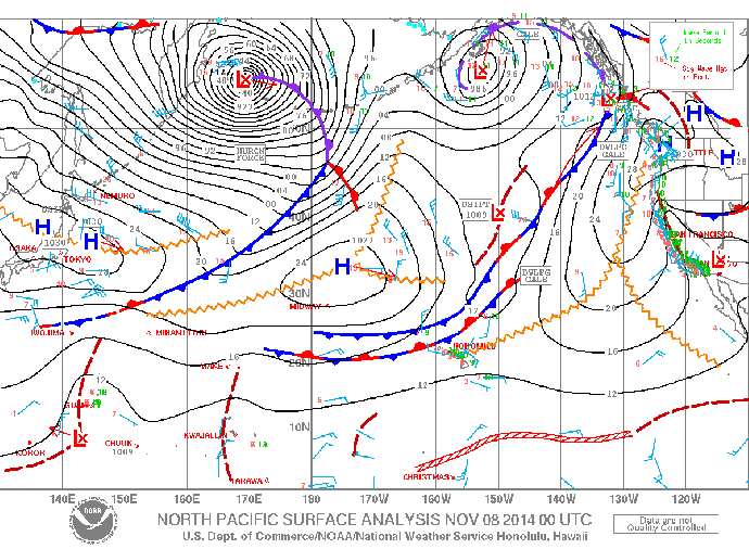
Surface maps – Image: NOAA / NWS
Sponsored Content


