

Advisory Level Surf Expected Today
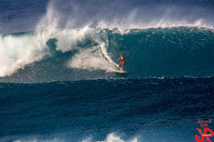
Ho’okipa / Image: Jimmie Hepp
By Meteorologist Malika Dudley / Email: malika@mauinow.com
Alerts
A High Surf Advisory has been issued by the National Weather Service for the north facing shores of Maui and Molokaʻi from 4 a.m. to 6 p.m. for a north-northwest swell that built in overnight.
Expect strong breaking waves, shore break and strong longshore and rip currents making swimming difficult and dangerous.
A Small Craft Advisory is posted from 4 a.m. to 6 p.m. for Maui County windward waters due to expected rough seas up to 12 feet. The Pailolo Channel, Māʻalaea Bay and the ʻAlenuihāhā Channel can also expect east winds up to 25 knots.
Inexperienced mariners should avoid navigating in these conditions.
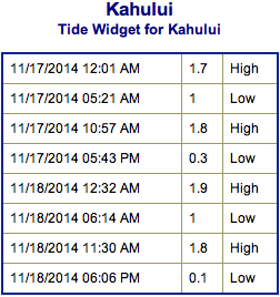
**Click directly on the images below to make them larger. Charts include: Maui County projected winds, forecasted swell direction, height & period, tides, a surface map and expected wave heights.**
 Maui County Surf Forecast, Monday November 17, 2014
North: Surf is expected head high to possibly slightly overhead at the best breaks early in the day quickly building to double overhead at the best spots on Molokaʻi and Maui by the afternoon. Occasionally bigger waves could be seen by sunset at the best exposures.
West: Breaks that don’t catch the swell are forecasted to get smaller surf at ankle high or flat. Spots that are open to the building north-northwest swell will get some wrap with waves expected ankle to knee high early on. Later in the day waist to shoulder high waves are expected at the best breaks.
South: Ankle-slappers to flat surf conditions are expected.
Our current north-northwest swell (325-350°) continues to fade through the day while a new, larger north northwest swell (330-350°) is expected to fill in through the day today, peak in the afternoon at advisory level heights, then gradually lower Tuesday and Wednesday. We expect to see another round of overhead to double overhead surf for the best breaks. Triple overhead surf is possible late in the day at the very best exposures.
 Another, but slightly smaller northwest swell is expected to slowly build Wednesday afternoon and peak through the day on Thursday before gradually fading on Friday.
Super small trace amounts of swell expected out of the SPAC. There isn’t much on the horizon out of the South Pacific. Possibly a small bump building on Tuesday but not expected to be over waist high at the best breaks.
Keep in mind, surf heights are measured on the face of the wave from trough to crest. Heights vary from beach to beach, and at the same beach, from break to break.
**Click here for your detailed Maui County weather report.**
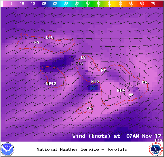
Image: NOAA / NWS
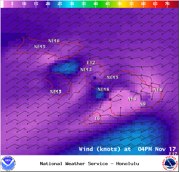
Image: NOAA / NWS
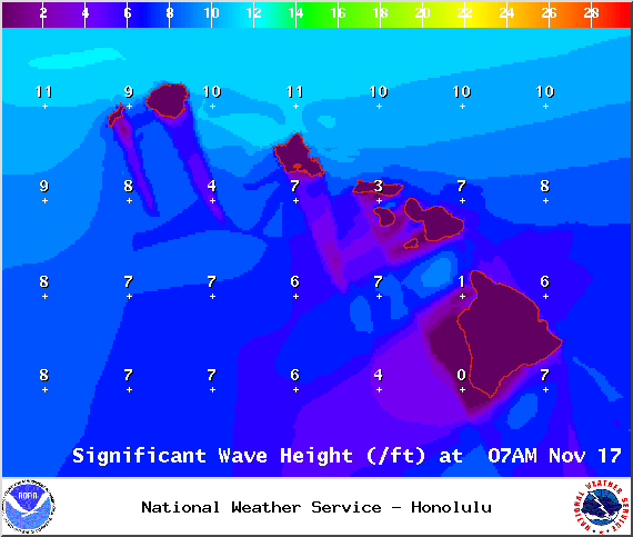
Image: NOAA / NWS

Image: NOAA / NWS
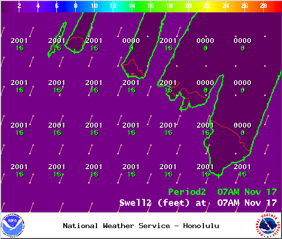
Image: NOAA / NWS
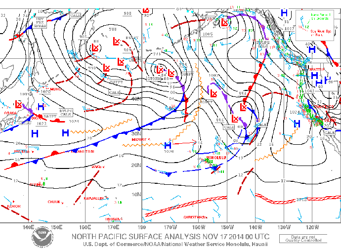
Image: NOAA / NWS
Sponsored Content


