

Biggest Surf Hoʻokipa to the East, More Swells on the Horizon
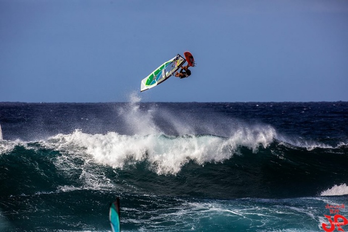
Ho’okipa / Image: Jimmie Hepp
By Meteorologist Malika Dudley / Email: malika@mauinow.com
Alerts
The Small Craft Advisory is posted for all Maui County channels and Māʻalaea Bay through midnight Friday. Winds of 25 to 30 knots are expected out of the northeast and seas up to 15 feet. Inexperienced mariners should avoid navigating in these conditions.
**Click directly on the images below to make them larger. Charts include: Maui County projected winds, forecasted swell direction, height & period, tides, a surface map and expected wave heights.**
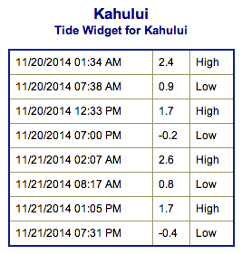 Maui County Surf Forecast, Thursday November 20, 2014
North: Surf is expected head high to possibly a couple feet overhead for the best spots on Molokaʻi and Maui’s northern exposures.
West: Breaks that don’t catch the swell are forecasted to get smaller surf at ankle high or flat. Spots that are open to the west-northwest swell will get some wrap with waves expected thigh high at best.
South: A small southwest will bring wave heights up to 3 foot faces to the best breaks but it’ll be inconsistent.
A broad angled west-northwest to northwest swell (300-330°) is filling in and expected to bring wave heights from head high to a few feet overhead at the best breaks and exposures from Thursday through Saturday. As usual with a swell from this direction Molokaʻi will partially block the swell from breaks west of Hoʻokipa.
 Another northwest swell (305-330°) is expected to build late Sunday. If the storm develops as the models are indicating right now, we could see wave heights overhead to well overhead. Will keep an eye on it. There’s also the possibility of a north swell for the middle of next week.
Our current small bump (220-190°) is expected to be waist high or less at the best breaks through Friday. Otherwise, super small trace amounts of swell expected out of the SPAC. There isn’t much on the horizon to get excited about.
**Click here for your detailed Maui County weather report.**

Image: NOAA / NWS
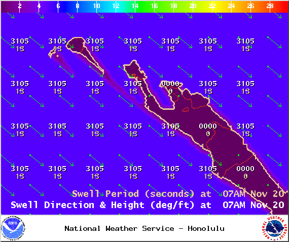
Image: NOAA / NWS
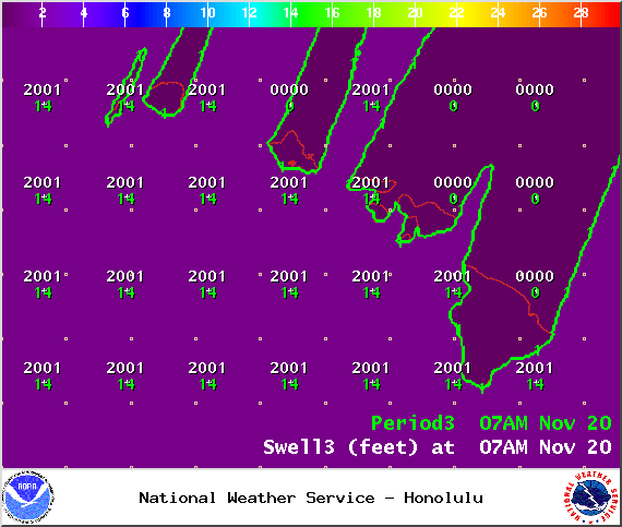
Image: NOAA / NWS

Image: NOAA / NWS
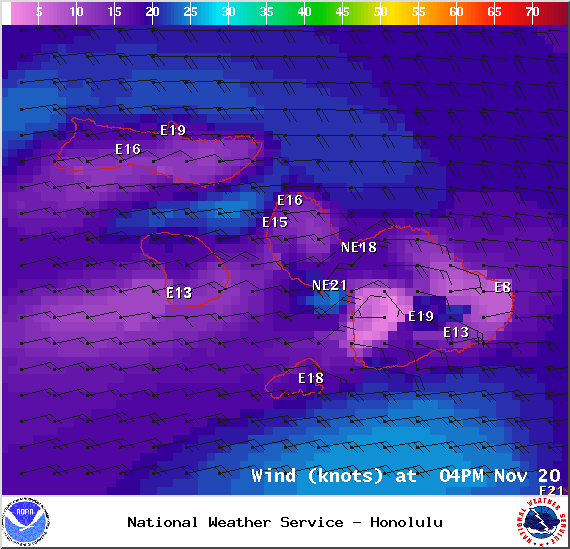
Image: NOAA / NWS
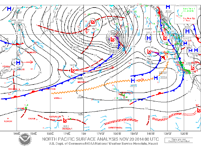
Image: NOAA / NWS
Sponsored Content


