

President’s Day XL Swell Holds Through Morning

Mākena Big Beach / Image: Aaron Lynton
By Meteorologist Malika Dudley / Email: malika@mauinow.com
Alerts
A High Surf Warning is in effect for the north facing shores of Moloka’i and Maui (10 to 15 foot faces) through 6:00 a.m. Monday. Expect strong breaking waves, shore break and strong longshore and rip currents making swimming difficult and dangerous.
A Small Craft Advisory is posted for Maui County windward waters, the Kaiwi Channel and the ʻAlenuihāhā channel through 6:00 a.m. Monday for rough seas of 10 to 15 feet. Inexperienced mariners should avoid navigating in these conditions.
**Click directly on the images below to make them larger. Charts include: Maui County projected winds, forecasted swell direction, height & period, tides, a surface map and expected wave heights.**
 Maui County Surf Forecast
North: The LOLA model is calling for double to triple overhead waves early today, slowly fading in the afternoon.
West: Ankle to knee high surf expected today.
South: Ankle to knee high surf expected today.
A shorter period mix of northwesterly swells is expected to hold early today, mainly showing for north Maui spots from Ho’okipa eastward. Deep water breaks could see 18 to 25 foot faces early Monday morning. This XL swell is forecasted to slowly fade late in the day.
 A recent storm near New Zealand has brought some fun waist to chest high waves for southern exposures. The swell should hold through Monday. A small new south-southwest is expected midweek. A fun sized swell is possible the middle of next week.
If the storm develops as models are indicating, we could see a west-northwest swell late this week.
Keep in mind, surf heights are measured on the face of the wave from trough to crest. Heights vary from beach to beach, and at the same beach, from break to break.
**Click here for your detailed Maui County weather report.**

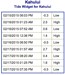
Image: NOAA / NWS

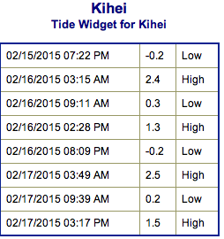
Image: NOAA / NWS
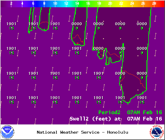
Image: NOAA / NWS

Image: NOAA / NWS
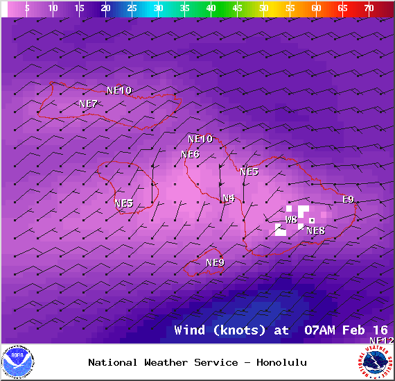
Image: NOAA / NWS
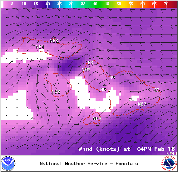
Image: NOAA / NWS
Sponsored Content


