

Possibility of Heavy Rain Lingers
Maui Sunset / Image: Jimmie Hepp
By Meteorologist Malika Dudley / Email: malika@mauinow.com
Alerts
A High Surf Advisory is in effect for the north facing shores of Maui and Moloka’i through midnight Monday. Surf heights of 10 to 15 feet are expected. Expect strong breaking waves, shore break and strong longshore and rip currents making swimming difficult and dangerous.
**Click directly on the images below to make them larger. Charts include: Maui County high/low forecasted temperatures, projected winds, projected localized weather conditions and expected wave heights.**
Today
Partly cloudy skies are expected today with scattered windward showers and isolated leeward showers. An area of instability that brought flooding and heavy rain to parts of Maui County over the last few days is still close enough to possibly spawn some heavy showers. I will keep an eye on that and bring you the latest should any severe weather pop up. Northeast winds are forecasted from 15 to 20 mph. High temperatures from 77° to 82°.
UV index at 8 (“very high” exposure level)
Tonight
Mostly cloudy skies are forecasted with showers likely in windward spots and scattered showers for leeward areas. Northeast winds are forecasted from 15 to 20 mph. Low temperatures of 69° to 74° degrees are expected.
Next Full Moon: 8:06 a.m. on Mar. 5
Looking Ahead
Instability in our area will create moist and unstable conditions over Maui through today. Locally breezy trade winds are expected to focus clouds and showers over windward slopes of Molokai. Showery trade wind weather will continue through at least mid week, especially on Maui. Another area of instability is expected to bring unsettled weather next weekend or perhaps a couple days later. Will watch the models to see how the situation develops.
Our Maui Now Weather homepage always includes daily: Sunrise | Sunset | Moonrise | Moonset | Moon Phase | Live Weather Cams | 5-day Forecast | Current Temperature & Conditions
**You can also click here for your detailed Maui County surf report.**
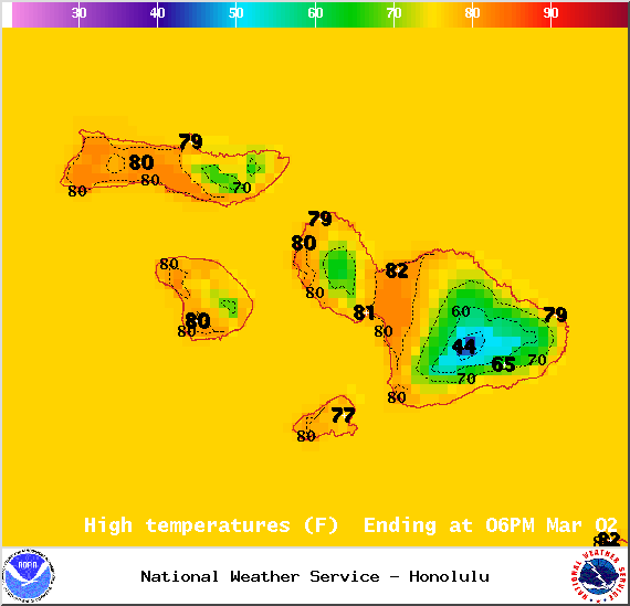
Image: NOAA / NWS
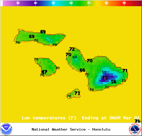
Image: NOAA / NWS
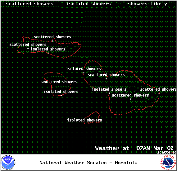
Image: NOAA / NWS
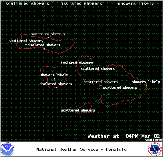
Image: NOAA / NWS
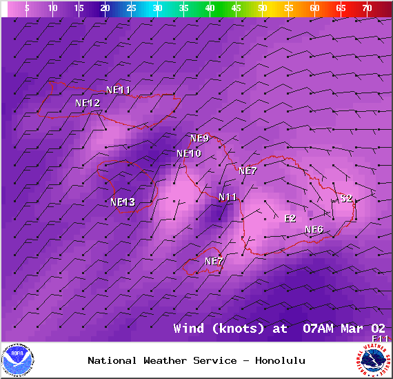
Image: NOAA / NWS
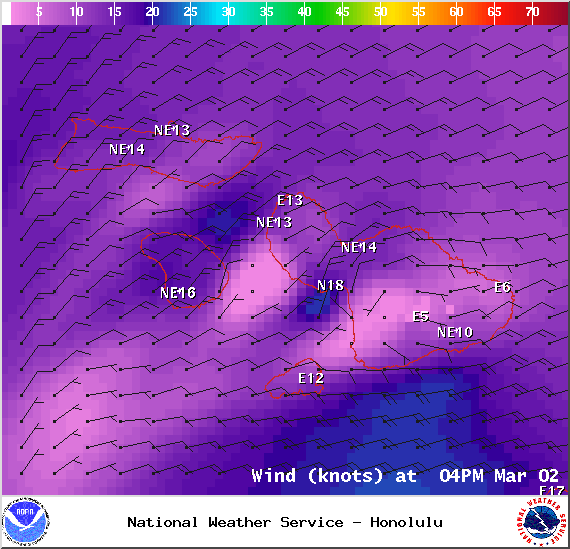
Image: NOAA / NWS
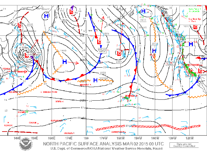
Image: NOAA / NWS
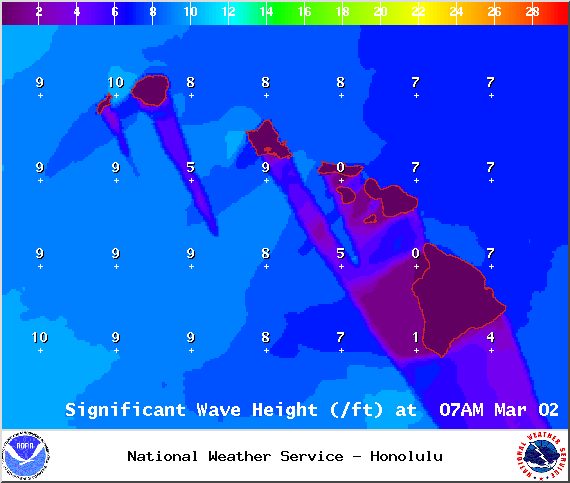
Image: NOAA / NWS
Sponsored Content


