

Heavy Showers and Thunderstorms Expected
Image: Malika Dudley
By Meteorologist Malika Dudley / Email: malika@mauinow.com
Alerts (Updated at 12 p.m.)
The FLOOD ADVISORY has been extended for the island of Moloka’i until 2:45 a.m. Radar showed moderate to heavy rain along Highway 450. The moderate to heavy rain is expected to continue over the next couple of hours at a rate of about 1 inch per hour.
The National Weather Service has issued a Flash Flood Watch for Maui through 6:00 a.m. Thursday. An area of instability is expected to push moisture up toward the island that could potential cause flooding and thunderstorms through Wednesday night. The rainfall will mainly focus over windward areas. Excessive runoff could result in rock and mudslides in steep terrain. Fast-moving waters could create life-threatening conditions.
A Small Craft Advisory is posted for the Kaiwi, Pailolo and ʻAlenuihāhā channels as well as Māʻalaea Bay. The advisory is posted from 6:00 a.m. Wednesday through 6:00 a.m. Friday for north winds from 25 to 30 knots and rough seas of 8 to 12 feet. Inexperienced mariners should avoid navigating in these conditions.
**Click directly on the images below to make them larger. Charts include: Maui County high/low forecasted temperatures, projected winds, projected localized weather conditions and expected wave heights.**
Today
Cloudy skies are expected today. Heavy rain and thunderstorms are a distinct possibility, especially for the windward side of Maui. Northeast winds are forecasted from 15 to 20 mph. High temperatures from 76° to 81°.
UV index at 5 (“moderate” exposure level)
Tonight
Cloudy skies are forecasted with showers likely in windward spots with the possibility of heavy showers and maybe even thunderstorms. Northeast winds are forecasted from 15 to 25 mph. Low temperatures of 65° to 70° degrees are expected.
Next Full Moon: 8:06 a.m. on Mar. 5
Looking Ahead
Trade winds are expected to become stronger through Friday. An area of instability near the state will result in heavy rain and thunderstorms on the Big Island and Maui through Thursday. Trade winds will focus rainfall over the windward slopes, with some showers carrying over to leeward areas. The weekend could bring another round of heavy rain and thunderstorms over the eastern half of the state. We will continue to watch the models and bring you the latest.
Our Maui Now Weather homepage always includes daily: Sunrise | Sunset | Moonrise | Moonset | Moon Phase | Live Weather Cams | 5-day Forecast | Current Temperature & Conditions
**You can also click here for your detailed Maui County surf report.**
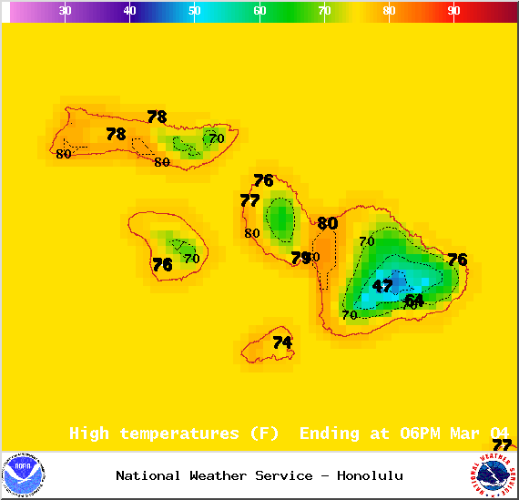
Image: NOAA / NWS
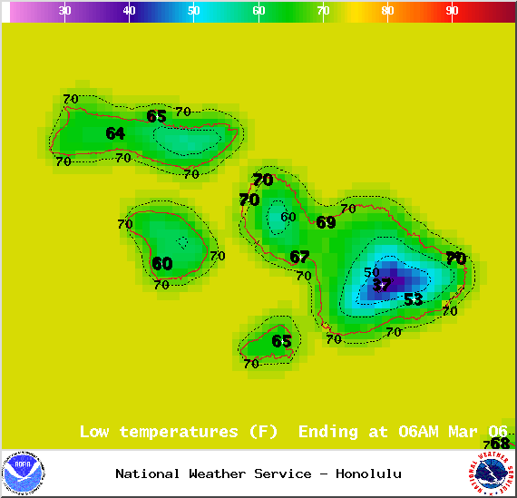
Image: NOAA / NWS
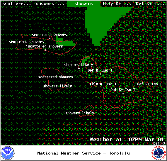
Image: NOAA / NWS

Image: NOAA / NWS
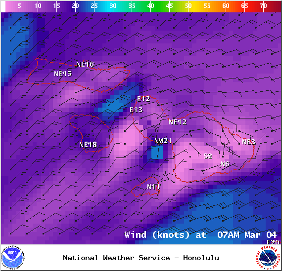
Image: NOAA / NWS
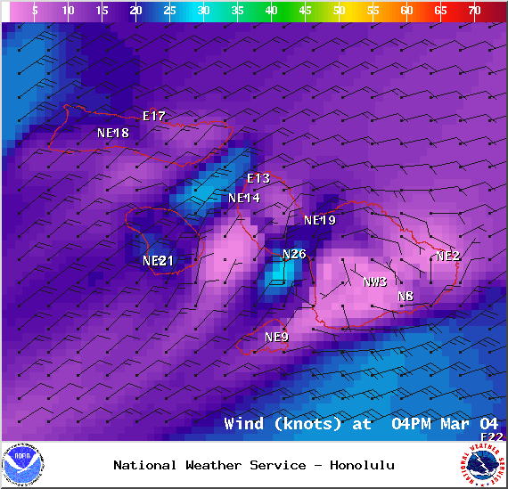
Image: NOAA / NWS
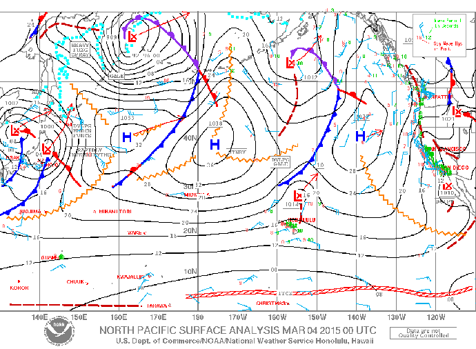
Image: NOAA / NWS
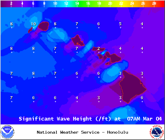
Image: NOAA / NWS
Sponsored Content


