

Hazy Skies as Front Approaches For Weekend

Maui Sunset / Image: Asa Ellison
By Meteorologist Malika Dudley / Email: malika@mauinow.com
Alerts
There are no weather alerts posted at this time.
**Click directly on the images below to make them larger. Charts include: Maui County high/low forecasted temperatures, projected winds, projected localized weather conditions and expected wave heights.**
Today
Partly cloudy skies are in the forecast with isolated showers. Hazy skies are also forecasted (see UHSOEST vog model above). South winds from 15 to 20 mph are expected with local afternoon sea breezes developing for some areas. High temperatures from 82° to 87° near shore and lower high temperatures at higher elevations (see graphic above).
UV index at 12 (“extreme” exposure level)
Tonight
Partly cloudy skies are expected with isolated showers. South winds are expected around 15 mph with local land breezes developing in some spots. Low temperatures from 66° to 71°.
Sunday
Sunday we expect partly cloudy skies to start and scattered showers as the front approaches. Hazy weather is expected to stick around and winds are forecasted to shift out of the northwest then northeast as the front dissipates and moves out of the area. High temperatures from 79° to 84° and low temperatures from 66° to 71°.
Looking Ahead
A front is approaching from the northwest. Locally breezy southeast winds ahead of the front will focus showers over southeast areas of the islands and carry volcanic haze north toward the other islands. There will also be afternoon clouds and showers over interior areas Saturday afternoon. A band of showers along the front is expected to reach Kauai Saturday evening, then stall and weaken over the central islands by Sunday night. Behind the front, breezy trade winds and showery weather is expected for windward areas through much of next week.
Our Maui Now Weather homepage always includes daily: Sunrise | Sunset | Moonrise | Moonset | Moon Phase | Live Weather Cams | 5-day Forecast | Current Temperature & Conditions
**Click here for your marine outlook and surf report.**
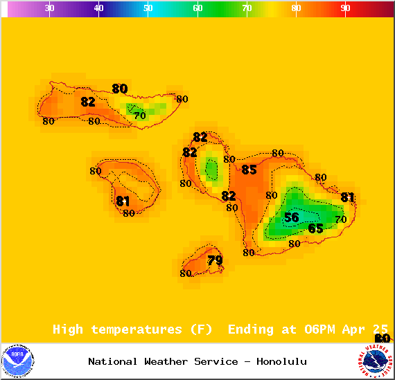
Image: NOAA / NWS

Image: NOAA / NWS
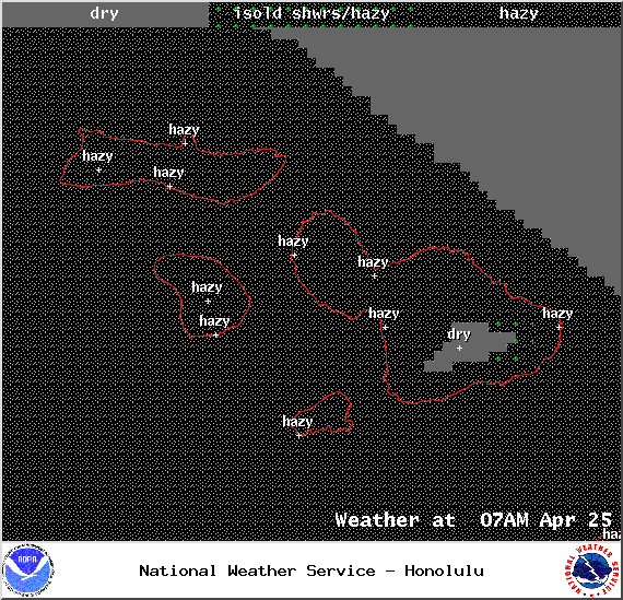
Image: NOAA / NWS
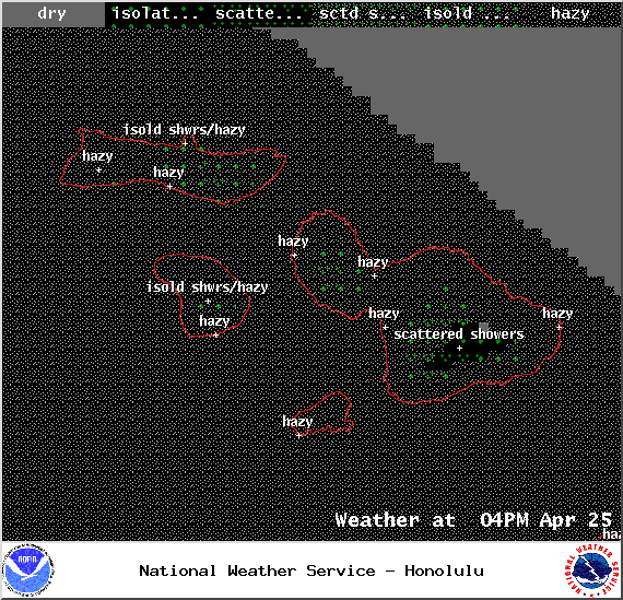
Image: NOAA / NWS

Image: NOAA / NWS
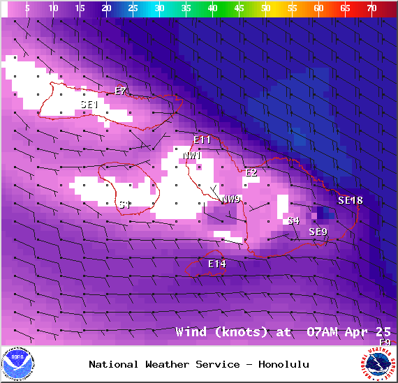
Image: NOAA / NWS
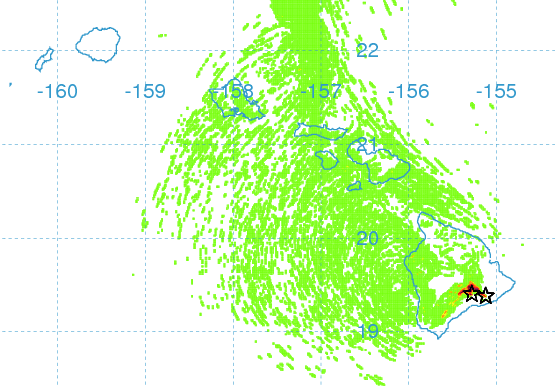
Image: UHSOEST

Image: NOAA / NWS
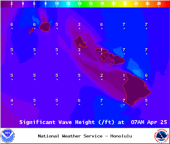
Image: NOAA / NWS
Sponsored Content


