

Guillermo Tracks Toward Hawaii, Trades Continue Today

Mākena Sunset / Image: Chris Archer
By Meteorologist Malika Dudley / Email: malika@mauinow.com
Alerts
A Small Craft Advisory is in effect for the Pailolo and ʻAlenuihāhā channels as well as Māʻalaea Bay through 6:00 a.m. Sunday. East winds up to 25 knots are expected with rough seas up to 10 feet.
**Click directly on the images below to make them larger. Charts include: Maui County high/low forecasted temperatures, projected winds, projected localized weather conditions and expected wave heights.**
Today
Today we expect high temperatures from 86° to 91°. Northeast winds are expected from 15 to 20 mph with higher gusts. Partly sunny skies with scattered morning showers for windward and mauka areas. Leeward spots will be mostly sunny with isolated showers.
UV index at 13 (“extreme” exposure level)
Tonight
Northeast winds are expected from 15 to 20 mph. Partly cloudy skies are expected with isolated leeward showers and scattered windward showers. Low temperatures from 72° to 77° are expected.
Looking Ahead
A high to the northeast and a series of weak tropical disturbances to the south will keep locally breezy trade winds blowing through early next week. The trades will bring some showers to windward areas, mostly during nights and mornings. Leeward areas will remain mostly dry except for afternoon showers over the Kona slopes. A tropical disturbance may pass northeast of the area by the middle of next week, bringing muggy weather.
Tropical Storm Guillermo Update
The forecast is uncertain after the coming weekend. A tropical disturbance about 2150 miles east southeast of Hilo is expected to move into the central Pacific over the weekend. The weather over the main Hawaiian islands next week will depend on the progress of this tropical system. Weather models currently show the system passing northeast of the Hawaiian islands through the middle of next week. That would likely bring light winds and muggy weather to the islands but it’s still too soon to know exactly what the disturbance will do. The National Hurricane Center in Miami will be issuing forecasts on the system for the next few days. If the system does move into the central Pacific, the Central Pacific Hurricane Center in Honolulu will take over the forecasts at that time.
Our Maui Now Weather homepage always includes daily: Sunrise | Sunset | Moonrise | Moonset | Moon Phase | Live Weather Cams | 5-day Forecast | Current Temperature & Conditions
**Click here for your marine outlook and surf report.**
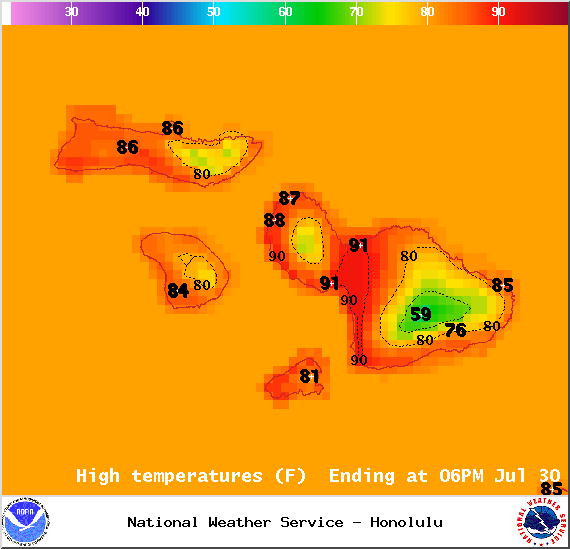
Image: NOAA / NWS
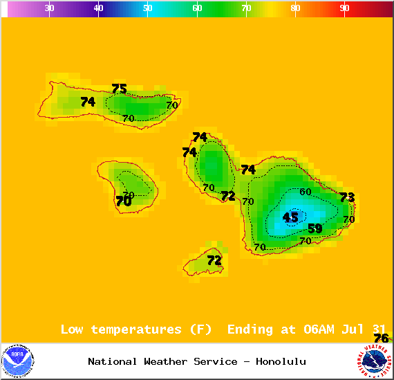
Image: NOAA / NWS

Image: NOAA / NWS
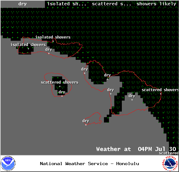
Image: NOAA / NWS

Image: NOAA / NWS

Image: NOAA / NWS
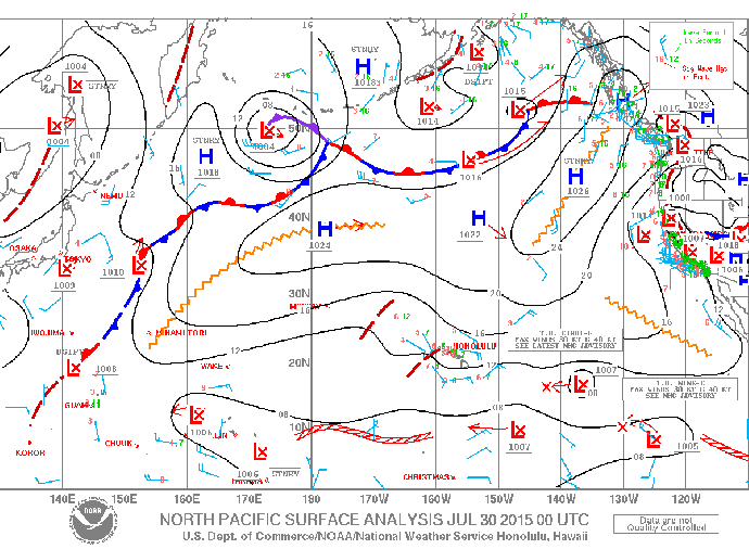
Image: NOAA / NWS
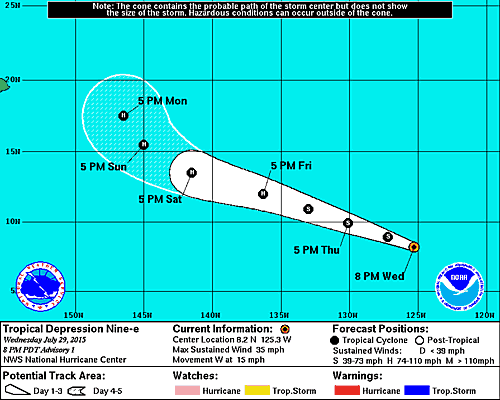
Image: NHC
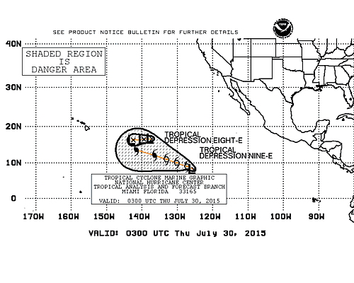
Image: NHC
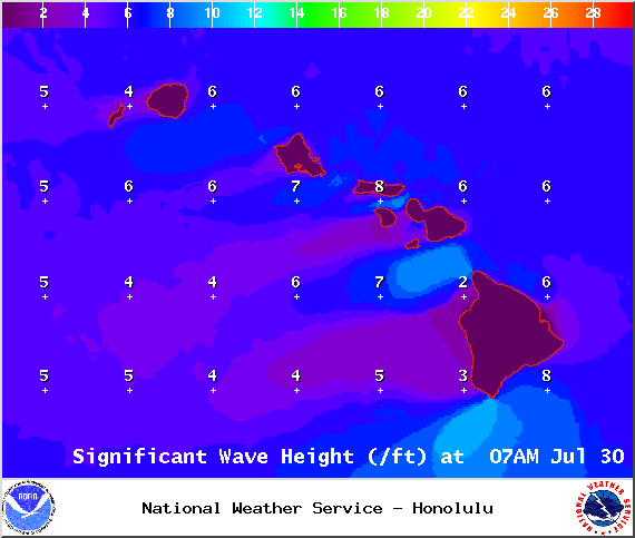
Image: NOAA / NWS
Sponsored Content


