

Today’s Forecast, Hilda Expected to Bring Heavy Rain

Image: Chris Archer / Wailea
By Meteorologist Malika Dudley / Email: malika@mauinow.com
Alerts
A Hydrologic Outlook has been issued by the National Weather Service. Heavy rain and flash flooding are possible Thursday and Friday as Hilda approaches the state. The NWS warns that regardless of its strength, the system will have the potential to produce very heavy rainfall and flash flooding as moisture spreads from east to west over the island chain. Details of timing, location and amount of rainfall are still highly dependent on where Hilda ends up tracking.
A Small Craft Advisory is posted for the Pailolo and ʻAlenuihāhā channels as well as Māʻalaea Bay. Winds of 20 to 25 knots out of the northeast are forecasted with rough seas up to 13 feet. This advisory is posted through 6:00 a.m. Tuesday. Inexperienced mariners should avoid navigating in these conditions.
A High Surf Advisory is posted for the east side of Maui as swell generated by hurricane Hilda builds. The advisory is posted through 6:00 a.m. Wednesday. Wave heights of 8 to 12 feet are expected Tuesday, dropping to 6 to 10 feet by Tuesday afternoon. Expect strong breaking waves, shore break and strong longshore and rip currents making swimming difficult and dangerous.
A Hurricane Warning is posted for Hawaiian offshore waters from 40 nautical miles out to 240 nautical miles until further notice.
**Click directly on the images below to make them larger. Charts include: Maui County high/low forecasted temperatures, projected winds, projected localized weather conditions and expected wave heights.**
Today
Today we expect high temperatures from 86° to 91°. East winds are expected today from 10 to 20 mph. Partly to mostly cloudy skies are forecasted with scattered morning showers for windward and mauka spots and isolated leeward showers.
UV index at 12 (“extreme” exposure level)
Tonight
East winds are expected tonight from 10 to 20 mph. Partly cloudy skies are forecasted with scattered showers for windward spots and isolated showers in leeward areas. Low temperatures from 72° to 77° are expected.
Looking Ahead
Moderate to locally breezy trade winds will decline slightly on Tuesday. Showers will remain focused over windward slopes, with an increase in low level moisture expected as early as Tuesday for windward Big Island. The forecast for the second half of the work week continues to depend on the evolution of hurricane Hilda, though chances are increasing for heavy rainfall and flash flooding over portions of the state.
Our Maui Now Weather homepage always includes daily: Sunrise | Sunset | Moonrise | Moonset | Moon Phase | Live Weather Cams | 5-day Forecast | Current Temperature & Conditions
**Click here for your marine outlook and surf report.**
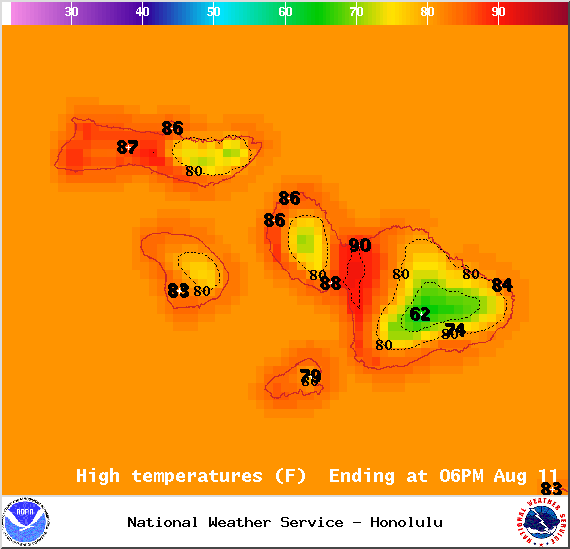
Image: NOAA / NWS
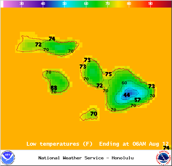
Image: NOAA / NWS
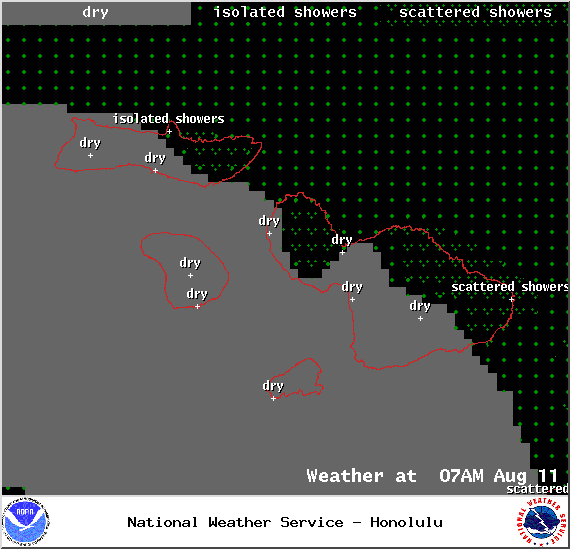
Image: NOAA / NWS
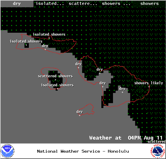
Image: NOAA / NWS
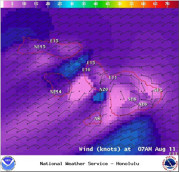
Image: NOAA / NWS
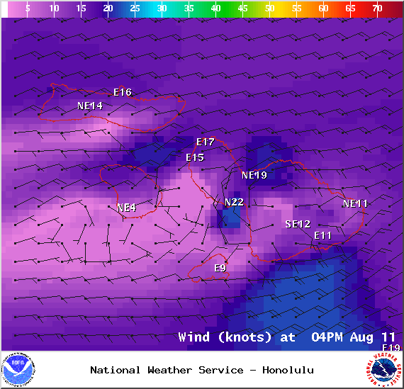
Image: NOAA / NWS
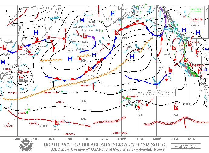
Image: NOAA / NWS
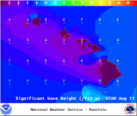
Image: NOAA / NWS
Sponsored Content


