


5pm Update: Kilo Stronger, Expected to be Hurricane Tuesday
[flashvideo file=http://www.youtube.com/watch?v=2UfDvkW0FQA /]

CPHC 5pm track for Kilo
(Updated at 5 p.m.)
By Meteorologist Malika Dudley
As of the 5 p.m. CPHC update, Kilo has maximum sustained winds near 35 mph with higher gusts. The system is located 460 miles SSW of Honolulu.
The system is moving west-northwest near 15 mph and this general motion should continue for the next 24 hours followed by a turn to the northwest with a gradual decrease in forward speed on Monday.
Kilo is in a weak wind shear environment and traveling over very warm waters which will act as fuel for the storm. The current forecast is a bit more aggressive than past forecasts bringing Kilo back to tropical storm status in the next day or so and up to hurricane status by Tuesday.
(Update: 11 a.m. 8/22/15)
By Wendy Osher
Forecasters with the National Weather Service say that for the moment, Kilo remains somewhat disorganized.
Forecasters with the Central Pacific Hurricane Center say, “although Kilo has been struggling to organize thus far, the environment certainly appears to be conducive for strengthening.”
The system has maximum sustained winds of 30 mph with higher gusts. As of 11 a.m., Kilo was located about 500 miles SSW of Honolulu, and about 570 miles S of Līhue, Kauaʻi.
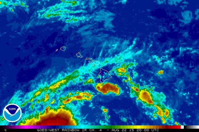
Kilo satellite imagery. 11 a.m. 8/22/15. Image credit: NOAA/NWS.
The NWS says Kilo may become a Tropical Storm once again in the next 24 to 48 hours.
“While Kilo weakened overnight, there is a possibility it will strengthen over the next few days,” said Vern Miyagi, the Hawaii Emergency Management Agency Executive Officer.
“We should not let our guard down because Tropical Depression Kilo still has a large cone of uncertainty. We ask the public to keep monitoring news media for more updated information,” said Miyagi.
*Pacific Media Group News Director Wendy Osher contributed to this report.
(Update: 5 a.m. 8/22/15)
By Meteorologist Malika Dudley
As of 5 a.m. this morning, the system has become a little more disorganized on satellite. Easterly wind shear is helping to tear the system a part a bit. This continues to make the intensity forecast tricky for forecasters.
Kilo’s track has not changed much since last night’s update but the system is expected to take longer to reach hurricane status.
Gradual strengthening is still expected with Kilo becoming a tropical storm once again sometime Sunday. Northwesterly to northerly wind shear is expected in the short term which will help to keep the system at bay. There is still a possibility that Kilo might not be able to reorganize and maintain deep convection at its center. While forecasters say this would be quite surprising, it’s not unheard of.

CPHC 5 a.m. Kilo track
As of the 5 a.m. CPHC update, Kilo has maximum sustained winds near 30 mph with higher gusts.
The system is located 500 miles SSW of Hana, 500 miles SSW of Kahului, 510 miles S of Kaunakakai
and 490 miles S of Lanai City.
The system is moving west-northwest near 17 mph and this general motion should continue through Saturday with a gradual decrease in speed expected tonight. Sunday a turn to the northwest and more significant slowing in forward speed are forecasted.
WEATHER FORECAST –
The National Weather Service has issued a Flash Flood Watch for the island of Hawaii in anticipation of widespread rain expected this weekend (An indirect side effect of Kilo). The watch will go into effect at 6 p.m. Saturday and will be posted through 6 p.m. Monday. A large area of moisture to the east of tropical storm Kilo is expected to spread across Maui and the Big Island. As the deep tropical moisture interacts with the land, flooding is possible due to heavy, slow-moving rainfall episodes.
Trade winds will turn southeasterly and weaken over the weekend. The very moist air mass over the state will become moister still. Showers and thunderstorms could easily pop up in these types of conditions and especially as interaction occurs with the land through orographic lifting and daytime heating. In fact, we could see locally heavy showers as early as Saturday. The Flash Flood Watch currently in effect for Maui and the Big Island will very likely be expanded to the other islands.
Tropical depression Kilo is predicted to pass south of the state through the weekend, and then to strengthen as it turns back towards the islands early next week. The storm itself could bring even heavier rain depending on the path it takes. And remember the ground is likely to already be quite saturated. HIgh winds and large surf are also distinct possibilities.
However, forecasters at the CPHC say the forecast will change significantly depending on the behavior of this storm. If Kilo takes a sharp, early turn to the right, then most of the smaller islands will be at risk for damaging winds and rain on a scale not seen for decades. If Kilo turns right slowly enough, or continues straight to the northwest, then it may miss the islands and coastal waters altogether, sending mainly large swells in our direction. Most weather models suggest outcomes between these two extremes.
The National Weather Service is asking anyone expecting to be in or near the main Hawaiian islands through the next week to pay close attention to this developing situation. Although it is best to prepare for hurricane season before it starts, this would be a good time to review your plans and gather supplies you may need to ride out several days of damaging wind and surf, and very heavy rain.
Sponsored Content


