

New SSW and NE Fill in Today
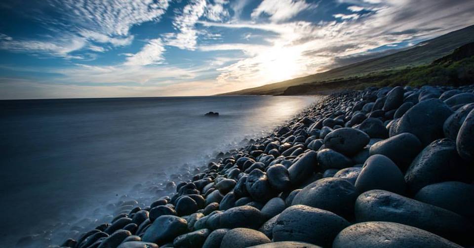
Image: Chris Archer
Alerts
A Small Craft Advisory is posted for all Maui County channels and Ma’alaea Bay through 6 a.m. Thursday. East winds up to 25 knots and seas up to 12 feet are expected. Inexperienced mariners should avoid navigating in these conditions.
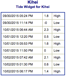
**Click directly on the images below to make them larger. Charts include: Maui County projected winds, tides, swell direction & period and expected wave heights.**
 Maui Surf Forecast
North: Wave heights are expected shoulder high to overhead today. Shadowed spots will be smaller with most size showing for Hana.
West: Wave heights knee/waist high are expected today with top breaks reaching chest high on the sets. Spots shadowed by other islands will be under knee high.
South: The south-southwest is expected to bring knee/waist high waves today. The best breaks could get up to chest high on the sets.
 A new modest south-southwest swell is expected to move in Thursday and Friday.
Trade winds will continue to generate short-period surf along east facing shores and combine with a mid-period northeast swell through Friday. Solid shot of north-northeast expected this weekend, building Friday night and peaking late Saturday, early Sunday.
Keep in mind, surf heights are measured on the face of the wave from trough to crest. Heights vary from beach to beach, and at the same beach, from break to break.
**Click here for your detailed Maui County weather report.**
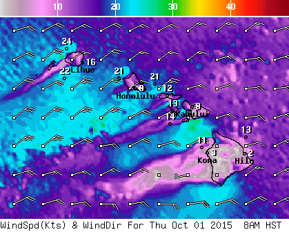
Image: NOAA / NWS

Image: NOAA / NWS
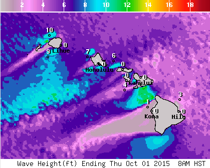
Image: NOAA / NWS
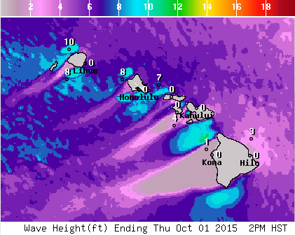
Image: NOAA / NWS
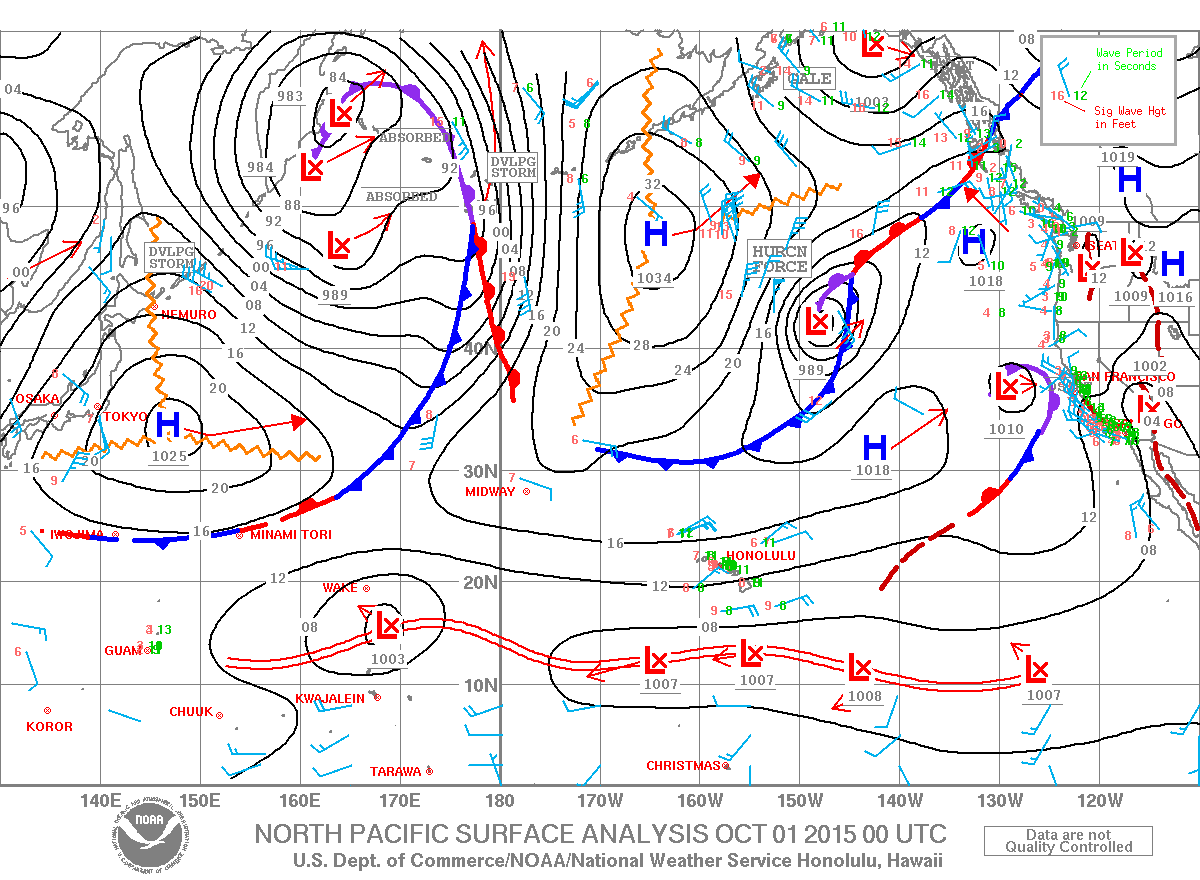
Image: NOAA / NWS
Sponsored Content


