

New Advisory Level Swell Expected Soon
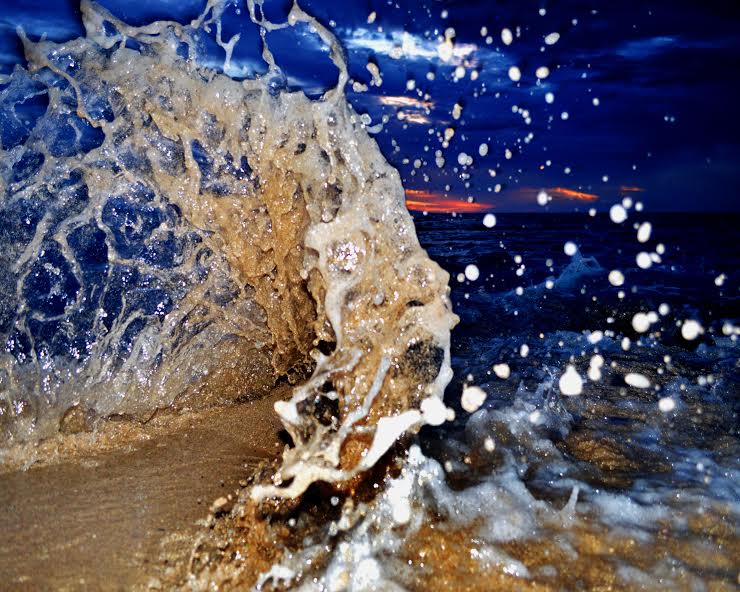
Image: John O’Leary
Alerts
There are no marine alerts posted at this time.
Check our breaking news section for any urgent weather alerts.
**Click directly on the images below to make them larger. Charts include: Maui County projected winds, tides, swell direction & period and expected wave heights.**
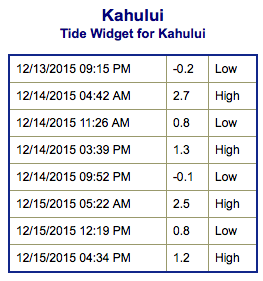 Maui Surf Forecast
North: Wave heights are expected to be waist/belly high today with the best breaks pulling in waves up to chest high on the sets.
West: Wave heights under waist high today. Spots not catching the swell are much smaller or flat.
South: Wave heights under waist high today. Spots shadowed by other islands will be flat.
 A northwest swell is expected to fill in late Monday and through the day Tuesday peaking last Tuesday into early Wednesday. This swell should bring surf near advisory levels along north and west facing shores at its peak. The low generating this swell will be quite deep, but the largest swells will pass north of Hawaii.
A big surge in easterly winds is expected to bring advisory conditions over most coastal waters by the middle of the week.
Small bump expected to build Tuesday out of the south-southwest and peak Wednesday around waist high.
Keep in mind, surf heights are measured on the face of the wave from trough to crest. Heights vary from beach to beach, and at the same beach, from break to break.
**Click here for your detailed Maui County weather report.*
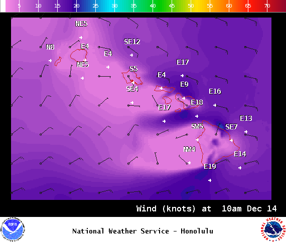
Image: NOAA / NWS

Image: NOAA / NWS
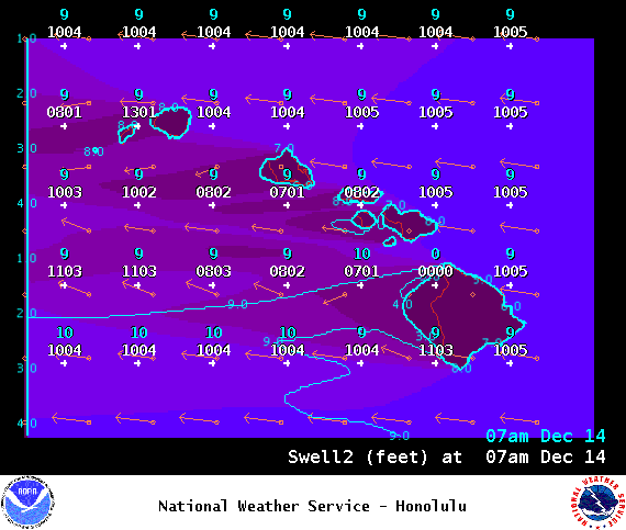
Image: NOAA / NWS
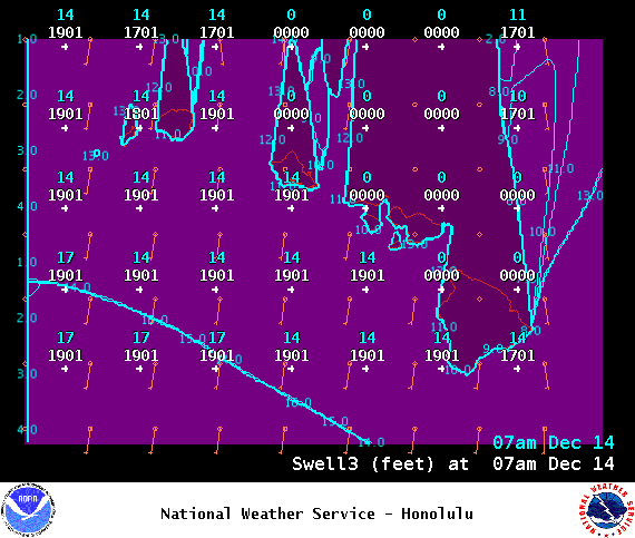
Image: NOAA / NWS
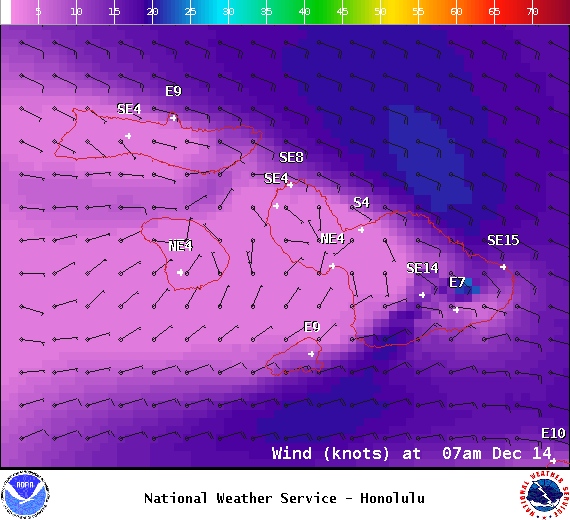
Image: NOAA / NWS
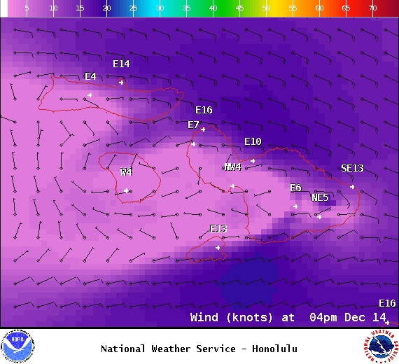
Image: NOAA / NWS
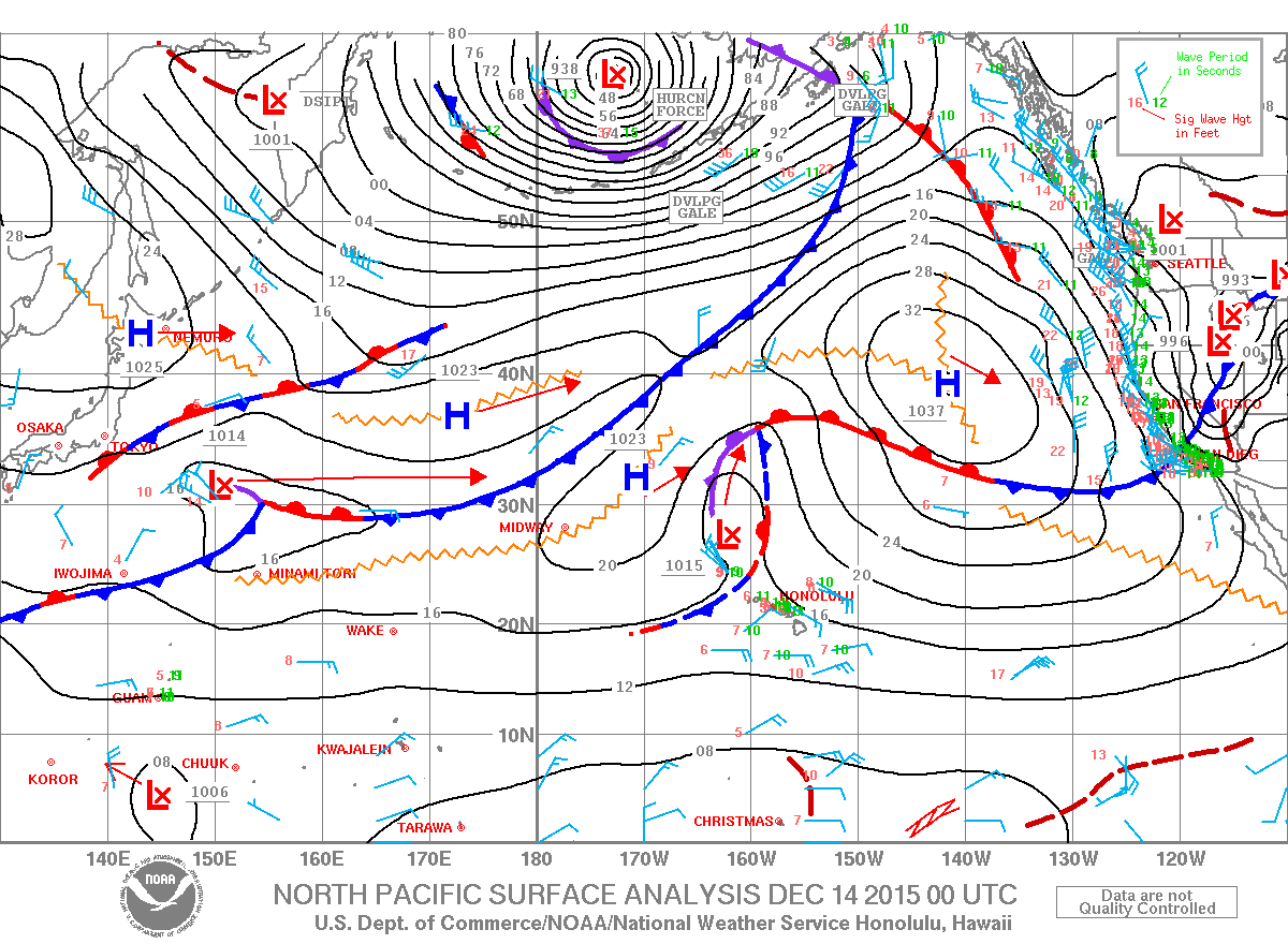
Image: NOAA / NWS
Sponsored Content


