

Cold Front Brings High Winds, Showers Later Today

Image: Blue Hawaiian Helicopters
Alerts (as of 1:00 a.m.)
A Small Craft Advisory is posted for all Hawaiian waters from 6 a.m. Tuesday through 6 a.m. Thursday.
A Special Weather Statement has been issued for the Hawaiian Islands for gusty north to northeast winds expected on Tuesday and Wednesday of this week. A fast-moving cold front is forecast to sweep down the islands bringing cool, dry and gusty winds especially over and downwind of higher terrain. The National Weather Service recommends you tie down loose outdoor objects and secure things before the winds increase.
**Click directly on the images below to make them larger. Charts include: Maui County high/low forecasted temperatures, projected winds, projected localized weather conditions and expected wave heights.**
Looking Ahead
A cold front will sweep down the island chain Tuesday through Wednesday, bringing clouds and showers. Cool and strong northerly winds will increase dramatically as the front passes, with windy conditions expected into Thursday as the winds turn to the northeast. Breezy trade winds will then prevail into the weekend brining clouds and brief showers to windward areas.
Today
Today we expect conditions to deteriorate as a front reaches us and travels down the island chain. Cloud cover will increase along with showers sometime in the afternoon / evening hours. Winds will be shifting as this occurs. Ahead of the front winds will be southwest from about 10 to 20 mph then shifting out of the north from 15 to 30 mph with gusts up to 45 mph in some spots. High temperatures from 78° to 83°.
UV index at 12 (“extreme” exposure level)
Tonight
North winds are expected from 15 to 30 mph tonight with gusts into the 40’s. Mostly cloudy skies with showers likely for Maui County tonight. Low temperatures from 67° to 72°.
Our Maui Now Weather homepage always includes daily: Sunrise | Sunset | Moonrise | Moonset | Moon Phase | Live Weather Cams | 5-day Forecast | Current Temperature & Conditions
***Click here for your marine outlook and surf report.***
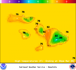
Image: NOAA /NWS
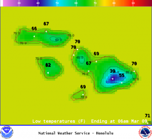
Image: NOAA /NWS
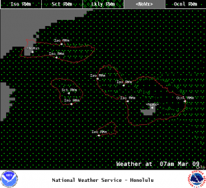
Image: NOAA /NWS
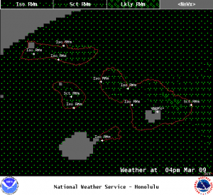
Image: NOAA /NWS
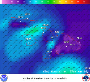
Image: NOAA /NWS

Image: NOAA /NWS
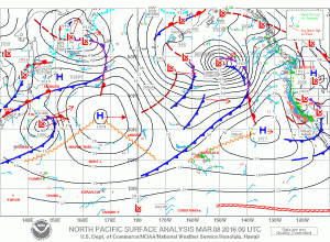
Image: NOAA /NWS
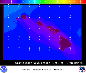
Image: NOAA /NWS
Sponsored Content


