Gusty Wind Conditions Continue Today

Image: Blue Hawaiian Helicopters
Alerts (as of 1:00 a.m.)
A Small Craft Advisory is posted for all Hawaiian waters through 6 p.m. Thursday. The Pailolo and ʻAlenuihāhā channels as well as Māʻalaea Bay are under a more urgent Gale Warning.
A Wind Advisory is posted for Lāna’i and Kaho’olawe through 6 a.m. Thursday and could be extended if conditions persist.
**Click directly on the images below to make them larger. Charts include: Maui County high/low forecasted temperatures, projected winds, projected localized weather conditions and expected wave heights.**
Looking Ahead
Breezy east to northeast trade winds are forecast to stay in place through the weekend with clouds and showers favoring windward and mauka areas. Early next week, winds should briefly weaken and the chance for showers will increase as another cold front moves through the island chain. Strong trades will return by the middle of next week, as another area of strong high pressure builds to the north of the state.
Today
Today we expect mostly sunny skies and isolated showers. High temperatures from 76° to 81°. Winds out of the northeast from 15 to 25 mph with higher gusts.
UV index at 7 (“high” exposure level)
Tonight
East winds are expected from 15 to 25 mph tonight. Partly cloudy skies with scattered showers for windward and mauka spots. Low temperatures from 66° to 72°.
Our Maui Now Weather homepage always includes daily: Sunrise | Sunset | Moonrise | Moonset | Moon Phase | Live Weather Cams | 5-day Forecast | Current Temperature & Conditions
***Click here for your marine outlook and surf report.***

Image: NOAA / NWS
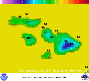
Image: NOAA / NWS
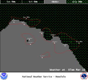
Image: NOAA / NWS
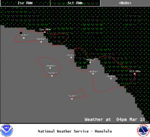
Image: NOAA / NWS
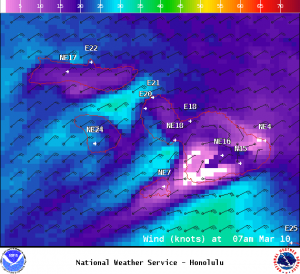
Image: NOAA / NWS
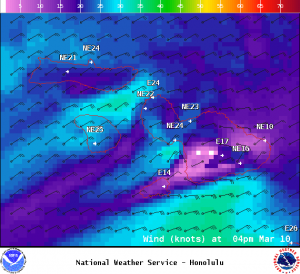
Image: NOAA / NWS
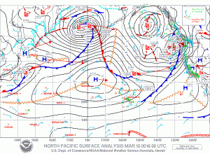
Image: NOAA / NWS
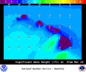
Image: NOAA / NWS
Sponsored Content