

Maui Flood Watch in Effect
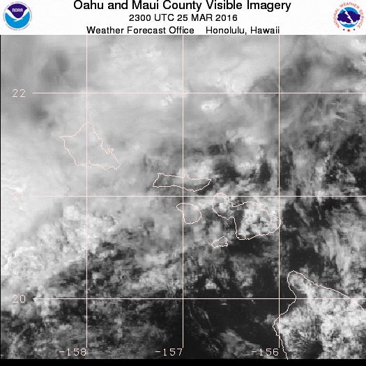
Maui Flood advisory 3.25.16. Image courtesy NOAA/NWS.
UPDATE: Saturday, 3:34 a.m. 3/26/16
The National Weather Service has EXTENDED the FLASH FLOOD WATCH for MAUI COUNTY now in effect until Saturday afternoon.
A Flash Flood Watch means that conditions may develop that lead to flash flooding.
EFFECTS: An upper level trough over the state will create instability that will interact with the daytime heating and moisture. Heavy showers and thunderstorms capable of producing flash flooding will be possible today as a result.
__________________
UPDATE: The National Weather Service has EXTENDED the FLOOD ADVISORY for MAUI ISLAND in effect until 9:30 p.m.
A Flood Advisory means that nuisance flooding is occurring or imminent. A Flood Advisory may be upgraded to a Flash Flood Warning if flooding worsens and poses a threat to life and property.
This advisory may need to be extended if heavy rain persists.
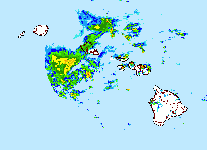
EFFECTS: At 7:42 p.m. radar continued to indicate moderate rainfall across leeward and upslope sections of Haleakala with rainfall rates between 0.50 and 1 inches per hour. The heaviest rains are beginning to exit off to the east of Maui and this trend for improving conditions is expected to continue over the next hour or two.
______________________
Previous Post:
UPDATE: A flood advisory is in effect until 8 p.m. for the island of Maui, and a flood watch is in effect until late tonight as deep tropical moisture associated with a trough of low pressure moves across the county, according to the National Weather Service.
At 4:58 p.m., the NWS reports that areas of heavy rain have weakened over Maui or moved offshore; however, there are a few areas still experiencing moderate to heavy rainfall including Upcountry and in Kīpahulu.
Forecasters say additional rain is also moving toward the island from the southwest and will reach the coast within the next hour.
As of 3:30 p.m., rain continued to fall at rates of 1 to 2 inches per hour between Keʻanae and Haʻikū.
The NWS reports that the gauge at Honopou Stream showed that water levels are dropping, but remain above normal levels.
The warning status may need to be extended if heavy rain persists.
______________
Previous Posts:
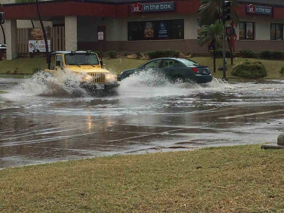
Hoʻohana near Safeway in Kahului. Courtesy photo: Jeanne McKay.
UPDATE: The National Weather Service has issued a Flood WARNING for the island of Maui until 5:15 p.m. on Friday, March 25, 2016.
At 2:19 p.m., radar showed heavy rains over the Windward slopes of Haleakalā with rainfall rates of 3 to 4 inches per hour near Twin Falls and Hāmoa.
The stream gauge at Honopou also showed a very rapid rise in water levels.
The NWS advises that hikers on trails and along streams are at high risk between Huelo and Haʻikū.
Additional rainfall is expected to develop this afternoon.
Locations in the warning area include: Pāʻia, Pukalani, Hāliʻimaile, Makawao, Keʻanae and Nāhiku.
The warning replaces the previously issued flood advisory that was in effect for portions of Maui.
______
Maui Flood advisory 3.25.16. Image courtesy NOAA/NWS.
The National Weather Service issued a flood advisory for the island of Maui until 4 p.m. on Friday, March 25, 2016.
At 1 p.m., NWS forecasters say radar showed moderate to heavy rainfall occurring along the windward slopes of Haleakalā, between Pāʻia and Kīpahulu.
The NWS states that the rainfall has been nearly stationary and “will especially affect drivers on the Hāna Highway and hikers on the windward slopes.”
Additional showers are expected to develop over the area through the afternoon, according to the NWS.
Locations in the advisory include: Haʻikū, Keʻanae, Hāna, Kīpahulu, Nāhiku, Makawao and Huelo.
The public is reminded to stay away from streams, drainage ditches and low-lying areas that are prone to flooding.
Rainfall and runoff may also cause hazardous driving conditions.
The NWS advises the pedestrians and motorists not to cross fast flowing or rising water in their vehicle or on foot.
Sponsored Content


