

Disturbance Near Islands Today, Daily Forecast

Image: Chris Archer
Alerts (as of 1:00 a.m.)
Small Craft Advisory: Windward waters, ʻAlenuihāhā, Kaiwi and Pailolo channels as well as Māʻalaea Bay through 6 p.m. Tuesday.
High Surf Advisory: Maui and Molokai east-facing shores through 6 p.m. Monday.
**Click directly on the images below to make them larger. Charts include: Maui County high/low forecasted temperatures, projected winds, projected localized weather conditions and expected wave heights.**
Looking Ahead
Breezy trade winds will continue over the islands through Tuesday before weakening for the second half of the work week. A disturbance high in the atmosphere is forecast to move south through Monday evening, then stall near the Big Island through Tuesday evening. Enhanced showers are expected during that time, especially for windward spots across the state. The disturbance is then expected to move slowly northeast during the second half of the week with a drier weather pattern expected across the state.
Today
We have east winds today from 15 to 25 mph. High temperatures are forecast from 81° to 86°. Partly sunny skies for windward areas with frequent showers in the morning and scattered showers in the afternoon. Leeward spots will be partly sunny with scattered showers from time to time.
UV index at 10 (“very high” exposure level)
Tonight
Mostly cloudy skies with frequent showers in windward spots and scattered leeward showers in the evening, becoming isolated after midnight. Low temperatures from 69° to 74°. Winds are expected to be east from 15 to 25 mph.
Our Maui Now Weather homepage always includes daily: Sunrise | Sunset | Moonrise | Moonset | Moon Phase | Live Weather Cams | 5-day Forecast | Current Temperature & Conditions
***Click here for your marine outlook and surf report.***
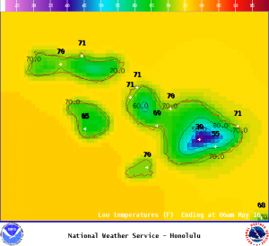
Image: NOAA
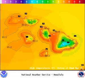
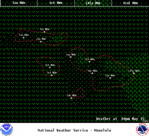
Image: NOAA
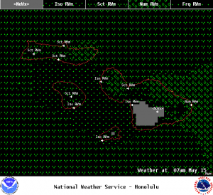
Image: NOAA
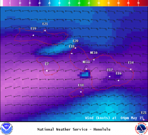
Image: NOAA
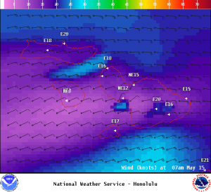
Image: NOAA
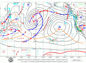
Image: NOAA
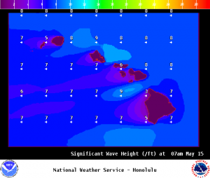
Image: NOAA
Sponsored Content


