

Heavy Rain, Thunderstorms Possible for Another Day

Image: Asa Ellison
Alerts (as of 1:00 a.m.)
Special Weather Statement: Coastal flooding associated with spring tides (King tides) is occurring and expected through mid-week. The greatest potential for flooding is during the peak daily tide.
Small Craft Advisory: Through 6 p.m. Thursday with winds up to 25 knots.
**Click directly on the images below to make them larger. Charts include: Maui County high/low forecasted temperatures, projected winds, projected localized weather conditions and expected wave heights.**
Looking Ahead
Thunderstorms and heavy showers are possible again today. Lots of moisture in the atmosphere combined with a disturbance high in the sky are keeping conditions unstable. Breezy trade winds and drier conditions are expected to return Wednesday. Trade winds are forecast to weaken a bit by the end of the weekend.
Today
We expect east winds around 10 to 20 mph with higher gusts. Mostly cloudy skies with showers likely for windward spots and scattered showers for leeward areas. Locally heavy rainfall is possible and there is a slight chance of thunderstorms. Temperatures up to 86° to 91° and humid, muggy conditions.
UV index at 12 (“extreme” exposure level)
Tonight
Mostly cloudy skies with showers likely in windward spots and scattered showers for leeward areas. There is a slight chance of thunderstorms as well. Low temperatures from 74° to 79°. Winds are expected to be east around 10 to 20 mph.
Our Maui Now Weather homepage always includes daily: Sunrise | Sunset | Moonrise | Moonset | Moon Phase | Live Weather Cams | 5-day Forecast | Current Temperature & Conditions
***Click here for your marine outlook and surf report.***

Image: NOAA

Image: NOAA

Image: NOAA
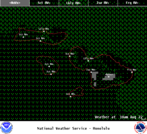
Image: NOAA
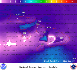
Image: NOAA
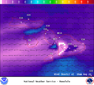
Image: NOAA
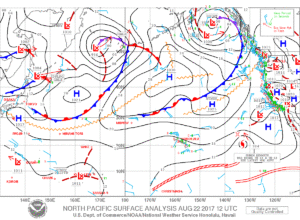
Image: NOAA
Sponsored Content


