

Earthquake swarm at Kamaʻehuakanaloa “Lōʻihi” Seamount likely due to magma movement
Increased seismic activity beneath Kamaʻehuakanaloa “Lōʻihi” seamount is likely the result of magma movement beneath the surface, according to scientists with the Hawaiian Volcano Observatory.
HVO Scientist-in-Charge, Ken Hon, said the movement currently shows no sign of leading to an eruption.
“If the swarm intensifies or changes significantly, HVO will issue an additional notice. Because of the great depth of the volcano within the ocean and style of Hawaiian eruptions, an eruption of Kamaʻehuakanaloa would pose no threat to the Island of Hawaiʻi,” said Hon. He said neither Mauna Loa nor Kīlauea volcanoes show any change in activity associated with the seamount earthquake swarm.
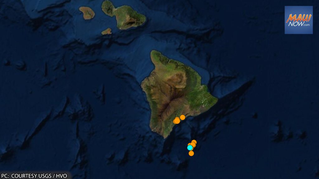
The increased activity at Kamaʻehuakanaloa, which is south of Hawaiʻi Island, began at around 2 a.m. on Saturday, July 16, 2022. “The US Geological Survey’s Hawaiian Volcano Observatory detected seismic tremors marked by pulses of seismic energy every 15-20 seconds,” which scientists say was still ongoing at 2:53 p.m. on Sunday, July 17.
Approximately 24 hours after the activity began, two dozen M1.8-M3.0 earthquakes occurred from 1:30 a.m. to 6 a.m. on Sunday, July 17.
The earthquake swarm is located about 27 miles SE of Nāʻālehu at a depth of 1-10 miles below sea level.
The HVO reports that intermittent earthquake activity has been recorded in the vicinity of Kama‘ehuakanaloa since as early as 1952. The most energetic earthquake sequence occurred in July-August 1996, which included more than 4,000 earthquakes, with nearly 300 events larger than M3.0 and 95 events in the M4.0 to 4.9 range.
More recently, a swarm of 100 earthquakes occurred on May 11, 2020, with 18 events in the M3.0 to 3.9 range.
There are no working monitoring instruments on Kama‘ehuakanaloa volcano, whose peak is about 3,280 feet below sea level. All real-time information about the volcano is derived from land-based seismometers on the Island of Hawai‘i.
Sponsored Content


