

Mauna Loa volcano warning issued as eruption begins at Moku‘āweoweo summit
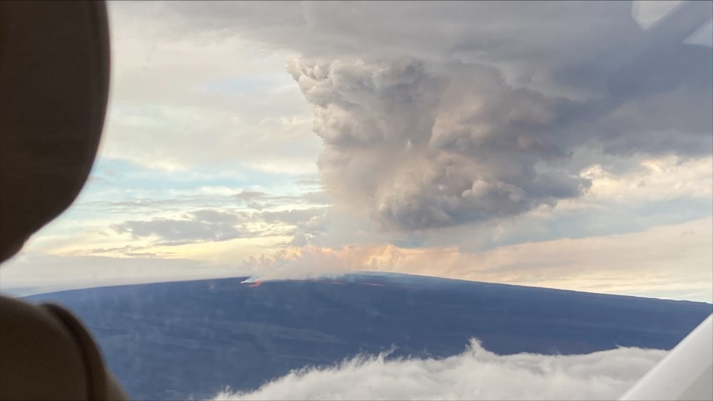
 Lava flow — Northeast rift zone eruption of Mauna Loa. Aerial photos taken at 7:15 a.m. local time (HST) from Civil Air Patrol flight. Northeast rift zone eruption of Mauna Loa. PC: USGS/HVO
- HVO field crews are at the summit of Mauna Loa to make observations and collect information about the eruption that began on Nov. 27, 2022. The eruption began at the summit and migrated to the Northeast Rift Zone, where this photo was taken in the morning hours on Nov. 28, 2022.
- Aerial photos taken at 7:15 AM local time (HST) from Civil Air Patrol flight. Northeast rift zone eruption of Mauna Loa. PC: USGS/HVO
- Summit, Moku‘āweoweo Caldera. This image is from a temporary research camera positioned on the north rim of Mokuʻāweoweo, the summit caldera of Mauna Loa volcano by the USGS Hawaiian Volcano Observatory. PC: 6:01 a.m. Nov. 28, 2022. USGS/HVO.
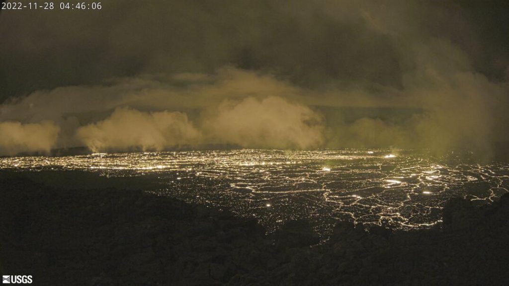
- Summit, Moku‘āweoweo Caldera. This image is from a temporary research camera positioned on the north rim of Mokuʻāweoweo, the summit caldera of Mauna Loa volcano by the USGS Hawaiian Volcano Observatory. If you look carefully around early morning or late evening, you may see a few thermal areas emitting steam. See ‘Current Activity’ for the latest Mauna Loa information. PC: 4:45 a.m., Nov. 28, 2022 USGS/HVO
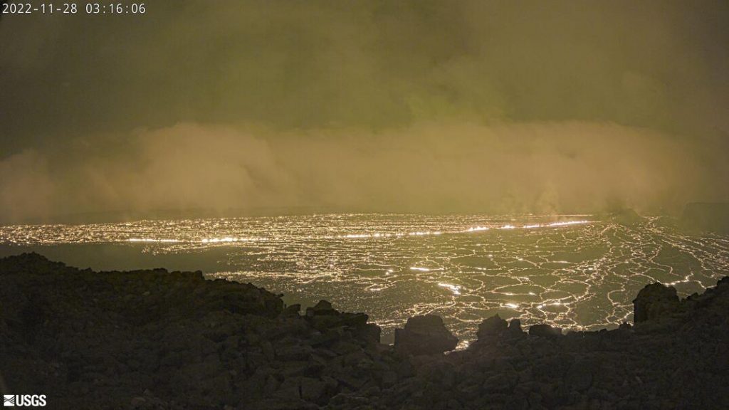
- This image is from a temporary research camera positioned on the north rim of Mokuʻāweoweo, the summit caldera of Mauna Loa volcano by the USGS Hawaiian Volcano Observatory. If you look carefully around early morning or late evening, you may see a few thermal areas emitting steam. See ‘Current Activity’ for the latest Mauna Loa information. PC: 3:16 a.m. Nov. 28, 2022. USGS/HVO.
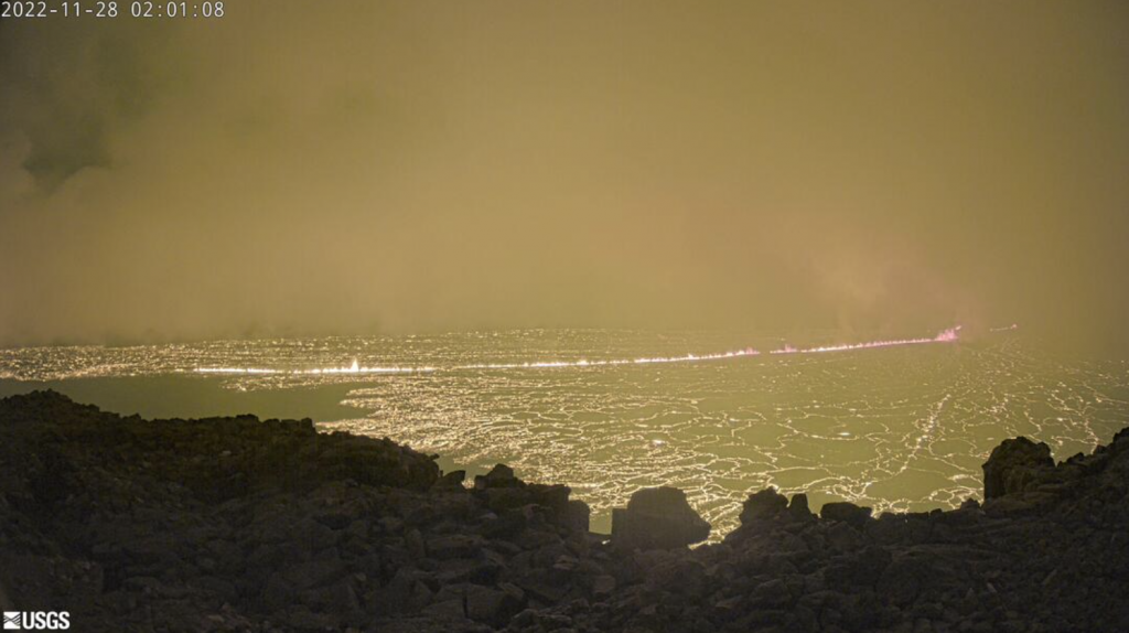
- This image is from a temporary research camera positioned on the north rim of Mokuʻāweoweo, the summit caldera of Mauna Loa volcano by the USGS Hawaiian Volcano Observatory. If you look carefully around early morning or late evening, you may see a few thermal areas emitting steam. See ‘Current Activity’ for the latest Mauna Loa information. PC: 2:01 a.m. Nov. 28, 2022. USGS/HVO
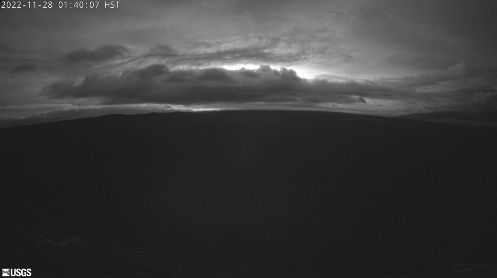
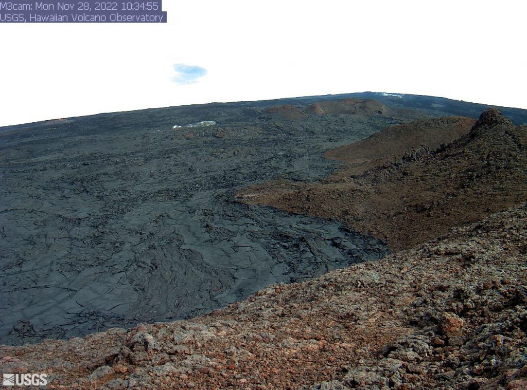
- This image is from a research camera positioned on a cone in Mauna Loa’s Southwest Rift Zone in Hawaiʻi Volcanoes National Park. The camera looks northeast (upslope), focusing on the middle part of the Southwest Rift Zone. The volcano’s summit is at upper right. PC: 1:40 a.m. Nov. 28, 2022 USGS/HVO
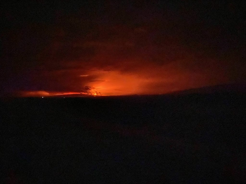
- Mauna Loa eruption as viewed from Waikoloa at about 1:25 a.m. local time (HST). The eruption is occurring from the summit of the volcano, though lava has overflowed the caldera. PC: USGS/HVO
- Mauna Loa eruption as viewed from Waikoloa at about 1:25 a.m. local time (HST). The eruption is occurring from the summit of the volcano, though lava has overflowed the caldera. PC: HVO/USGS
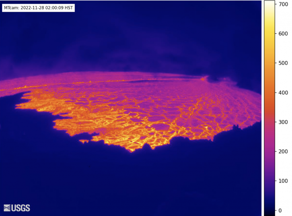
- This image is from a temporary thermal camera located on the north rim of Mauna Loa’s summit caldera. The temperature scale is in degrees Celsius up to a maximum of 500 degrees (932 degrees Fahrenheit) for this camera model, and scales automatically based on the maximum and minimum temperatures on the caldera floor and not the whole frame, which sometimes results in the rim (bottom of image) looking saturated (white). Thick fume, image pixel size and other factors often result in image temperatures being lower than actual surface temperatures. PC: USGS/HVO
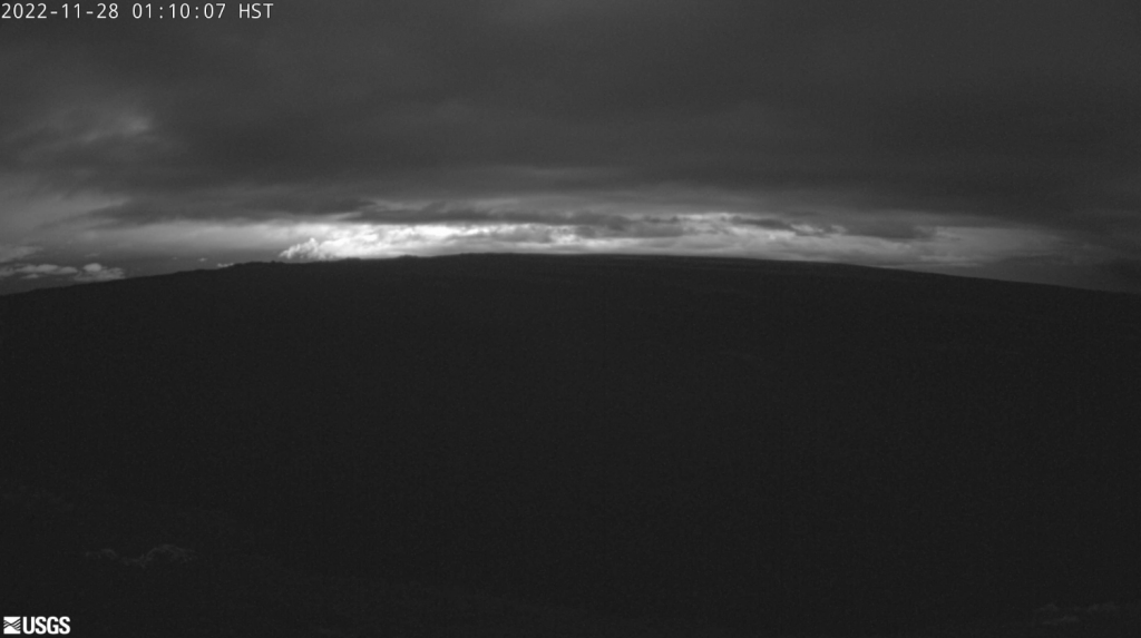
- This image is from a research camera positioned on a cone in Mauna Loa’s Southwest Rift Zone in Hawaiʻi Volcanoes National Park. The camera looks northeast (upslope), focusing on the middle part of the Southwest Rift Zone. The volcano’s summit is at upper right. PC: Nov. 28, 2022, 1:10 a.m. USGS/HVO
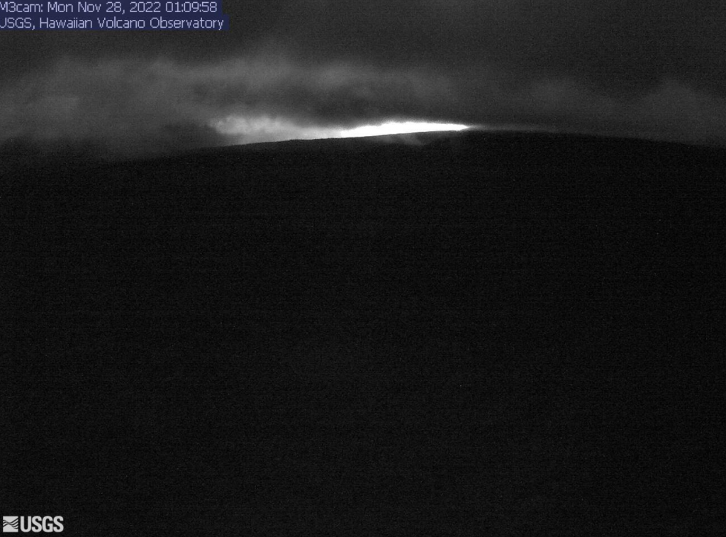
- This image is from a research camera positioned on a cone in Mauna Loa’s Southwest Rift Zone in Hawaiʻi Volcanoes National Park. The camera looks northeast (upslope), focusing on the upper part of the Southwest Rift Zone. The upper flank of Mauna Loa forms the skyline. PC: USGS/HVO, Monday, Nov. 28, 2022, 1:09 a.m.
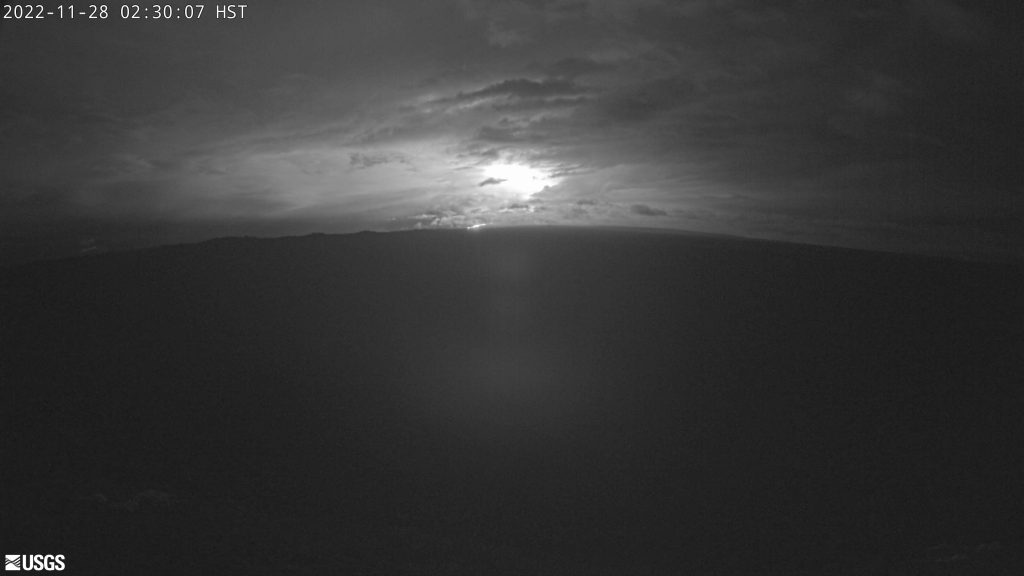
- This image is from a research camera positioned on a cone in Mauna Loa’s Southwest Rift Zone in Hawaiʻi Volcanoes National Park. The camera looks northeast (upslope), focusing on the middle part of the Southwest Rift Zone. The volcano’s summit is at upper right. PC: 2:30 a.m. Nov. 28, 2022. USGS/HVO
- Summit, Moku‘āweoweo Caldera. This image is from a research camera positioned on a cone in Mauna Loa’s Southwest Rift Zone in Hawaiʻi Volcanoes National Park. The camera looks northeast (upslope), focusing on the middle part of the Southwest Rift Zone. The volcano’s summit is at upper right. PC: Nov. 28, 2022, 1:10 a.m. USGS/HVO


Mauna Loa eruption includes three fissures;
All are at above the 10,000 foot elevation
Update: 4:55 p.m., Nov. 28, 2022
The eruption of Mauna Loa continues on the Northeast Rift Zone. Three fissures erupted by noon, and as of 1:30 p.m., only the lowest of the three fissures was active, according to the Hawaiian Volcano Observatory.
Estimates of the tallest fountain heights are between 100–200 feet, but most are a few yards (meters) tall, according to an afternoon update.
“The fissures sent lava flows to the northeast and parallel to the rift zone. Lava flows from the two higher fissures moved downslope but stalled about 11 miles from Saddle Road. Fissure 3 is currently feeding lava flows moving east parallel to the Northeast Rift Zone. These remain at above 10,000 feet elevation and over 10 miles away from Saddle Road,” according to an HVO status update.
“We do not expect upper fissures to reactivate. However, additional fissures could open along the Northeast Rift Zone below the current location, and lava flows can continue to travel downslope.”
–HVO scientists
As of Monday afternoon, there is no active lava within Moku’āweoweo caldera, and there is no lava erupting from the Southwest Rift Zone.
“We do not expect any eruptive activity outside the Northeast Rift Zone. No property is at risk currently. There is a visible gas plume from the erupting fissure fountains and lava flows, with the plume primarily being blown to the Northwest,” the HVO reports.
Hawaiʻi Island schools to remain open
Update: 5 p.m., Nov. 28, 2022
All HIDOE campuses on Hawaiʻi Island are scheduled to remain open to students and staff tomorrow, Tuesday, Nov. 29, and going forward unless otherwise noted.
The Department will continue to follow the advice of Civil Defense officials and will be monitoring conditions on a daily basis. In the event that school operations are forecast to be impacted, families will be notified immediately. In the meantime, families should make sure their child’s school has the most accessible contact information on file.
Joint statment from Hawai‘i Island Complex Area Superintendents
“Based on the latest updates, we are cautiously optimistic but continue to monitor conditions closely and follow the guidance and direction from Hawaii County Civil Defense.
As with all emergencies, the health and safety of our students and staff is our top priority. Our goal is to be able to keep schools open as long as we can do so safely, and avoid having to abruptly close school during the school day. We will be reviewing conditions on a daily basis, looking at a variety of factors such as air quality, transportation, and the direction of the lava flow. In the event that school operations are impacted, families will be notified and updated through official school channels.
All Hawai‘i Island schools are updating their contingency plans to account for this type of emergency, should a school need to transition to a different mode of instruction for an extended period of time. Transition plans will be communicated to school communities as needed.
Mahalo to our staff and school communities for their support and dedication.”
– Stacey Bello, Ka‘ū-Kea‘au-Pāhoa Complex Area Superintendent
– Esther Kanehailua, Hilo-Waiākea Complex Area Superintendent
– Janette Snelling, Honoka‘a-Kealakehe-Kohala-Konawaena Complex Area Superintendent
HVO: Flow is similar to 1984 eruption;
Long-term forecast discussed
Update: 2:18 p.m., Nov. 28, 2022
Experts from the Hawaiʻi Volcano Observatory, Hawaiʻi Emergency Management Agency, and government leaders discussed the short- and long-term forecast for the Mauna Loa eruption during an afternoon press briefing hosted by Governor David Ige on Monday. Details here.
Salvation Army stands ready to assist
With the eruption of Mauna Loa starting overnight, The Salvation Army Hawaiian & Pacific Islands Division today announced they are on standby to provide food for evacuation shelters should Hawaiʻi County require evacuations.
“The Salvation Army has an established presence on Hawaii Island and we are ready to respond with food services in our island communities as needs arise,” said Victor Leonardi, Divisional Director of Emergency Services & Safety for The Salvation Army Hawaiian & Pacific Islands Division. “During emergencies, the best way to help those in need is to provide monetary donations which allows the delivery of the exact relief supplies a community needs. Plus, The Salvation Army uses one-hundred percent of all donations designated ‘disaster relief’ in support of disaster operations.”
Photo dump: 10:39 a.m., 11.28.22
- Mokuʻāweoweo Caldera from the Northwest Rim. Mauna Loa summit. This image is from a temporary research camera positioned on the north rim of Mokuʻāweoweo, the summit caldera of Mauna Loa volcano by the USGS Hawaiian Volcano Observatory. PC: 11.28.22, 10:31 a.m.
- Summit and Northeast Rift Zone. Mauna Loa’s Summit and Northeast Rift Zone. This image is from a research camera positioned on Mauna Kea. The camera looks south toward the summit and Northeast Rift Zone of Mauna Loa. PC: USGS/HVO (11.28.22, 10:36 a.m.)
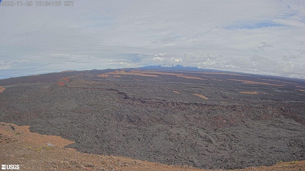
- Southwest Rift Zone. The Middle Part of Mauna Loa’s Southwest Rift Zone. PC: (11.28.22, 10:39 a.m.)
- Northeast Rift Zone. Mauna Loa’s Northeast Rift Zone. This image is from a research camera positioned in the observation tower at the Hawaiian Volcano Observatory. The camera looks northwest toward the summit and Northeast Rift Zone of Mauna Loa. PC: (11.28.22, 10:33 a.m.) USGS/HVO
- The Upper Part of Mauna Loa’s Southwest Rift Zone. This image is from a research camera positioned on a cone in Mauna Loa’s Southwest Rift Zone in Hawaiʻi Volcanoes National Park. The camera looks northeast (upslope), focusing on the upper part of the Southwest Rift Zone. The upper flank of Mauna Loa forms the skyline. PC: (11.28.22, 10:34 a.m.) USGS/HVO


Ashfall advisory cancelled
Update: 8:42 a.m., Nov. 28, 2022
The National Weather Service has cancelled an ashfall advisory that was issued overnight saying the threat for ashfall has ended. However, people with respiratory illness or sensitivities should continue be mindful of the potential for areas of low air quality due to vog.
Update: Eruption has migrated to the NE Rift Zone
Update: 7:20 a.m. Nov. 28, 2022
The eruption of Mauna Loa has migrated from the summit to the Northeast Rift Zone where fissures are feeding several lava flows, according to an update from the Hawaiian Volcano Observatory, issued at 7:20 a.m. on Monday, Nov. 28, 2022.
HVO staff conducted an overflight at approximately 6:30 a.m., and confirmed fissures at high elevations within Hawai‘i Volcanoes National Park are feeding lava flows upslope of the Mauna Loa Weather Observatory.
“Lava flows are not threatening any downslope communities and all indications are that the eruption will remain in the Northeast Rift Zone,” according to the update. The Hawaiʻi Tourism Authority advises that the northeast flank is not populated and does not pose a threat to any communities at this time.
The HTA issued an update saying: “Residents and visitors staying in communities downslope of Mauna Loa should have emergency preparedness plans ready in the event an evacuation becomes necessary. Visitors staying in short-term vacation rentals should contact their hosts for more information. The major resort areas of Kailua-Kona, the Kohala Coast, and Hilo are not immediately downslope of the eruption.”
The Hawaiʻi Visitors and Convention Bureau also issued an update with the following highlights:
- Maunaloa is located on the island of Hawaiʻi.
- There is no reason at this time for travelers to change or alter their leisure or business plans to Hawaiʻi.
- Air Access: All flights into Ellison Onizuka Kona International Airport at Keāhole and Hilo International Airport are operating normally. We suggest checking with your air carrier.
- Accommodations and Activities: All accommodations, activities, and attractions on the island are also operating normally.
The HVO continues to advise that volcanic gas and possibly fine ash and Pele’s Hair may be carried downwind. Residents at risk from Mauna Loa lava flows are advised to. review preparedness and refer to Hawai‘i County Civil Defense information for further guidance.
“Based on past events, the early stages of a Mauna Loa rift zone eruption can be very dynamic, and the location and advance of lava flows can change rapidly,” according to the HVO.
Update: 8:07 a.m., Monday, Nov. 8, 2022
Hawaiian Airlines reports that it is continuing to operate flights to and from Hilo today. Dispatchers are closely monitoring the eruption of Mauna Loa. Guests are advised to check their flight status online and visit hawaiianairlines.com for any updates.
Shelters Open at Old Kona Airport Rec. area and Kaʻū Gym
Update: 6:07 a.m., Monday, Nov. 28, 2022
Volunteers with the American Red Cross, working closely with the Parks and Recreation Department of Hawaii County, have opened the following shelter locations in response to the eruption of Mauna Loa.
- Old Kona Airport State Recreation Area – 75-5560 Kuakini Hwy, Kailua-Kona, HI 96740.
- Kaʻū District Gym Multi-Purpose Room – 96-1219 Kamani St, Pahala, HI 96777.
Those coming to the shelter are advised to bring essentials such as medicine, important documentation and personal protective equipment like masks and sanitizer. For those with pets, animals are also welcome at the shelter.
All Hawaiʻi Island schools remain open today
Update: 5:33 a.m., Monday, Nov. 28, 2022
As of 5:30 a.m. all HIDOE campuses on Hawaiʻi Island will be open to staff and students today, Nov. 28, as the Department continues to monitor the potential impacts of the Mauna Loa eruption. Civil Defense and Hawaii County officials have advised that no school closures are needed at this time; mandatory evacuations have not been ordered and school operations can safely continue at this time.
Eruption continues, lava activity remains at summit
Update: 2:47 a.m., Monday, Nov. 28, 2022
The eruption continues at the summit of Mauna Loa. “All vents remain restricted to the summit area. However, lava flows in the summit region are visible from Kona. There is currently no indication of any migration of the eruption into a rift zone,” according to a status update issued by the USGS Hawaiian Volcano Observatory. Hawai‘i Volcanoes National Park has closed the Mauna Loa summit area to visitors.
Mauna Loa begins erupting again after 38 years
Previous post:
The Mauna Loa volcano on Hawaiʻi Island is now erupting as of 11:30 p.m. on Sunday, Nov. 27, at the Moku‘āweoweo summit caldera inside Hawaiʻi Volcanoes National Park. This has resulted in a warning level alert, a red aviation color code for passing air traffic, and an ashfall advisory. There was also a series of earthquakes, including a 4.1 tremor at 11:52 p.m. on Sunday evening, which did not result in a tsunami threat.
The Hawaiʻi Police Department advises that Mauna Loa Access Road is closed at the intersection with Daniel K. Inouye Highway due to the summit eruption. Our Big Island Now sister site reports that shelters have been opened at Old Kona Airport in Kailua-Kona and Kaʻu Gymnasium in Pāhala as a precaution.
The USGS Hawaiian Volcano Observatory issued an activity notice before midnight saying that lava flows were contained within the summit area and were not threatening downslope communities. Residents were being advised that winds could carry volcanic gas and possibly fine ash and Pele’s hair downwind.
Residents at risk from Mauna Loa lava flows are advised to review preparedness measures by following the guidance of the Hawai‘i County Civil Defense agency.
“Based on past events, the early stages of a Mauna Loa eruption can be very dynamic and the location and advance of lava flows can change rapidly,” according to the HVO notice.
“If the eruption remains in Moku‘āweoweo, lava flows will most likely be confined within the caldera walls. However, if the eruptive vents migrate outside its walls, lava flows may move rapidly downslope,” according to the advisory.
The Hawaiʻi Emergency Management Agency issued an update at around 1:11 a.m. saying, “At this time, the lava is confined to the immediate area of the mountain’s summit, and has not begun flowing outside that area. No communities downslope from the caldera are immediately threatened, and about half of all recorded Mauna Loa eruptions have been confined to the summit area.”
HI-EMA reports that Mauna Loa has been exhibiting increased seismic activity since September, prompting increased monitoring and public outreach.
The last time Mauna Loa erupted was 38 years ago on March 25, 1984. The HVO reports that Mauna Loa is among Earth’s most active volcanoes, having erupted 33 times since a historical eruption in 1843. During the last event in 1984, lava came within 4.5 miles of Hilo, the island’s largest population center, according to the HVO.
Resources and links:
- The Hawaiʻi County Civil Defense agency has a web page on volcano hazards with maps of inundation zones and hazard zones. Alerts are posted here.
- Hawai‘i Volcanoes National Park has closed the Mauna Loa summit area to visitors.
- Vog information can be found here.
- What does a warning and warning alert level mean? Find out here.
- HVO: Preparing for the next eruption of Earth’s largest active volcano.
- Lava Flows from Mauna Loa (1843-2018)
- Mauna Loa Eruption Response Times over the past 200 years
- Current alerts.
- Mauna Loa webcams.
- Frequently Asked Questions about Mauna Loa Volcano
No Tsunami following 4.1 Earthquake at 11:52 p.m.
There is no tsunami following a 4.1 earthquake reported in the summit region of Mauna Loa Volcano at 11:54 p.m. on Sunday, Nov. 27, 2022.
Ashfall advisory:
An ashfall advisory has been extended to 10 a.m. for portions of the Big Island. This will result in ashfall accumulation of up to one quarter inch resulting in possible harm to crops and animals, and minor equipment and infrastructure damage. The public is advised of reduced visibility. Individuals with respiratory illnesses should remain indoors to avoid inhaling the ash particles and anyone outside should cover their mouth and nose with a mask or cloth, according to advisory.
Marine Ashfall Advisory:
A marine ashfall advisory has been extended to 10 a.m. “A volcanic eruption is causing volcanic ash and debris to fall over the waters near and downwind of the volcano, depositing ash and debris. A light accumulation of ashfall is expected on vessels,” according to the advisory. This is for the following waters: Alenuihaha Channel, and Big Island windward, leeward and southeast waters.
Sponsored Content


